Good Morning. This is Doug Chabot with the Gallatin National Forest Avalanche Forecast issued on Tuesday, December 11th at 7:00 a.m. Today’s forecast is sponsored by Stronghold Fabrication and Community Food Co-op. This forecast does not apply to operating ski areas.
An evenly distributed 3-4” of new snow fell overnight. At 6 a.m. wind is from the west at 10-15 mph with 30 mph gusts in Hyalite. Mountain temperatures are in the teens F. Today will become mostly cloudy and west winds will increase to 30 mph. Snow will fall tonight and I expect 2-4” by morning with more accumulation on Wednesday.

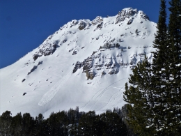
This is the first significant snow in a week, although it seems a lot longer than that. The 3-4” of snow measures 6-10% density; aka powder. The last 7 days of sunshine, frigid temperatures, and clear nights created a weak surface of small, sugary facets, and some feathery surface hoar (photo) which are now buried. This interface of new and old snow is our #1 concern. I do not expect avalanches to break in deeper layers or step down. Alex found this to be the case in Buck Ridge (video) and I found similar conditions around Cooke City (video).
Over the last few days wind slab avalanches have been isolated and small. Yesterday, an ice climber triggered a wind slab in Hyalite (photo) and on Sunday skiers near Bridger Bowl found the snow easily broke under a wind-slab in their stability test (video). A few inches of new snow and increasing wind, especially in areas where a weak layer was buried, will increase the potential for triggering slides. Wind-loading will occur all day. Assess all slopes because even a small avalanche can be deadly. To get a visual idea of what we are currently finding in the backcountry, check out our YouTube Playlist, Photos, and Snowpits. For today, the avalanche danger is rated MODERATE since triggering avalanches is possible.
The snow structure near West Yellowstone is especially worrisome. The entire depth is 1-2 feet of weak, sugary facets that will not support much of a snow load (video). Last night’s 3 inches will be blown into thicker drifts that could avalanche into deeper layers or even break at the ground. The slopes in Lionhead are uniformly weak and avalanches may be wide. Eric is down there today and he’ll have an update for tomorrow’s forecast. For today, the avalanche danger is rated MODERATE since the new snow and wind-loading are making human triggered avalanches possible.
If you get out and have any avalanche or snowpack observations to share, contact us via our website, email (mtavalanche@gmail.com), phone (406-587-6984), or Instagram (#gnfacobs).
Upcoming Avalanche Education and Events
Our education calendar is full of awareness lectures and field courses. Check it out: Events and Education Calendar.
BOZEMAN
December 12, 1-hr Avalanche Awareness for Snowmobilers, 6-7 p.m. at Yellowstone Motorsports, Bozeman.
December 13, 1-hr Avalanche Awareness, 6-7 p.m. at Play It Again Sports, Bozeman.
HELENA
December 12, 1-hr Avalanche Awareness, 6-7 p.m. at The Basecamp, Helena.
COOKE CITY
Every Friday and Saturday, Rescue Training and Snowpack Update. Friday 6:30-7:30 p.m. at the Soda Butte Lodge. Saturday anytime between 10-2 @ Round Lake.
Check out our new “Avalanches and Snowpits” menu item where we list all the reported avalanche activity.