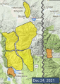
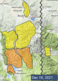
Advisory Archive

Santa’s delivery of snow arrived early. As the storm ended yesterday morning an additional 6-8” of snow fell near West Yellowstone, the southern Madison Range and Cooke City, 1” near Big Sky and Hyalite, and none in the Bridger Range. Southwesterly wind has been 10-15 mph with gusts in the 20s. This morning temperatures are single digits to teens F and west-southwest wind has increased to 15-20 mph with gusts at ridgetops of 45-55 mph. Today these winds will accompany temperatures in the teens to low 20s F. Our next gift of snow should arrive tonight and tomorrow. By morning the mountains near West Yellowstone and Cooke City could have 4-7” new snow with 1-2” near Big Sky and Bozeman.


Since yesterday morning, Cooke City and Lionhead each got 11” of new snow, 9” fell at Bridger Bowl, 7” in the southern Madison Range, and 3-4” elsewhere. Winds are strong out of the southwest at 20-30 mph, with gusts as high as 70 mph. Winds have backed off a bit this morning and will continue from the southwest at 10-20 mph with gusts up to 30 mph. Another 1-3” will fall by tomorrow morning with up to 5” in Cooke City.


Today is the Eve of Christmas Eve which is when Santa makes his list and checks it twice. I’m wishing for lots of snow, but it’s unclear if I’ve been naughty or nice.
In the last 24 hours Cooke City got 7” of new snow with 1-2” around West Yellowstone. It remained dry everywhere else. Winds are strong out of the west to southwest at 20-40 mph with gusts touching 59 mph. Snowfall will continue in the south with Cooke City and West Yellowstone getting 8-12” by tomorrow morning. Everywhere else will get 2-3” with snowfall starting later this afternoon. Winds will continue to be westerly and strong and temperatures won’t budge out of the low 20s.


We turned a corner. Yesterday’s Solstice means days are getting longer and summer is approaching, but not quite yet. In the last 24 hours there is no new snow to report, but tomorrow morning we will have 1-2” in the mountains around West Yellowstone and Cooke City. Winds are west to southwest at 20-30 mph with gusts of 55 mph. Under partly cloudy skies temperatures are in the high teens to mid-twenties. Wind will be southwest, clouds will increase and temperatures will be in the high 20s F; warm for this time of year. More snow is expected Thursday and Friday.


Yesterday, the mountains around Cooke City received 6-8” of new snow with 2” in the Bridger, Madison, and Southern Gallatin Ranges while the Northern Gallatin Range and Lionhead area remained dry. Temperatures this morning are in the 20s F and the wind is 25-35 mph from the west to northwest. Temperatures today will be in the mid 20s to low 30s F with 15-25 mph winds from the west to southwest. Cooke City will get a trace of new snow with nothing throughout the remainder of the advisory area.

In the last 24 hours, Cooke City, the Madison, Southern Gallatin and the Bridger Ranges picked up 4-7” of snow with 1” in the Northern Gallatin Range, and a goose egg in West Yellowstone. Temperatures are in the teens to low 20s F and winds are 15-30 mph from the west to southwest. Today, temperatures will reach the upper 20s F with southwest winds blowing 20-25 mph. The mountains around Cooke City will receive an additional 5-7” of snow through the day with 1-2” across the rest of the advisory area.


Yesterday the mountains near Cooke City got 1-2” of snow with zero to a trace elsewhere. Overnight, west-southwest wind increased to 15-35 mph with gusts of 40-73 mph. This morning temperatures range from single digits near Cooke City and West Yellowstone to low 30s F near Bozeman. Today temperatures will be high 20s to low 30s F with west-southwest wind at 30-55 mph. Snow is expected tonight with 5-8” possible near Cooke City, Big Sky and Bozeman, and 1-3” near West Yellowstone.


The Southern Madison Range squeezed out 2” of snow as the storm finished up yesterday morning while the rest of the area remained dry. Winds are 15-20 mph out of the southwest to northwest with gusts of 30-50 mph. Temperatures are in the single digits to teens F this morning and will rise into the teens and 20s F. Moderate westerly winds will continue today with strong gusts. Skies will be partly sunny in the north and increasingly cloudy as you go south. A few snow showers are possible tonight with more substantial snowfall returning Sunday night.


Most areas picked up 3-4” of new snow in the last 24 hours with 6” near Big Sky. Winds are 15-20 mph out of the west, gusting 30-40 mph. Temperatures in the single digits and teens this morning won’t rise much if at all today. Moderate winds will shift a bit more northwest today. Another inch or two of snow is possible this morning before skies clear.
West Yellowstone and the Southern Madison Range picked up 1” of snow yesterday before the storm exited and the rest of the advisory area remained dry. Winds are 10-20 mph from the west to southwest and temperatures are in the single digits F. Today, temperatures will climb into the mid-teens F with 5-15 mph winds from the southwest. A smaller storm moving south to north will begin this morning with 4-6” of snow in Cooke City and 2-4” falling everywhere else by tomorrow morning.