Advisory Archive
Temperatures are frigid this morning, but not nearly as cold as yesterday. At 5 a.m. temps range from the single digits above or below zero F under mostly cloudy skies. Winds are blowing 10-25 mph out of the W-NW. Today, highs will climb into the single digits to low teens F and winds will remain light to moderate out of the W-NW. A general warming trend with increased moisture will impact the area over the next few days. The next chance for snow looks to be Saturday night into Sunday.


Frigid temperatures and dangerous wind chills will be a concern today. At 5 a.m. temps range from 10 to 20 below zero F under clear skies and winds are blowing 5 mph to 20 mph out of the N-NE. Today, skies will remain mostly clear and highs will struggle to warm into the single digits above zero. Winds will remain light to moderate and shift to the N-NW. Cold temps are expected again tonight, but there will be a slight moderation in temperatures tomorrow.
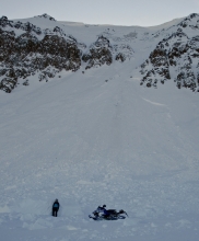
Under partly cloudy skies mountain temperatures are -5F and ridgetop winds are 10-15 mph out of the west. Like yesterday, daytime temperatures will reach the positive single digits as winds remain light. Tonight will be the coldest of the week with -15F expected. By Friday temperatures will moderate to the teens and building high-pressure will push our next bout of snow to Sunday evening. We just got hit with a one-two sucker punch of cold weather and no snow.

A trace to 1” of snow fell in the last 24 hours with light winds. This morning, under partly cloudy skies, thermometers are showing -15F in the northern mountains with 5 to 10 degrees warmer at the ridgetops from an inversion. The southern mountains are -5F. Today will warm to near zero before chilling back to minus teens tonight with light winds and mostly clear skies. The arctic air is expected to last through Thursday followed by a high-pressure ridge of seasonable temperatures for the weekend.
The mountains got 1-2” of low density new snow over the past 24 hours. Temperatures at 4 a.m. are in the single digits to teens below zero F. Wind overnight was out of the south-southeast at 10-20 mph and shifted easterly at 5-10 mph this morning. Temperatures will reach the single digits above and below zero F today then drop to the teens below zero F tonight. Wind will remain easterly at 5-15 mph. Skies will be mostly cloudy with light snow showers. The mountains will have a trace to 2” of new snow by morning with highest amounts in the southern ranges.


At the start of the New Year, skies are clear with temperatures in the single digits to low teens F. The mountains have not received any new snow over the past 24 hours. Wind overnight was out of the W-SW at 10-20 mph with gusts of 30-40 mph. Today, temperatures will reach the teens F and drop below zero F tonight. Wind will be out the SW at 15-25 mph, and snow showers this afternoon will deliver 2-4” of low density snow by tomorrow morning.


Since noon yesterday, the mountains around Bozeman and Big Sky received 6-8” of new snow. The mountains near West Yellowstone and Cooke City picked up 2-4”. At 5 a.m. skies have started to clear and temperatures have dropped into the single digits above zero F. Winds are blowing 20-40 mph out of the W-NW in the Bridger Range and 15-30 mph out of the W-SW elsewhere. Today, a break in the weather will produce sunny skies and warmer temps. Highs will climb into the upper teens to low 20s F and winds will continue to blow 15-30 mph out of the W-SW. Skies will become increasingly cloudy by this evening as another storm approaches. No accumulation is expected tonight, but widespread snow showers will impact the area tomorrow afternoon into Monday.

This morning mountain temperatures range from the 20s F in the north to mid-teens F in the south. Winds are blowing 20-40 mph out of W-SW with ridgeline gusts reaching 50 mph. Today, highs will warm into the 20s to low 30s F and winds will gradually decrease and shift to the W-NW. Snow moves into the area this afternoon and the mountains should see 2-4” by tomorrow morning.


This morning mountain temperatures range from the 20s F in the north to mid-teens F in the south. Winds are blowing 20-40 mph out of W-SW with ridgeline gusts reaching 50 mph. Today, highs will warm into the 20s to low 30s F and winds will gradually decrease and shift to the W-NW. Snow moves into the area this afternoon and the mountains should see 2-4” by tomorrow morning.
Over the past 24 hours no new snow has fallen. At 5 a.m. temperatures are in the single digits above or below zero F and skies are mostly clear. Winds are blowing 10-25 mph out of the W-NW. Today, a weak ridge of high pressure builds over the area producing a brief interval of calm and dry weather. Highs today will warm into the upper teens to mid-20s F and winds will continue to blow 10-25 mph out of the W-NW. The ridge begins to break down this evening as another storm approaches. Winds will increase tonight with gusts upwards of 60 mph possible by tomorrow morning. Snow moves into the area tomorrow afternoon and the mountains should see modest accumulation by Saturday morning.