Good Morning. This is Doug Chabot with the Gallatin National Forest Avalanche Forecast on Wednesday, March 4th at 7:00 a.m. Today’s forecast is sponsored by Yellowstone Arctic Yamaha and Gallatin Valley Snowmobile Assoc. This advisory does not apply to operating ski areas.
There is no new snow to report, just wind and mild temperatures. Under partly to mostly cloudy skies mountain temperatures are in the 20sF and wind is blowing W-SW at 20-40 mph and gusts of 55 mph in Hyalite. Today will be partly cloudy and wind will continue to be strong from the southwest. Snow showers this afternoon will drop a trace to 1” of new snow. Tomorrow and Friday look to be warm and sunny giving us a taste of spring.

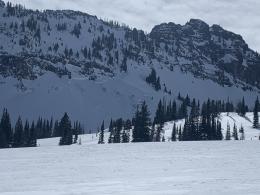
Dave and I went to the Throne in the northern Bridger Range yesterday (video). The wind was ripping at all elevations and blowing the couple inches of new snow into thin drifts, our primary avalanche concern. Strong winds have also fed cornices. These overhangs of snow came tumbling down on Buck Ridge (video, photo) this past weekend, and triggered an avalanche last Wednesday in the Hourglass (a gulley north of Bridger Bowl) that broke in weak, sugary facets near the ground (photo). Last Friday we investigated a large slide that was triggered by a snowcat in a thin and weak snowpack near Swan Creek (video, photo and details). Crumbly, sugary snow (depth hoar) on the ground avalanched as the groomer cleared the trail proving that thin snowpacks still harbor weak snow that a skier, rider or cornice could trigger. Skiers on Mt Ellis yesterday had poor stability test scores (ECTP13) in this bottom layer; more evidence of avalanche potential in areas with thin snow cover.
Wind drifts, cornices and weak facets at the ground are all partners in crime. When they team up, avalanches can happen. The travel advice today is simple: give cornices a wide berth, stay off of slopes if you get cracking in the wind-drifts and realize that facets at ground could break if you get unlucky. For today the avalanche danger is rated MODERATE on all slopes.

In the southern ranges, including the mountains around West Yellowstone and Cooke City, avalanche conditions are generally safe. Even though triggering avalanches is unlikely, wind has been blowing and a few thin wind drifts may crack and slide. Cornices are also growing and could break far back from their edge. Don’t temp these overhanging behemoths; gravity always wins. Avalanches are not impossible, just not expected. During times of relative stability due diligence is still required. Carry rescue gear, travel with a partner, assess the snowpack, and only expose one person at a time in avalanche terrain. These protocols have a long history of saving lives, even during times of stability. For today the avalanche danger is rated LOW.
If you get out, please send us your observations no matter how brief. You can fill out an observation form, email us (mtavalanche@gmail.com), leave a VM at 406-587-6984, or Instagram (#gnfacobs).
Upcoming Avalanche Education and Events
Our education calendar is full of awareness lectures and field courses. Check it out and plan to attend one or two: Events and Education Calendar.
COOKE CITY
Every Friday and Saturday, Snowpack Update and Rescue Training. Friday, 6:30-7:30 p.m. at the Soda Butte Lodge. Saturday anytime between 10-2 @ Round Lake.
BOZEMAN
TONIGHT! 1-hr Avalanche Awareness. 6-7 p.m. at REI.
March 6 and 7, She Jumps Companion Rescue Clinic, Fri 6-8 p.m. and Sat 10a-2p. More info and Register HERE.
BILLINGS
March 12, 1-hr Avalanche Awareness, 6-7 p.m. at The Basecamp.
MSU film student, Nate Kenney made Propagation, a video that profiles GNFAC forecaster Alex Marienthal and highlights what we do at the Avalanche Center. Thanks, Nate! Nice job.