Good Morning. This is Doug Chabot with the Gallatin National Forest Avalanche Advisory issued on Wednesday, March 21st at 6:45 a.m. Today’s advisory is sponsored by World Boards and Yellowstone Ski Tours. This advisory does not apply to operating ski areas.
Snowmobiler triggered cornice avalanche in Centennial Mountains (ID)
Yesterday, a snowmobiler was injured when a cornice broke and carried him a few hundred feet down a cliff which triggered an avalanche in the Centennial Range of Idaho between Sawtelle Peak and Mt. Jefferson (google earth). Fremont County Search and Rescue reported the rider was injured and ambulatory, and med-evacuated by air to a hospital.
In the last 24 hours the southern mountains and Cooke City picked up 1-2” of new snow while the northern areas remained dry. Mountain temperature are in the high teens with W-SW winds of 15-25 mph. Today will become mostly cloudy, temperatures will reach into the 30s and tonight expect a little rain in the valleys and 1-2” of snow in the mountains with precipitation continuing into tomorrow.

Yesterday, west to southwest wind steadily increased and blew snow into 5-6” thick wind slabs. Skiers up Hyalite and around Big Sky easily triggered these with ski cuts and I expect similar results today. The snowpack is generally stable (video) and these soft slabs of wind deposited snow are unlikely to break into older snow. The wind slabs will be found near ridgelines where a second hazard lurks: cornices. Every range has them (photo) and yesterday a skier in Hyalite noted a few recently broke. The rider in the Centennial Mountains is lucky to be alive after a long fall and avalanche. Cornices this season are extra beefy and overhang far off ridges, ready to break from a passing skier or sledder. Until you’ve soiled your pants with a close call, it’s hard to appreciate how unexpected and far back cornices break.
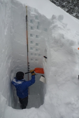
Winds have lessened overnight but soft wind slabs that formed yesterday are still possible to trigger. The old snow lacks widespread weak layers and avalanches on non-wind-loaded slopes are not expected, but not impossible either. Even during times of relative stability it’s a good idea to dig and test the upper couple feet of the snowpack to confirm the new snow is sticking well to the old surface. For today, the avalanche danger is rated MODERATE on wind-loaded slopes and LOW on all others.
If you get out and have any avalanche or snowpack observations to share, drop a line via our website, email (mtavalanche@gmail.com), phone (406-587-6984), or Instagram (#gnfacobs).
Send us your observations on Instagram! #gnfacobs
Posting your snowpack and avalanche observations on Instagram (#gnfacobs) is a great way to share information with us and everyone else this spring.
Cooke City is buried with snow this winter. Sam Wilson of the Billings Gazette wrote an article on the potentially record busting season (article).