Snow Observations List
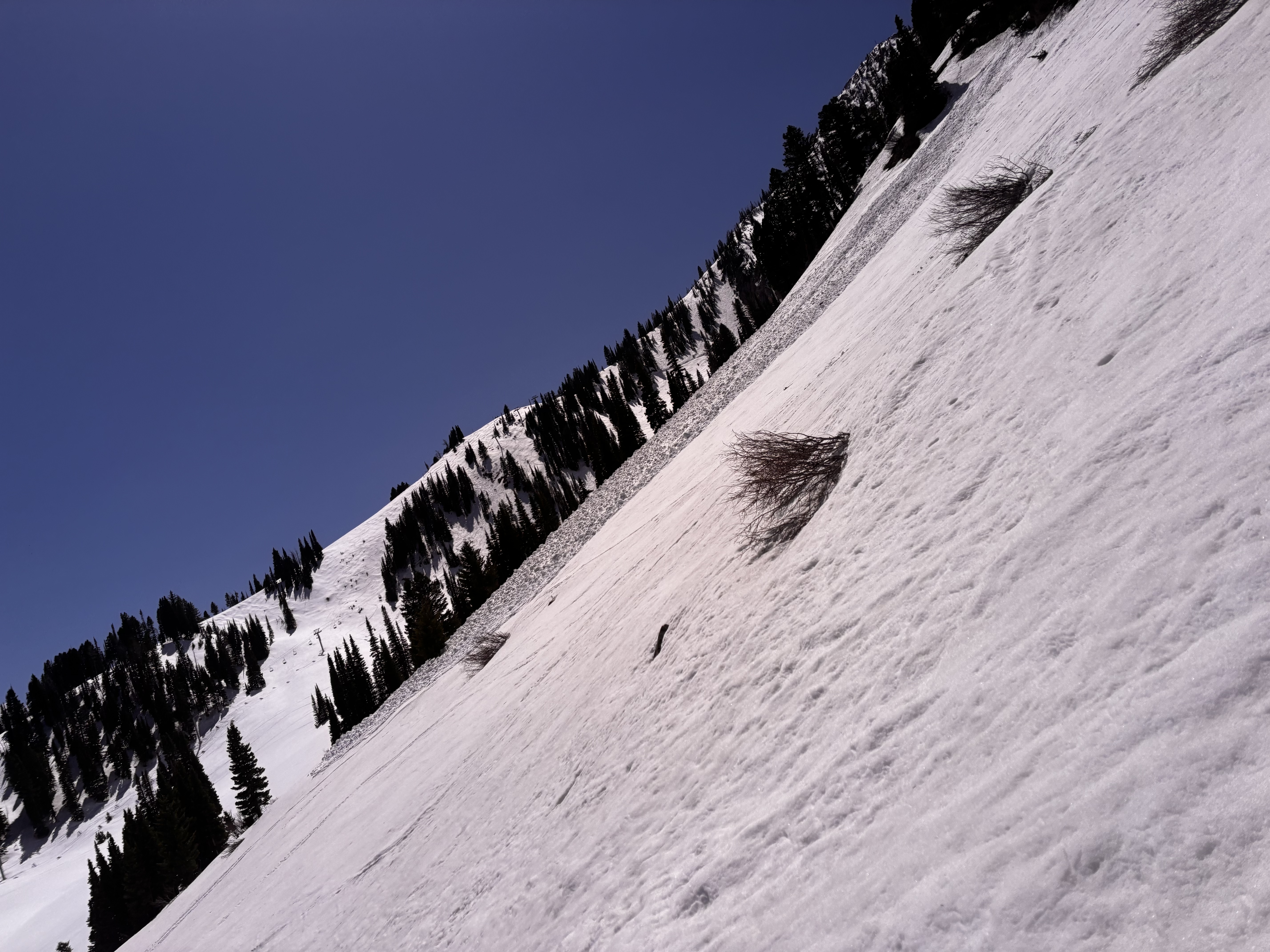
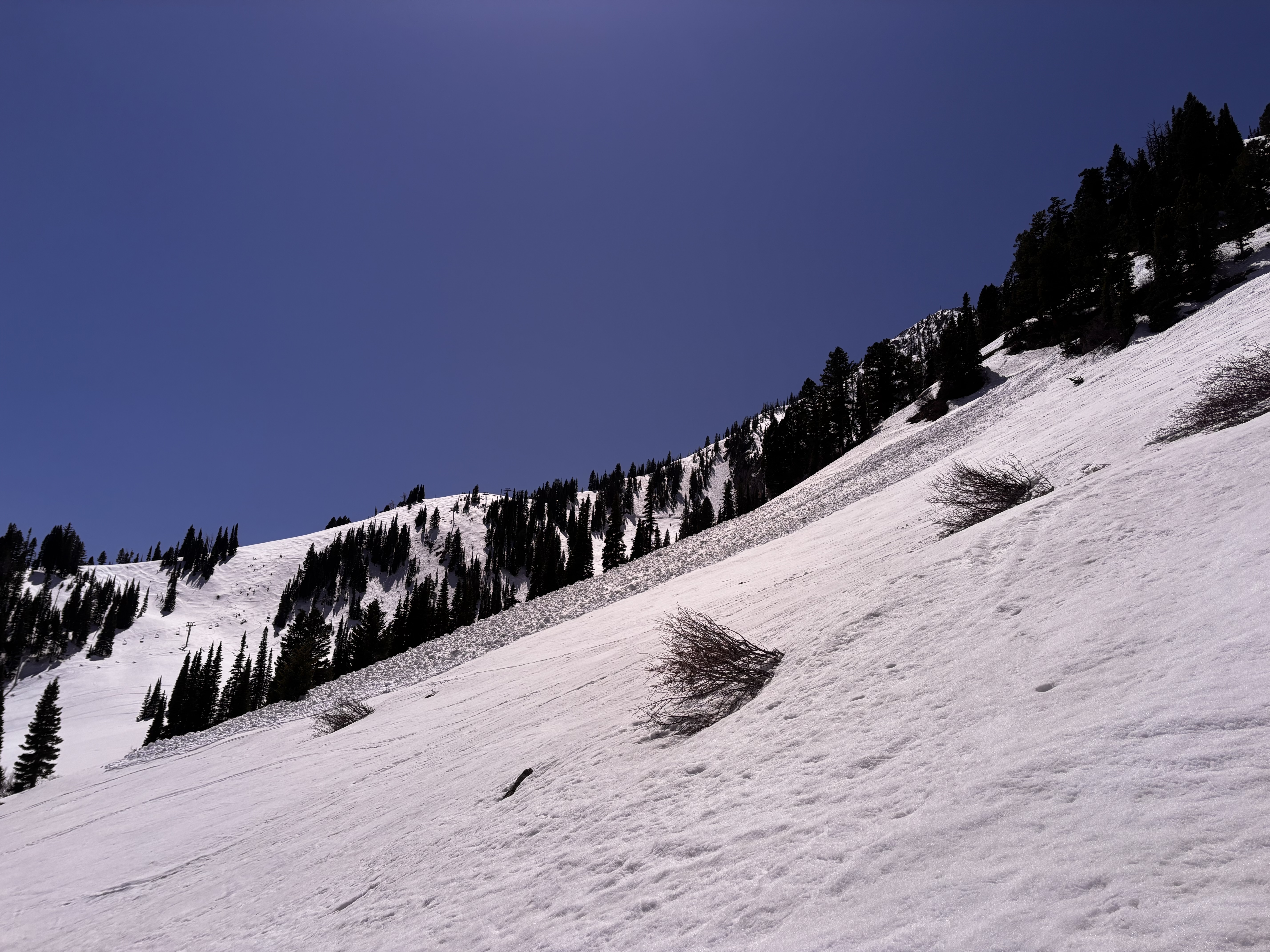
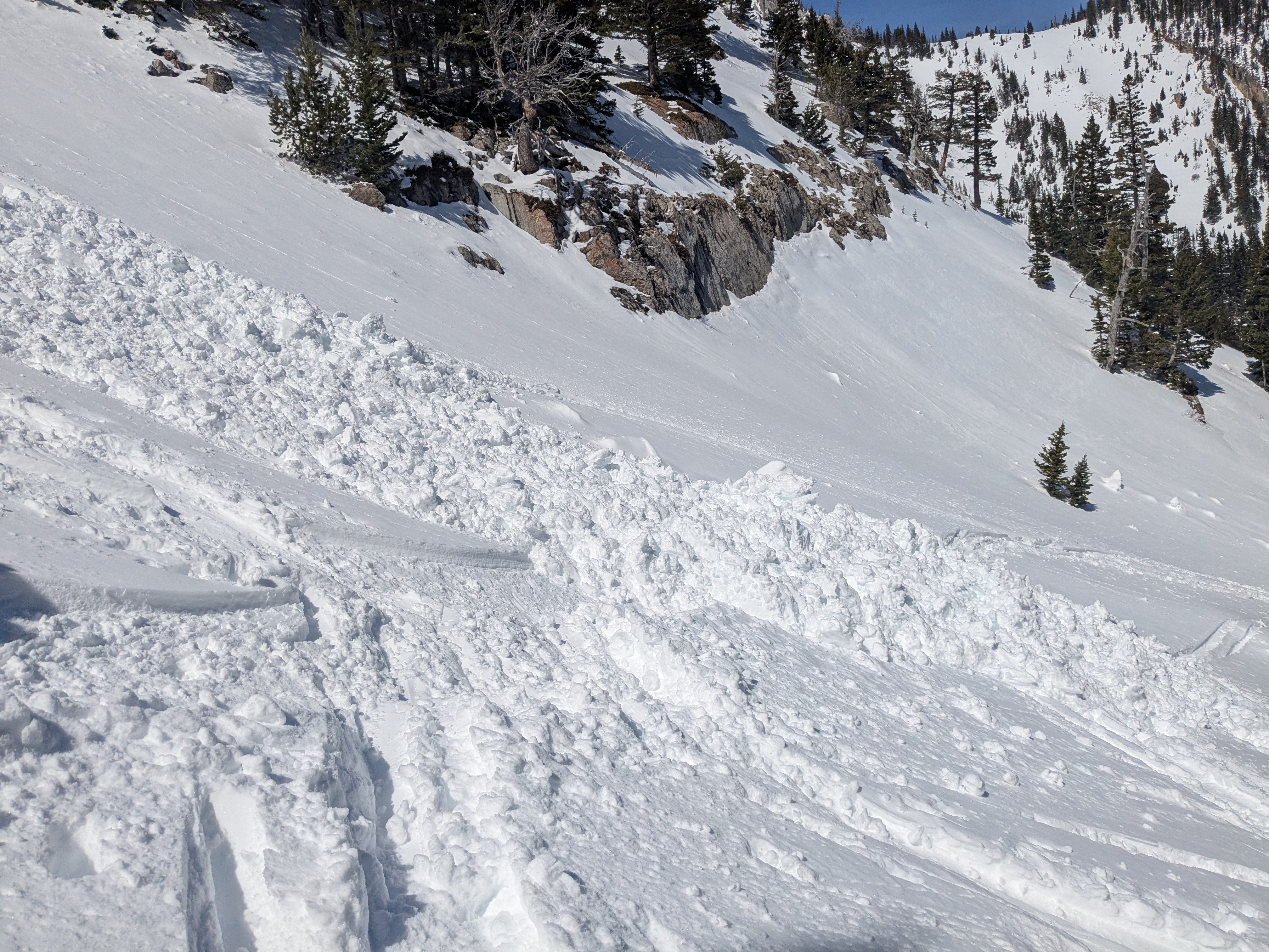
Our party of three triggered a wet loose avalanche comprised of new snow in Mad Man’s chute that slid into North Bowl. No skiers caught or harmed.
Full Snow Observation ReportObserved one pile of what looked to be fairly recent wet slide debris at the bottom of the cliffs below the Football Field on Saddle. Surprisingly, not a whole lot else of recent activity around Bridger. Seems like most things that wanted to go has already done so some days ago...
Full Snow Observation Report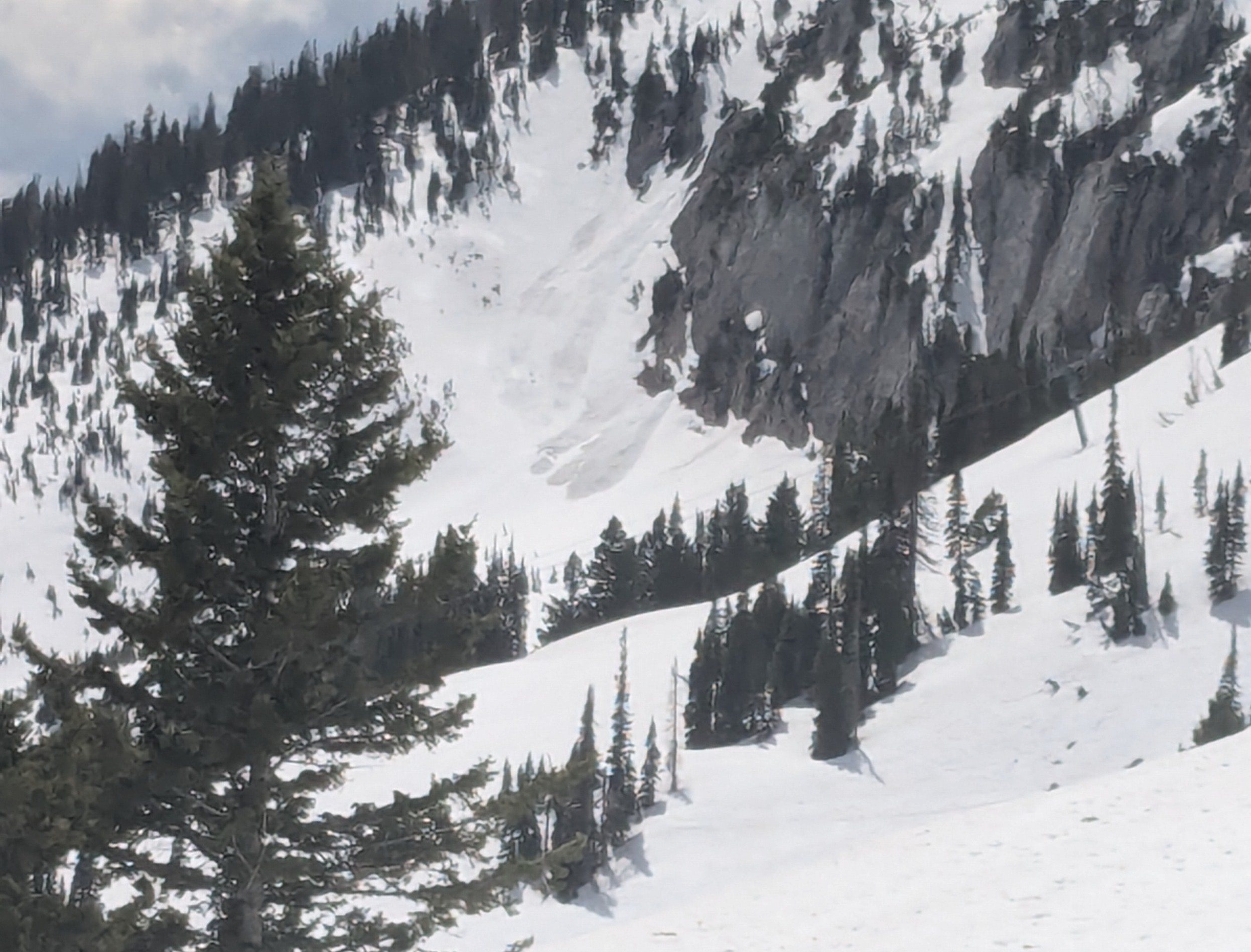
I skied to the bottom of the ramp this morning. There was 8-12” of heavy, mostly moist snow from yesterday. Winds were moderate to strong on the ridge and above ~7800’. Mostly cloudy.
There were some fresh, hard wind slabs on the ramp. These may exist for another day or so on high, shady slopes.
Below the new snow, the snowpack was not refrozen. There was a very thin, 1cm crust with saturated wet snow below. There were old wet slides, d2, that ran last week out of the steep terrain south of the ramp. Wet snow avalanche potential could increase quick when temperatures get hot.
Full Snow Observation Report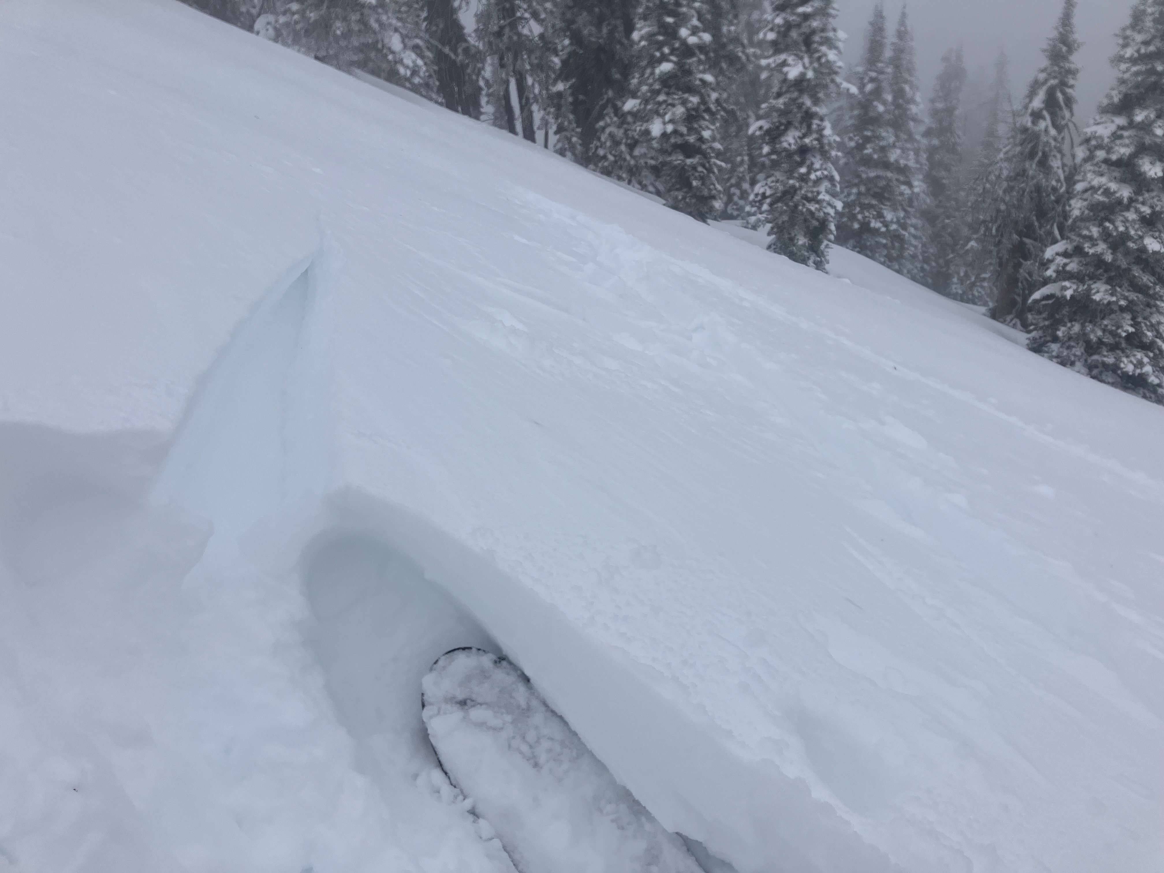
S1.5, winds Mod from N, OVC ~ 1400
6-8” of cold snow at Bradley’s Meadow (7,800’) but about 4-5 inches of isothermal snow and a M/F crust interface below.
if temps drop overnight, this could be a problematic layer.
winds scouring some parts of Bradley’s ridgeline and depositing 4f to 1f slabs
Full Snow Observation Report
We were above the entrance to Exit Chute and triggered a slough slide that slid down one of the gullies that emptied into PK bowl. It appears to have followed an existing slide path, terminating in the top of what looked to be a significant existing avalanche runout. The slide looks pretty wide but not deep.
Full Snow Observation Report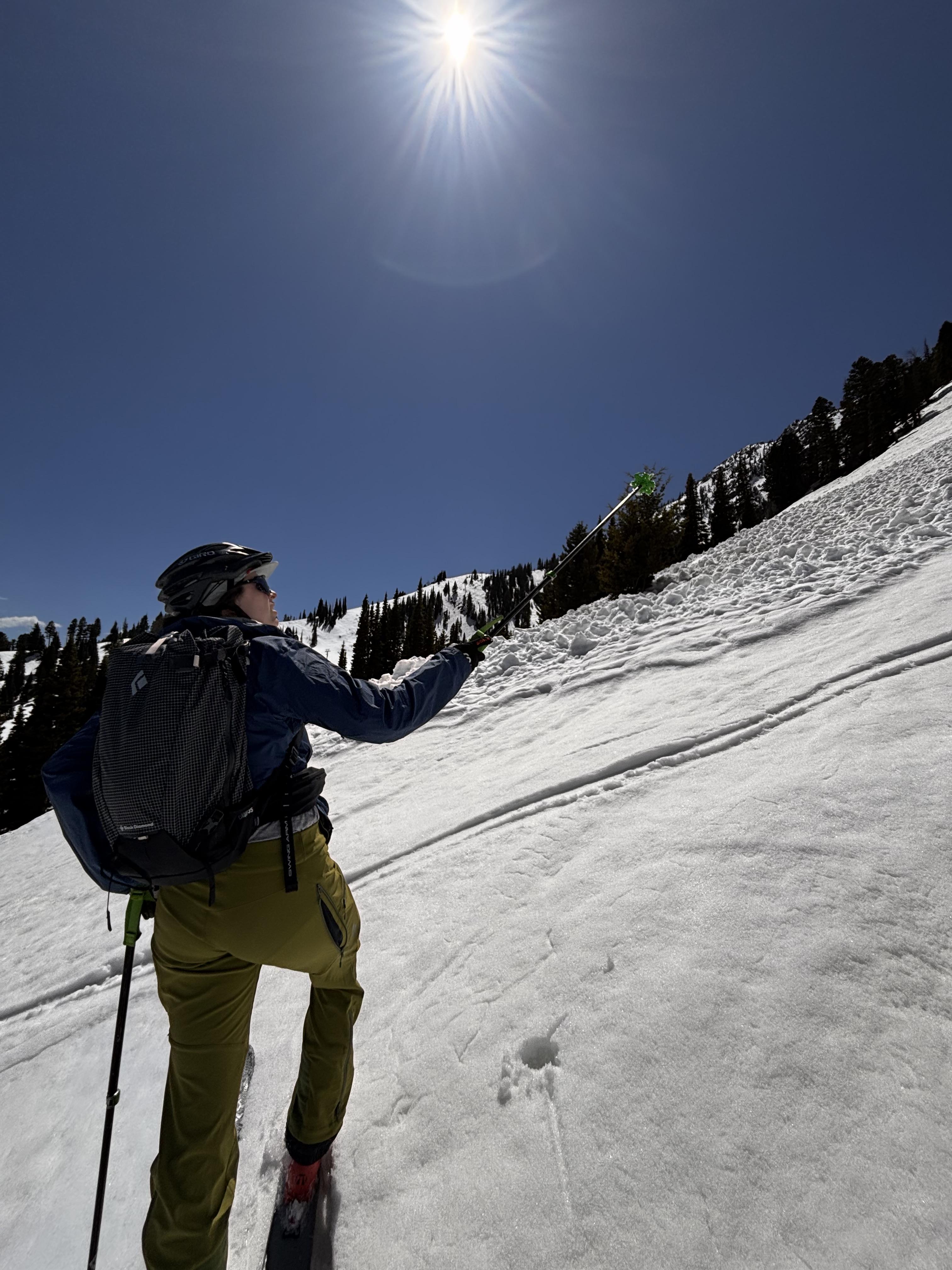
Saw many recent looking wet loose avalanches on east facing slopes at Bridger. We got a good look at the debris pile from one in Z chute and it looked big enough to bury a person (D2) and had run far past the cat track into south bowl.
We encountered a lot of variation in ski penetration with ~1' of loose melt forms in places on north and east facing slopes ~8k' in elevation.
Full Snow Observation ReportThis wet loose avalanche is a great example of where they often occur. Rocks absorb extra heat from the sun and can quickly melt and destabilize the snow. Either move under areas like this early in the morning (as we did), or if you have to travel under them later in the day, move quickly.
Full Snow Observation Report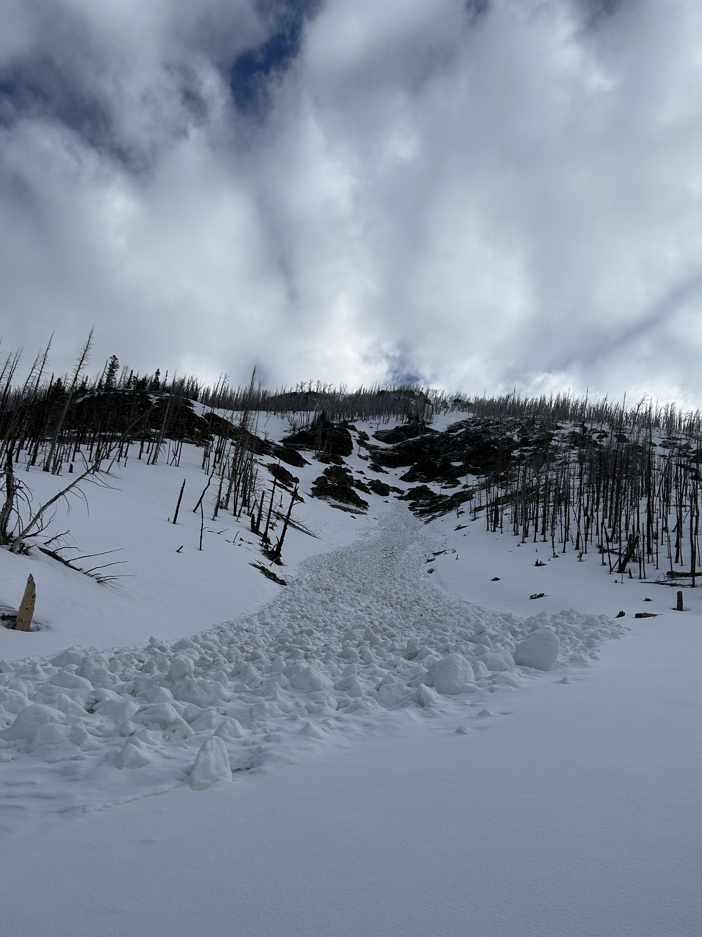
We skied the NE bowl on Black Lion mountain in the East Pioneers. A solid refreeze overnight made for easy skinning in the morning. Despite the relatively warm ambient air temperature, moderate winds kept the snow cool above 9000'. Snow showers from convective activity started at 1300, with no accumulation. We saw several point releases on the steep east face, and the mostly filled in crown of a deep slab avalanche on the north face. Low elevation snow is virtually nonexistent and mid elevation snow is melting fast. Overall, conditions were good.
Full Snow Observation ReportWe rode into Tepee Basin along the headwall and up to the wilderness boundary. There had been a number of small releases of roller balls in steep rocky terrain but nothing got legs and ran. It would be hard to classify any of the activity, even as small wet loose avalanches. Crusts stayed robust and supportable throughout the day.
There was 2-3” new snow at the bottom of the basin and 4–5 inches up near the wilderness boundary. Winds were calm, and there was no active wind loading. The new snow throughout the basin got moist during the heat of the day. North-facing slopes at upper elevations stayed cool and mostly dry.
We had a nice late-season ride. Avalanches are unlikely under the current status quo. Today, the primary problem was isolated wind-slab instability in upper-wind-exposed terrain. Overall, there are safe avalanche conditions.
A significant warm-up or a significant pulse of snow would change the equation. At this point, it seems like most of the snow around has been transformed by warm temperatures over the last few weeks. I am more worried about new snow than a warm-up.
Full Snow Observation ReportToured out of beehive basin yesterday (4/22). I spotted a storm slab avalanche on a northeast-facing slope at 9400 ft It was fairly far away, but the debris pile was decently sized. While skiing a northwest aspect in the high alpine, I pulled out several small wind slab pockets, including one that propagated about 10 ft and was a foot or so deep. These slabs were beginning to set up and weren't super touchy. Later in the day, I saw a small point release originating from an east-facing rock band at around 10000 ft.
Full Snow Observation Report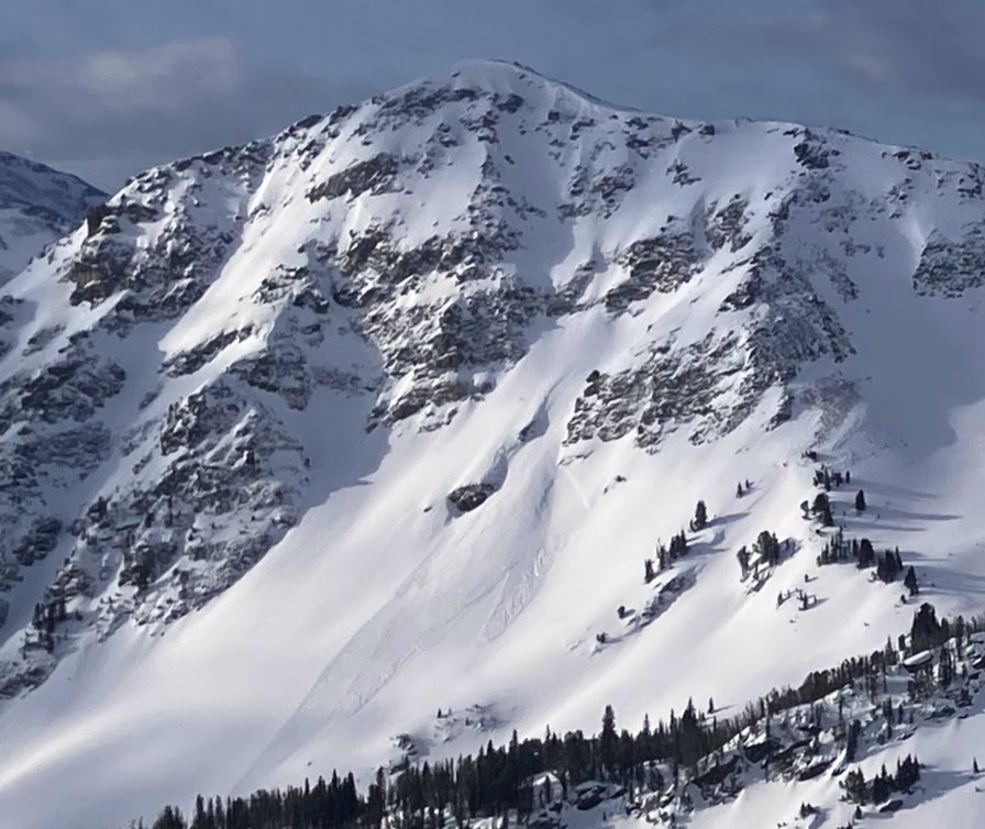
NE facing ridgeline near Hidden Couloir was touchy, with a 6-8” stiff wind slab breaking quite easily underfoot. Not the first person to ski Hidden, so observed this slab was not propagating far, but was breaking easily as temps heated up.
Full Snow Observation Report
Toured through Bradley's Meadow today and N into the drainage and the backside of Texas Meadows. Approx 6" of dense, new snow. New snow has bonded well and we couldn't get anything to move or sluff. Zero shooting cracks, no collapsing on N, E, or S aspects. Nice skiing with the existing layer supporting the new snow.
Full Snow Observation ReportNear Cooke City on 4/19 skiers triggered a dry loose avalanche and a small wind slab avalanche. The wind slab broke in a drifted pocket near the base of cliffs, 3-6" deep x 10' wide. Northeast aspect, 10,200'.
Full Snow Observation Report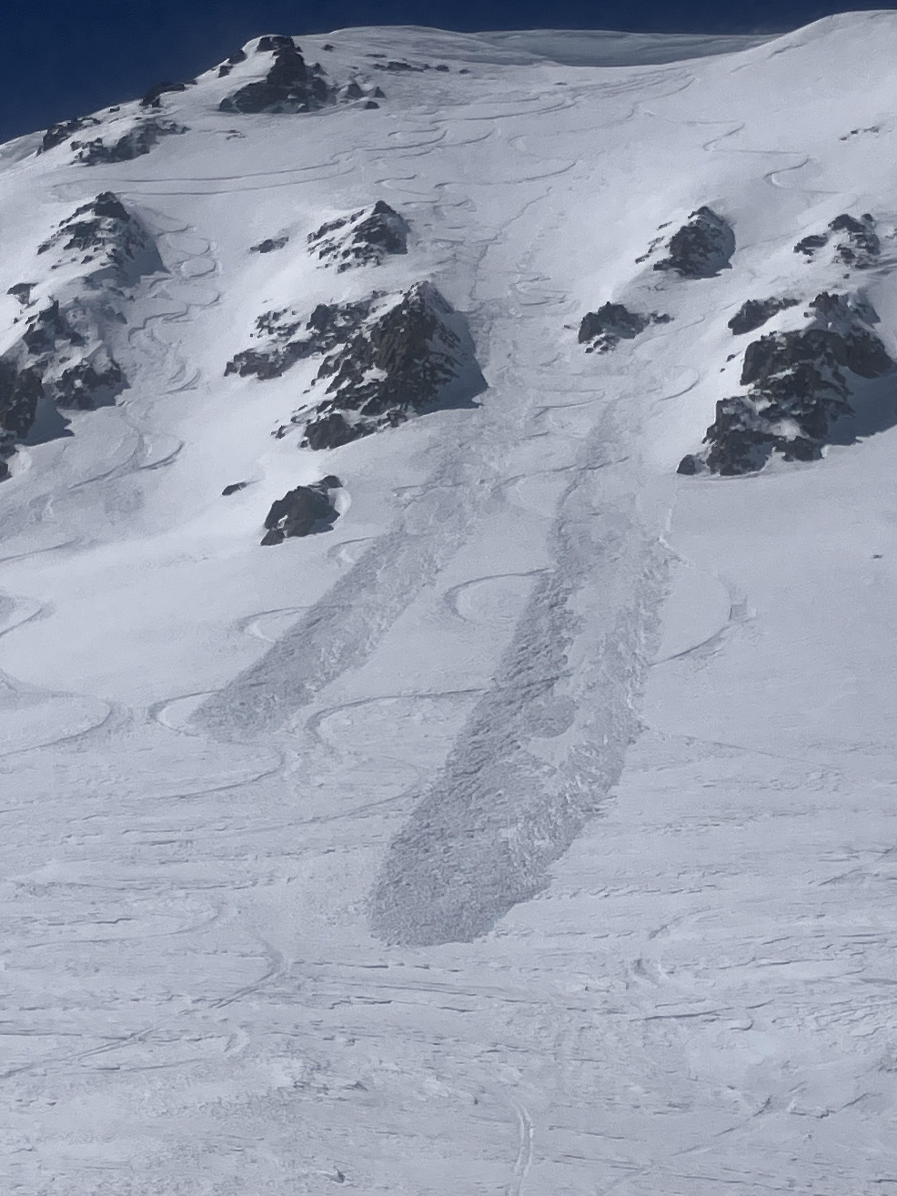
Today (Saturday, 4/19), I triggered a small soft-slab avalanche at about 7,700' on a E-NE aspect on the headwall between Frazier Lake and Angier Lake in the northern Bridgers. The slide was maybe 6" deep, 20' wide and ran 100-200 feet and involved only the new storm snow over the icy, thick crust underneath. No one was caught or injured, though I had a bit of a scare because my dog was right in the path (luckily she outran it). We had gone up with the intention of skiing the Ainger "Love Chutes", but bailed partway up when that whole aspect turned out to be breakable crust. However, we had beta from another party that conditions on the Frazier-Angier headwall were good, so decided to check that out. We skinned up without incident, following a well-set skin track that followed the line of least resistance; snow surface was variable but seemed stable. Coming down, we mostly followed the ascent route, but towards the end I was tempted onto a fun-looking, untracked stash a bit to skier's left, that seemed only a tad steeper than the ascent line. A few turns into this line is when I triggered the slide, right at the steepest part (mid-high 30s). It definitely took me by surprise given that we'd been skiing great, stable powder in the Bridgers the past couple days. No harm done but definitely a good wake-up call!
Full Snow Observation Report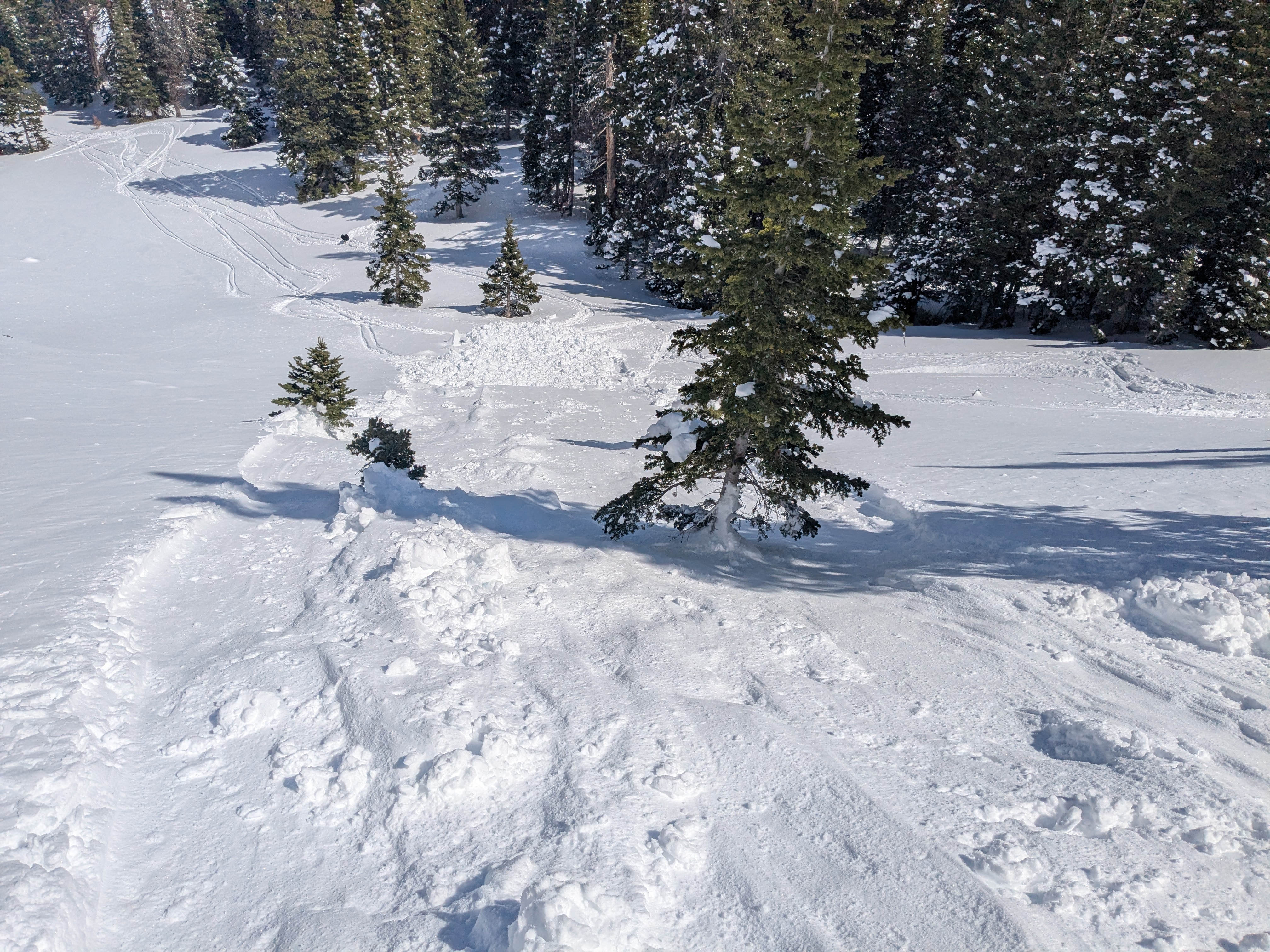
Meant to submit this yesterday (4/18), saw this one wet loose slide that naturally started off some rocks. Decent size by the bottom. Other than that, just some spiff. Surprisingly didn’t see any big wind slabs trigger, despite the widespread wind effect in the northern Bridger’s. Lots of wind scour on southerly aspects. Northern aspects had wind loading.
Full Snow Observation Report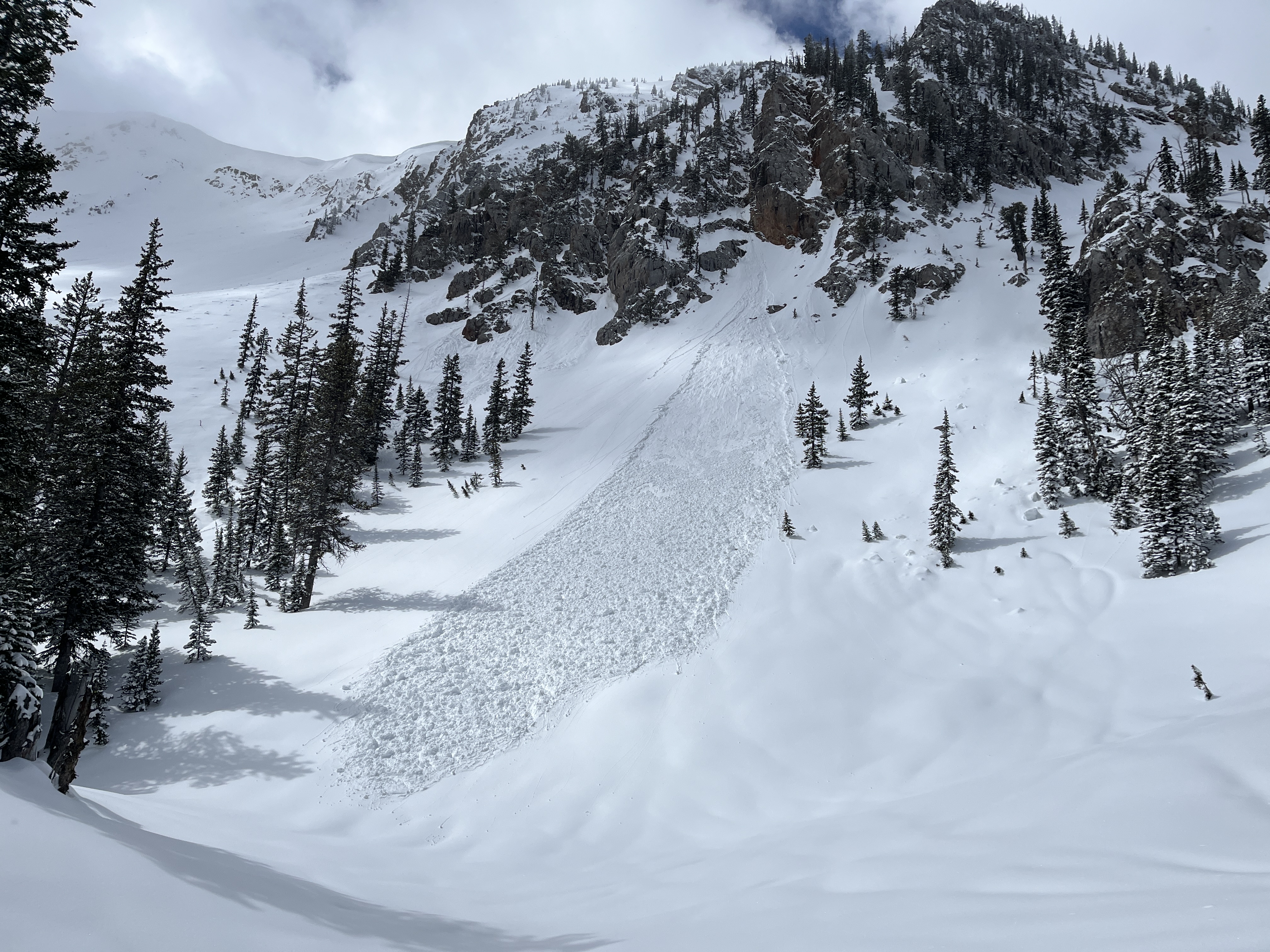
We rode up to the old weather station and then to the current weather station, down Airplane Bowl, along the base of the LH Ridge to the head of Targhee Creek and back. There is a 4-5" Thick refrozen crust below 3-5 inches of new snow at upper elevations. At lower elevations, there was less snow, and I suspect more rain, and east winds stripped many of the upper starting zones back down to the melt-freeze crust.
There was little, if any danger of avalanches today. You may have been able to find an isolated wind slab from the east wind-loading, but it would have been small in area and depth. We rode out at 2 PM and the crust had not started breaking down in any meaningful way.
Tomorrow is supposed to be 8-10 degrees F warmer, but cold temperatures tonight should refreeze the crust, and it is pretty robust. There may be a few very small, wet snow avalanches in the recent snow with warming temperatures, but I would not be particularly worried about slides. There is more snow and colder temps forecast for Sunday and Monday. Fingers crossed for a bit more powder riding.
The road from the Buttermilk TH was reasonable but is melting out quickly. There were a few dirt patches that will grow tomorrow.
Beautiful day to spend in the mountains and the riding through the upper bowls was quite nice.
Full Snow Observation Report

Toured out Deep Creek to Zeppo’s. Summer trail was largely melted out in the drainage. Despite warm temps and sticky, wet snow on E-S-W aspects, we still found about 4-10 inches of dry new snow over a MF crust on N aspects above 8500 feet. Snow in the Zeppo’s burn was holding up surprisingly well from the previous night’s freeze and was supportable through the afternoon. Large cornice formation on E aspects.
Full Snow Observation ReportWe went through Flanders' Creek to the Flanders Weather Station to pull it for the season. We descended to the Grotto Falls TH via the Winter Dance Route. The surface snow got wet as the day progressed, but we saw no wet snow avalanche activity. I wouldn't be surprised if there was limited activity as the day progressed.
Recent warm temperatures have almost universally affected snow surfaces. North-facing slopes above 9500' elevation remain dry, and pockets of dry snow exist at lower elevations on shaded slopes. South-facing slopes have cycled a few times, and the corn snow is coming in reasonably well.
There were no signs of dry snow instability.
Full Snow Observation Report

We found soft snow on north-facing terrain in Sac Bowl and off Pomp Peak, skiing until about 2 p.m. on 4/14. The recent storm winds stripped some southeast facing terrain down to crust, but had deposited 4-6 inches of creamy pow in sheltered N zones. Skiing was mostly bomber, with the exception of some wind slab we avoided on a start zone immediately below ridgeline in Sac Bowl. Saw a few small dry loose / point release slides in southern Bridgers, but nothing in N. Bridgers except for old debris piles.
Full Snow Observation ReportI rode the motorized zone and noticed natural wind slab avalanches running pretty far on: East Henderson, SE Scotch Bonnet, East Miller, NE Crown Butte. D1.5-2.0
Loose wet debris from yesterday were also present in many places.
Full Snow Observation Report