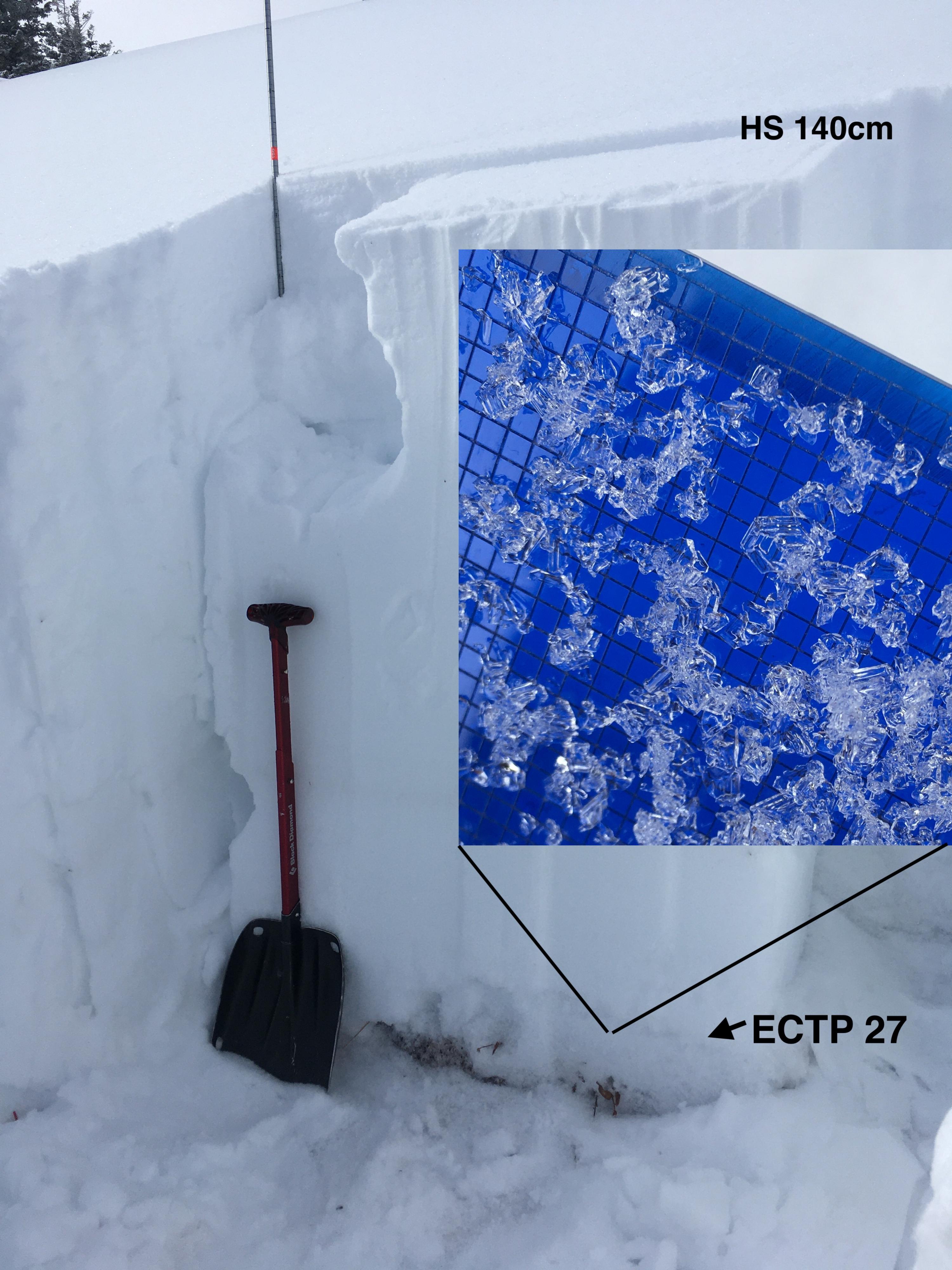
On Mt Ellis (2/27/21) the snowpack has 20-40cm of depth hoar and facets at the bottom. Stability tests took a lot of force to collapse this layer, but it propagated (broke across the whole column) every time once initiated. This is a poor snowpack structure that makes large avalanche possible to trigger if you hit the wrong spot on a slope. Photo: GNFAC
Location
Mt Ellis