Snow Observations List
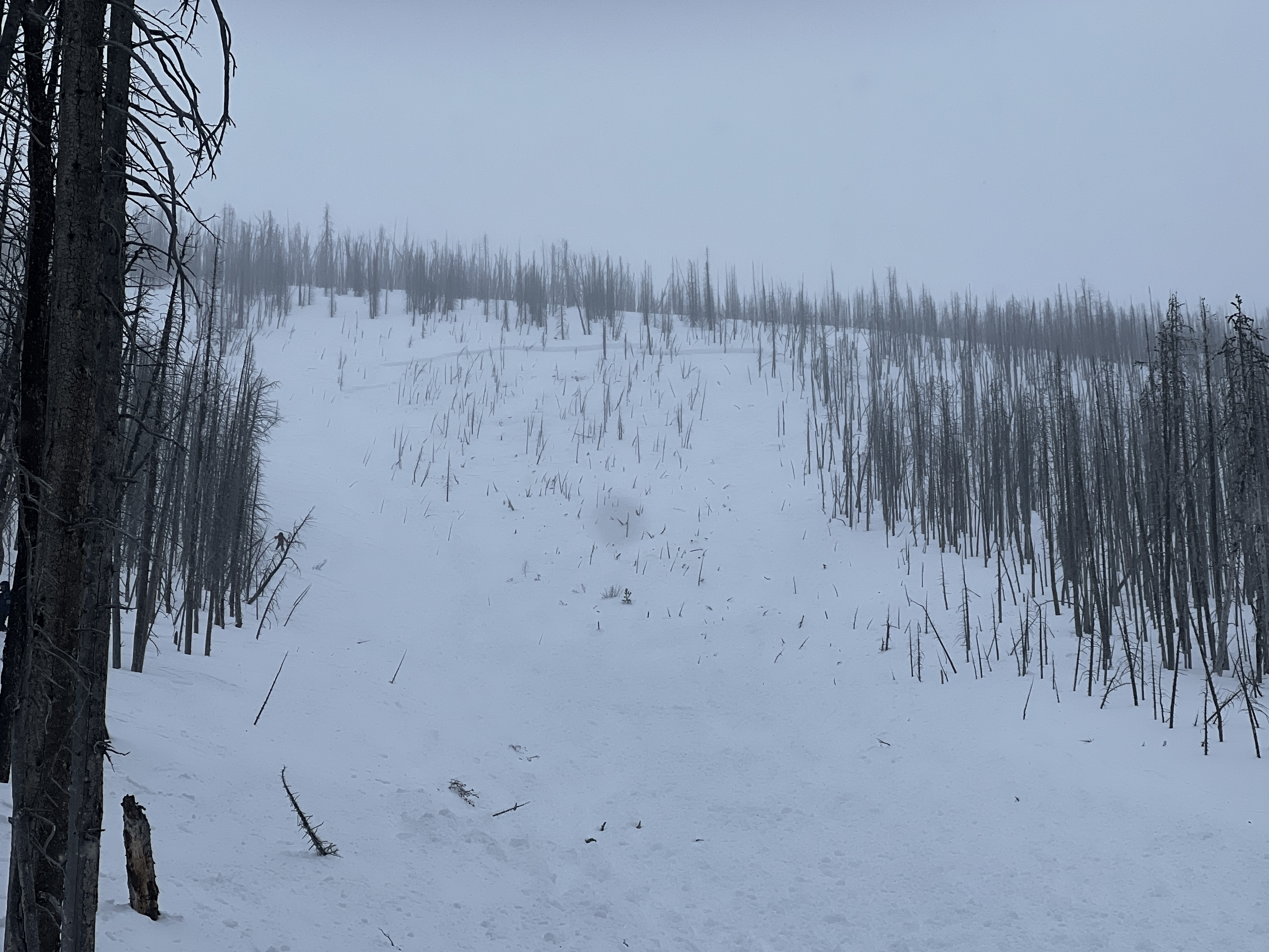
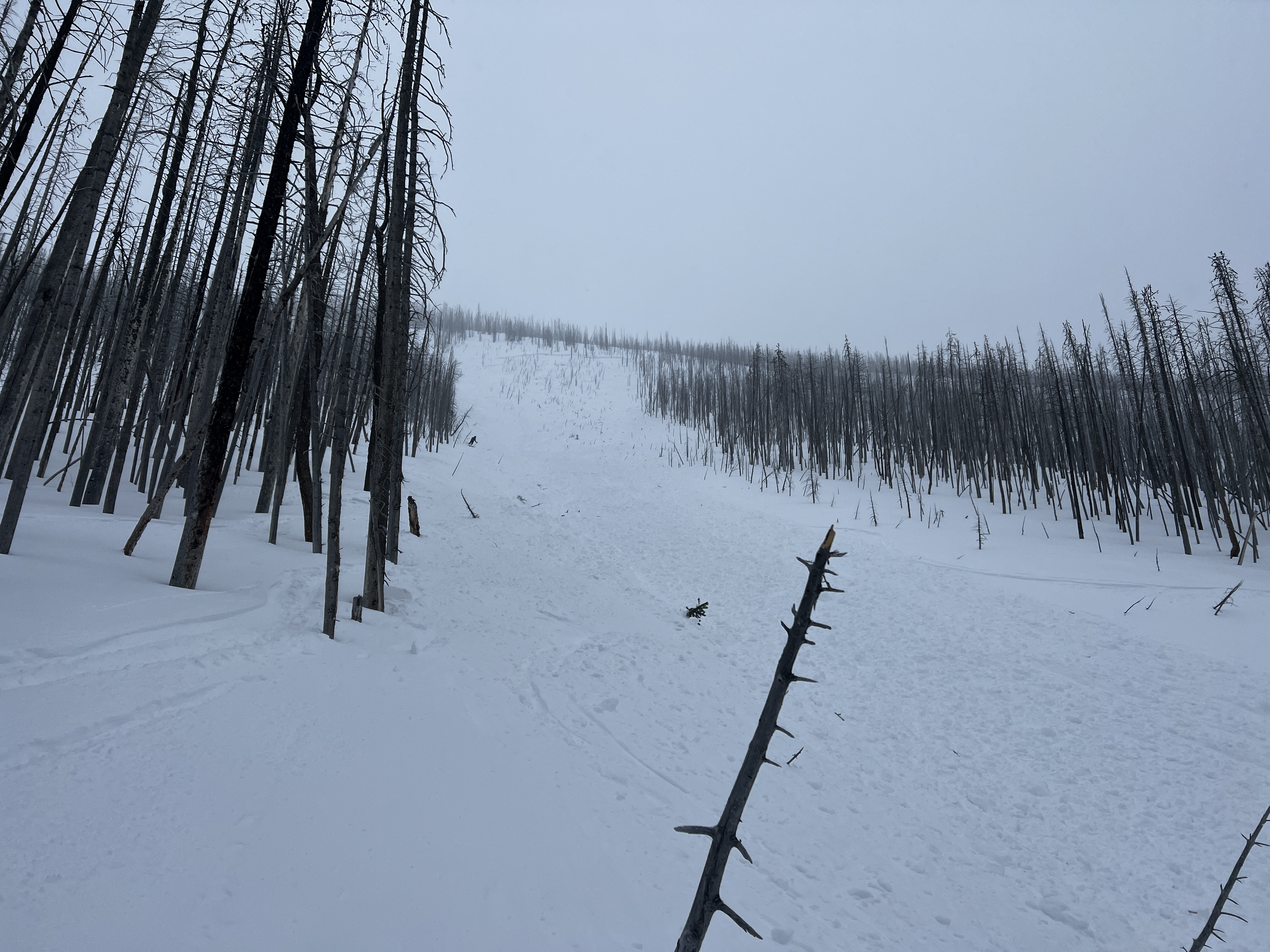
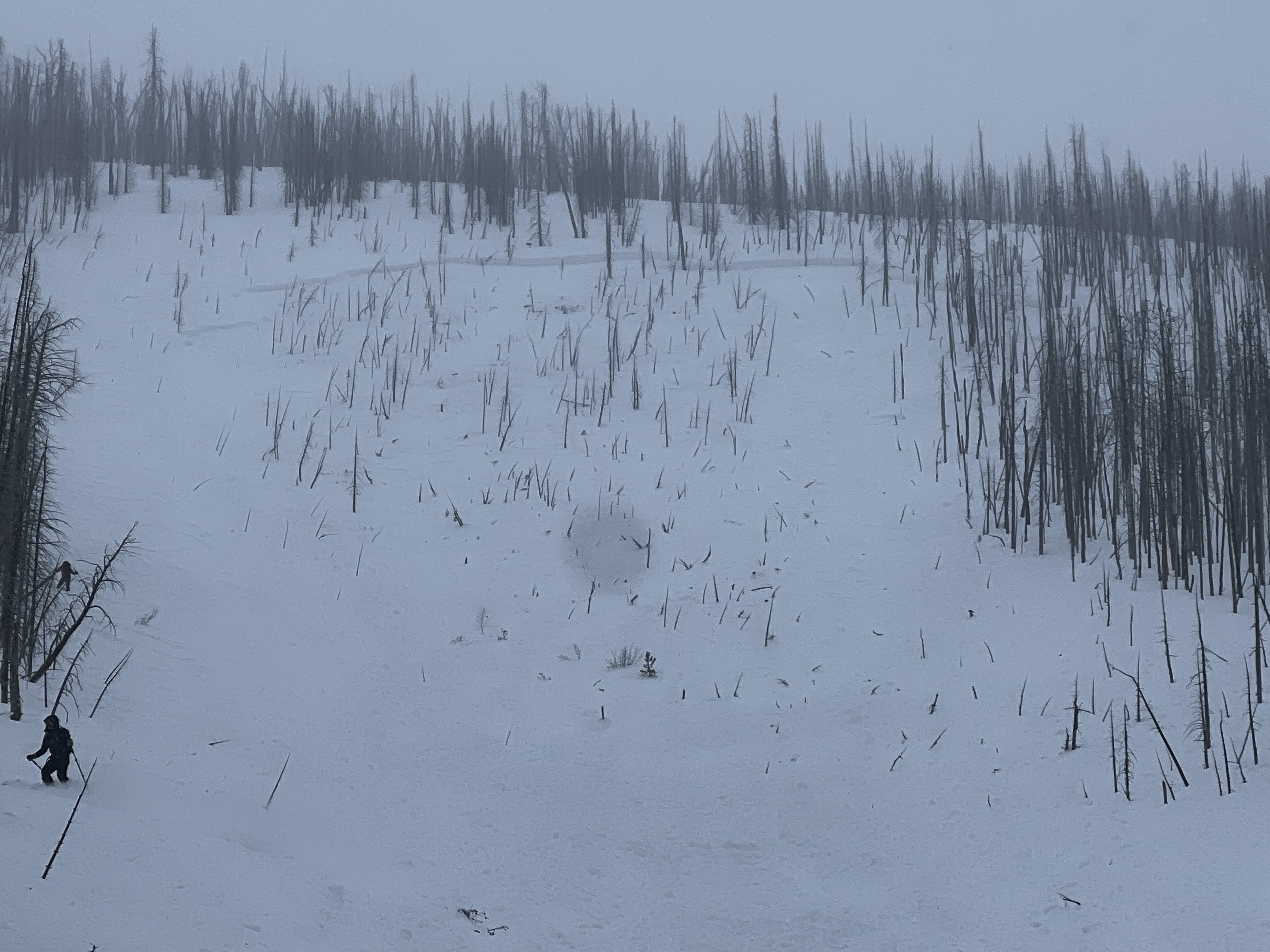
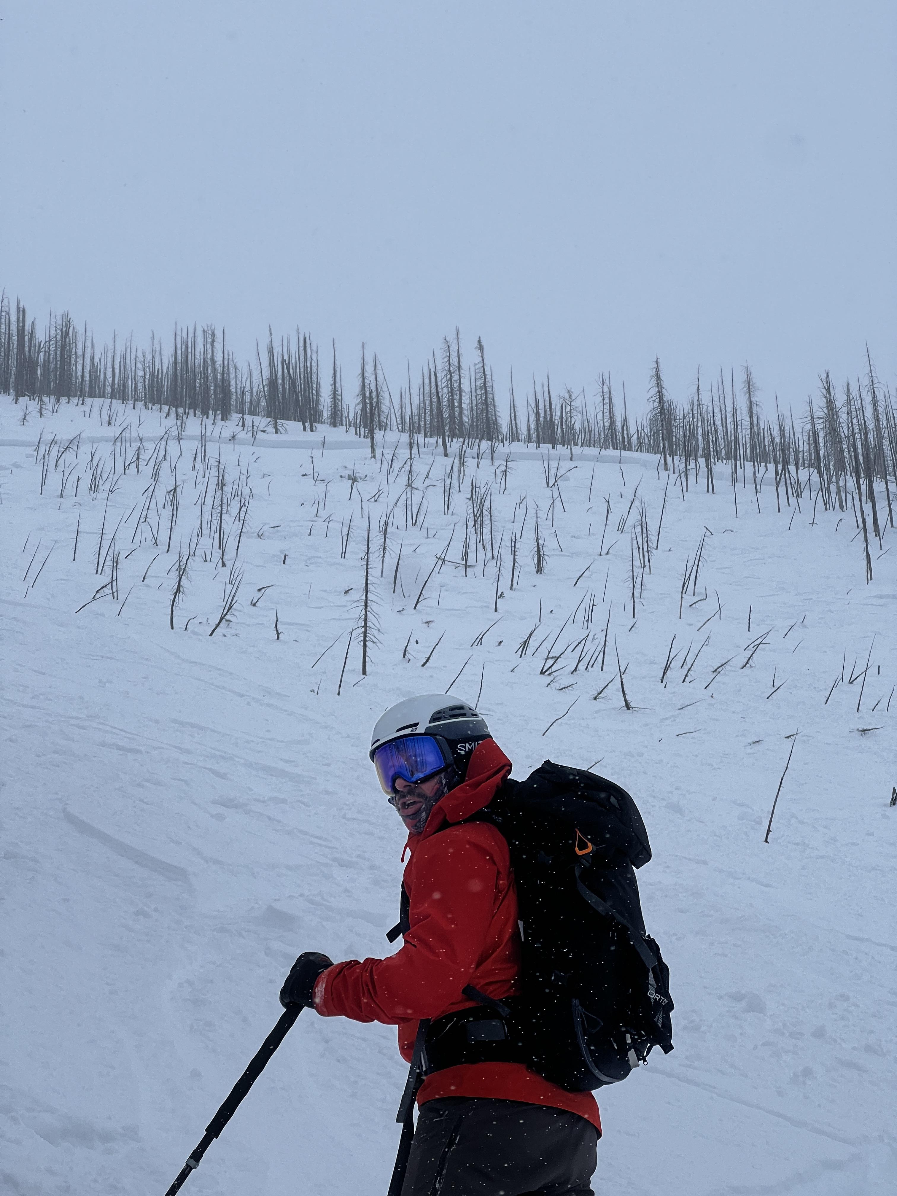
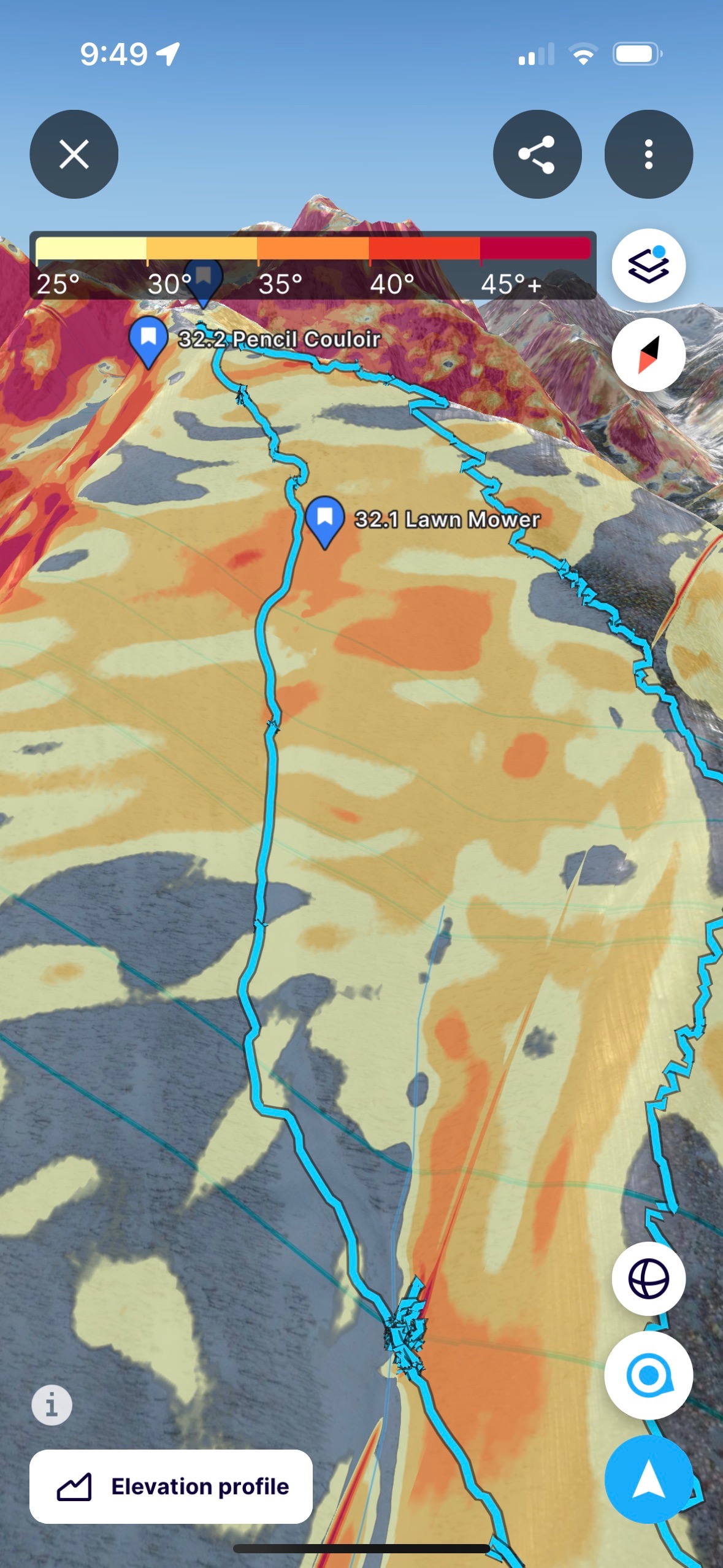
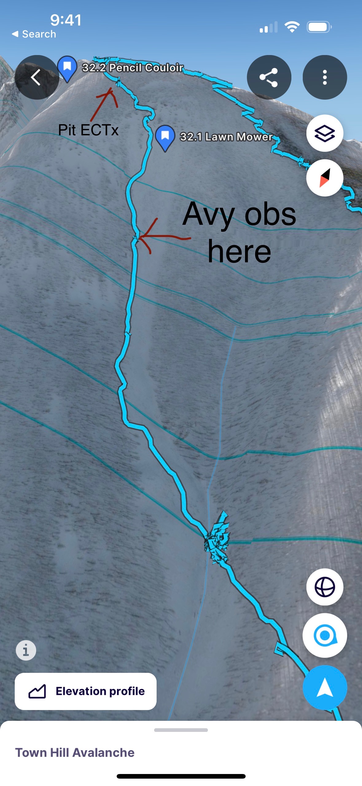
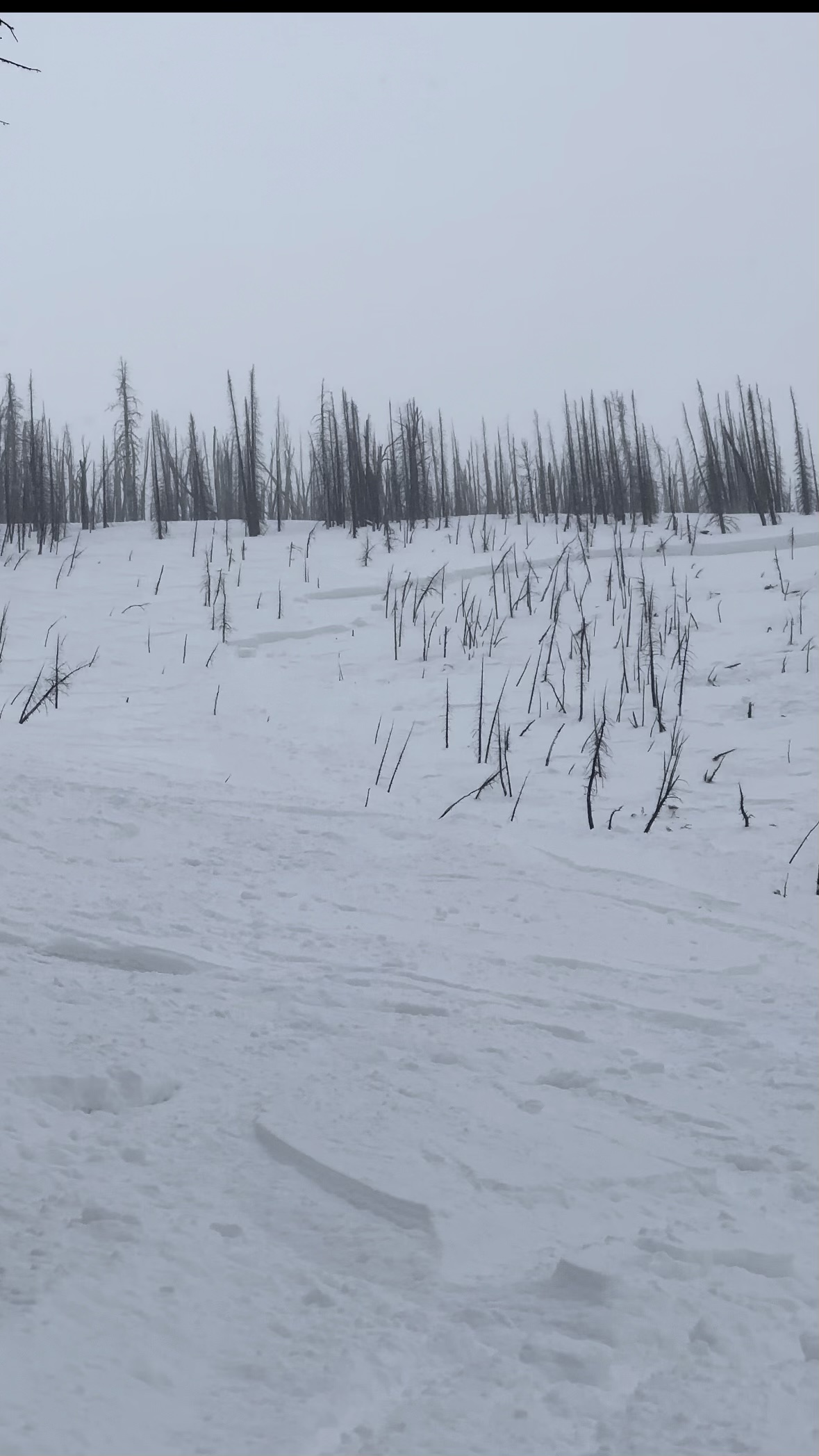
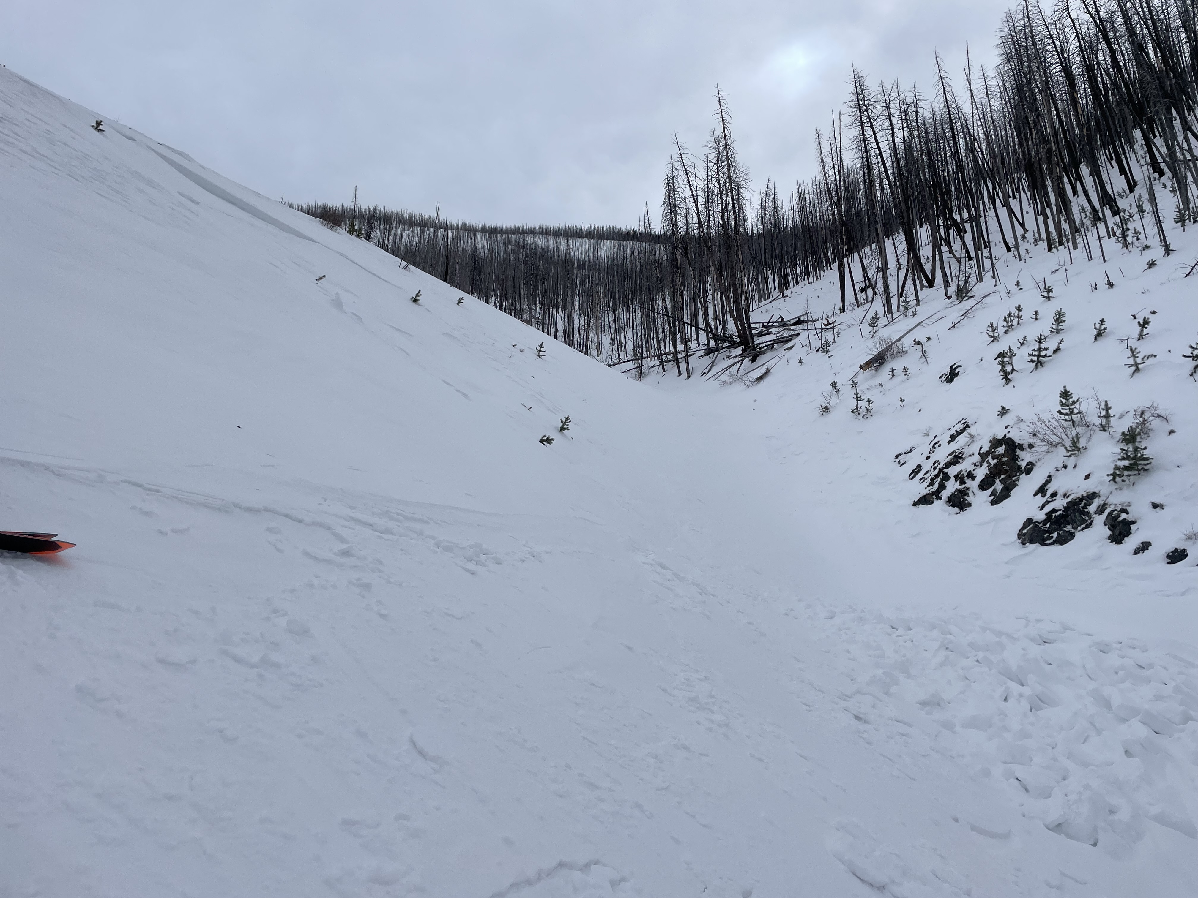
FYI big skier triggered avalanche on the lawn mower slide path on town hill today around 3pm. One skier caught and buried to neck and later airlifted out with leg injury. Our party arrived maybe 45 min after the slide and assisted others who were there.
Full Snow Observation ReportYesterday, I was in the party of three that had one skier injured on the Lawn Mower, and witnessed the slide.
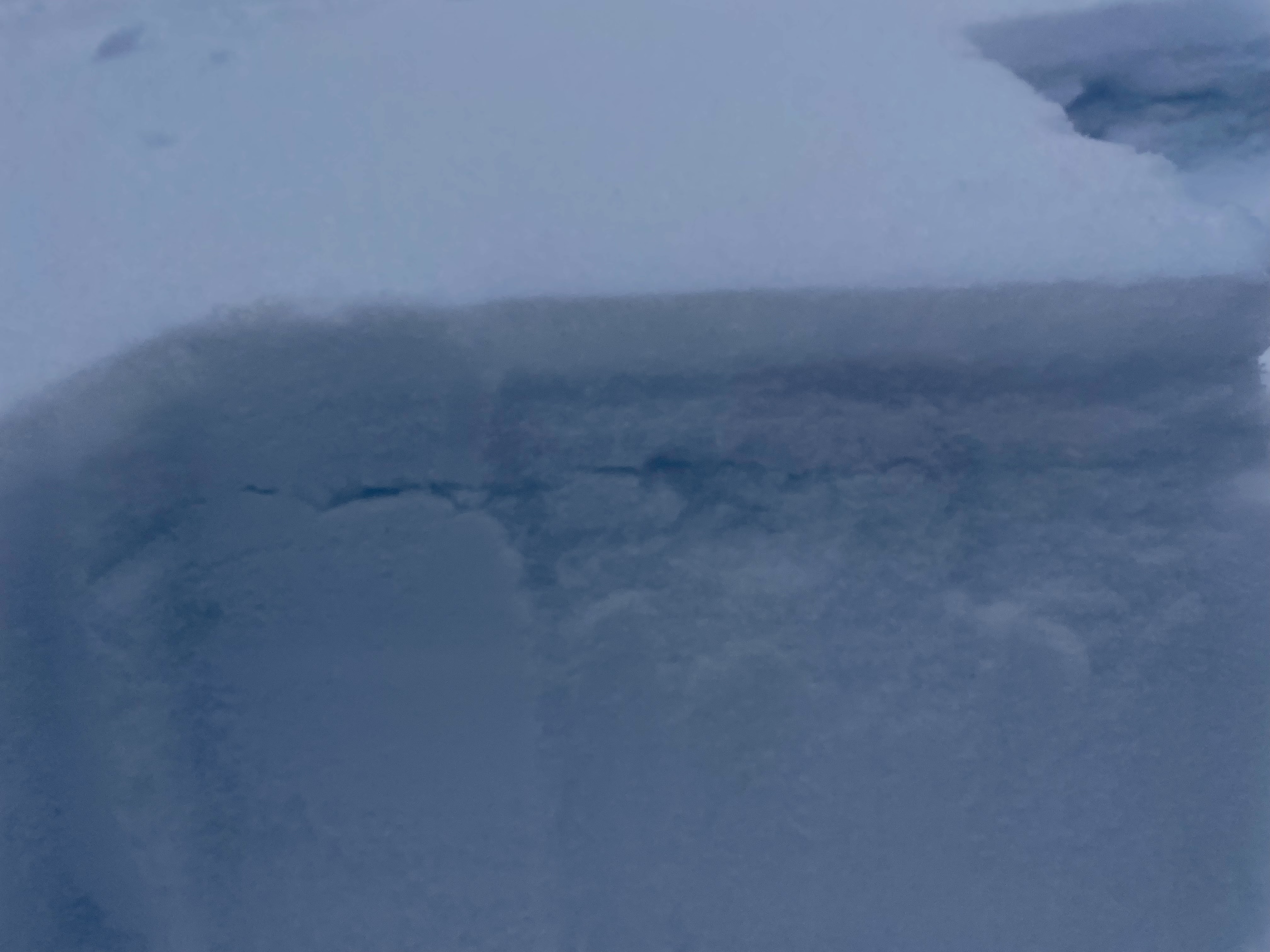
Our pit results before the descent were stable (ECT-X), we made sure to dig past the problematic layer noted in the snowpit observation at town hill on 2/19.
We began our descent leapfrogging one another to zones of safety. Myself and the third person in our party below the skier in a safe zone when he was was caught. The avalanche broke above him and came down on to him to sweep him down into the gully. Based on how he trigged it toward the far edge of the path, best guess is he found a shallower trigger point that remote triggered above.
The two of use remaining split up so one could search above where we last saw him, and one going down the path. Got a signal and shortly spotted him buried with his head and arm out and conscious. After excavating him it was clear his leg was broken at the femur.
Two other groups showed up on the scene some time after to help.
------------------
Outside of the observation above, one of the groups gave their extra jackets and we do not have contact information to return them. If possible would you be able to share that with me?
Full Snow Observation ReportOn March 4th around 2:15 PM my partner and I observed a skier (of a separate party that was caught and carried) in a D2 R2 on the Lawnmower in the Absorkas. I believe the slide was released on a buried weak layer (We only observed the crown from a distance). The victim came to a stop approximately 1,200 ft below the start zone and was buried up to his neck. There were multiple tracks on the slope prior to the avalanche. My partner and I skied up to the separate party with the victim approximately 30 minutes after the event.
Full Snow Observation ReportWe skied the Throne today, the windboard from thursdays wind was more widespead than we had hoped. It wasn't very well bonded, and didn't feel good, but it wouldn't move, either. I dug a pit on the north facing at the top, away from the windboard, and got no results. I tried to get down to the older weak layers and could spot them and get them to break, but I had to wrestle with it to get it to do it. Parking is still limited.
Full Snow Observation Report
Traveling into Blackmore Basin we assessed two potential lines from below that we had already planned to potentially ski. We gained the saddle between Blackmore and Elephant. We observed snow transport from SW winds and noted the zone we were heading to might have wind loading occurring at the top. We traversed on scoured slopes by foot over to the entrance of the line that we intended to ski. Upon our arrival we noted a convexity of wind loaded snow on the skiers left of the start zone and made note to avoid it. We transitioned to skis and made a plan for skier 1 to enter traversing to the skiers right. Once skier 1 started traversing to the right, approximately 40 feet from skier 2, a small collapse propagated at the ski tips of skier 1 across the entire entrance. Skier 1 yelled avalanche and was able to self arrest on the bed surface/ crown. After the slide occurred, we reassessed and felt comfortable descending on the bed surface to the toe of the debris, one at a time. We decided that was enough for one day and headed back to the trailhead. In retrospect, we underestimated the size of the potential wind slab and the danger of the high consequences terrain where a slide might not bury but potentially carry and kill a skier by taking them over cliffs.
SS-ASu-R2-D1.5-I
Vertical Fall: ~700'
Distance Traveled: ~1000'
Aspect: 15 N
Elevation of start zone: 9645'
Full Snow Observation ReportChunk of cornice fell off the top of Arden Peak. Notably the same aspect/elevation as the 2/27 observed natural slide on E face of Mt Bole but the cornice fall did not step down beyond the surface snow.
Full Snow Observation Report(NE, HS, ASu, D3, R4)
We toured into Hyalite with the intention of skiing the North East Face of Hyalite Peak. Our primary concern was wind loading on leeward slopes. Before starting the day 6" of snow was reported in the Northern Gallatin range however we only found up to three inches of new snow. Approaching the saddle we found soft snow (2-3") on a pencil-hard crust. Once reaching the summit we descended carefully onto the NE face observing a shooting crack on a pocketed soft wind-slab after performing a ski cut. Noting this we descended further staying on the ridgeline. We then found a similar snowpack to the saddle with no cracking after a few more ski cuts and decided to ski one at a time down the duration of the face. Skier 1 skied a few turns down the face when a loud wumph was heard and the whole face started sliding. Skier 1 was caught, carried, and partially buried at the tail of the slide path. Skier 2 observed skier 1 and skied down to them after the avalanche stopped. Skier 1 was then fully dug out and both skiers left the avalanche path unharmed. The slide was thought to be (D3,R4) breaking all the way to the ground and spanning at least 500' wide.
Full Snow Observation ReportDuring wolf watching this morning we noticed large areas of avalanching snow between Mammoth-Balacktail-Tower. Break face 2-3 feet. Slope was only 20%. We were very surprised to see this terrain producing avalanches.
Full Snow Observation ReportWe toured up to the top of Town Hill (S. Fork Deep Crk.) we approached on the north west shoulder and stayed on the same ridge line to gain the “summit”. We noticed extreme variability as we crossed aspects on our skin track. There were areas that were nearly un-edgeable and slick, and areas that were faceted and hollow all the way to the ground. We observed and spoke to a group who had skiied the “Lawn Mower” on our way up and observed several tracks. We dug a pit at the top of the “Lawn Mower” in the burn area (~8900ft) before the slope steepened. We observed a HS of 230cm and had a test result or ECTX. We gave our extended column a pull to try and identify any potential slabs and observed two distinct slabs in the upper two feet, but they didn’t pull out any wider than the width of our shovel. We took this as further indication of low quality and potential for propagation across the snowpack.
We chose to ski one at a time to the toe of the slope. I skiied down first along the east side of the lawn mower and waited for the remaining skiiers to follow. As my partners descended we realized an avalanche had ripped earlier in the day and we skiied down the side of the debris and met the two parties at the tail of the slide debris. The third skier that triggered the avalanche had been caught and partially buried with his head above ground and badly injured. Part of our party stayed to stabilize the victim and provide support while I and two others from the other party left to bring SAR in.
Full Snow Observation Report
From FB mesage: "Buck ridge. East facing slope. Beaver creek area. Sled triggered. No burials."
Full Snow Observation ReportThe combination of wind and storm snow has created potentially hazardous conditions at mid and high elevations, be extra cautious on wind loaded slopes and wary of any slope steeper than 30 degrees whether it is wind loaded or not. We have seen in excess of 3 feet of new snow in the Centennial Mountain range during the last week alone, without any break for the newly loaded slopes to stabilize. The PWL's deeper in the snowpack are largely dormant but could still be triggered in the shallower areas. Or a large loose snow avalanche could step down to the deeply buried PWL's. With the new round of snow expected during the next 48 hours, things could get a little dicey.
Over 20 inches of new snow has collected during the previous 4 days. Additionally we have accumulated new snow during 12 of the last 13 days.
Upwards of 20 inches of snow is available for transport. Light winds can move a large amount of snow. More snow is scheduled for most days of the next week.
I only found one avalanche during today's tour, but our route was cut short just when we were going into the best terrain for avalanche activity because the travelling conditions became so difficult. NE aspect at 9000', crown broke about 3' deep immediately under the cornice. R2 D1 naturally triggered likely early morning of 3 March.
I saw some failures with my CT, but the extended column test scored an ECTX. The storm snow from the previous 48 hours has become my biggest concern with plenty of snow available for transport. Many large and deep soft wind drifts were encountered throughout the day.
My biggest concern is in the additional weight added to the snowpack incrementally most days during the last two weeks. With the available snow for transport and heavily wind loaded slopes our mountain terrain has become very hazardous on any slope steeper than 30 degrees.
All terrain above 30 degrees has been closed. We stayed on shallow slopes the whole day and were very aware of surroundings at all times. This is not the time to explore unknown terrain only to find yourself in a dangerous situation.
Full Snow Observation ReportHere is a picture of an avalanche that occurred between Daisy and lulu road just off HWY 212 today. SE facing slope that was snowmobile triggered
Full Snow Observation ReportToured wolverine bowl and noticed a couple of large slides near the ridge on NE aspects. The most obvious was this one on hourglass that looks like it went in the last week. Trigger could have been part of the massive cornices breaking off.
Full Snow Observation Reportfrom text 3/3/23: "[talked to some skiers in the coffee shop] saw multiple natural avalanches yesterday [3/2] on the north side of Miller in Abundance...."
Full Snow Observation ReportHi,
My partner and I toured up the south fork of deep creek and skied the lawnmower on town hill. Conditions were variable, we found good snow in the upper portion of the lawnmower but the mid to low elevations were extremely scoured and/or icy. Snow along ridgelines had been drifted into thick, very hard slabs. We dug a pit at 9000', NW aspect. HS170, ECTPX. The snowpack above the weak, sugary facets near the ground seemed generally right side up and stable. No cracking or collapsing except for a thin layer of what looked like near surface facets or surface hoar in the top two inches. We kicked off many small, inch to half-inch thick wind slabs on our way down, that only propagated a few feet out while skiing down. We weren't concerned given this weak snow was confined to the very top of the snowpack, but it could be an issue in the future. Near the bottom of the slide path we saw one small wind slab avalanche that was likely skier triggered, but that was the only avalanche activity we observed. Hopefully this info is useful.
Full Snow Observation ReportWe skied to the east face in mostly calm conditions. Last night's 2" of new snow was not blown around. We could still see the crown of the natural avalanche that broke on Friday, 24 February. Skiing across wind drifts produced no cracking. We dug off the ridge on the east face near the first line down. HS was 215 and we got an ECTN 11 at 195 cm. With a load of new or windblown snow this layer could propagate, but not today. The snowpack consisted of multiple layers of wind slab which was not surprising given the location.
Full Snow Observation ReportFrom email: Hi, I noticed the slide that went over the Daisy pass road was labeled natural. We rode over it in the afternoon around 5pm and it hadn't been there when we went over the pass early that morning. We heard from a couple of other snowmobilers that some folks had been skiing up there, parked a sled at the bottom for their lap, then triggered the slide by ski cut before they dropped in. The slide buried their sled and they had to dig it out. Here's a few photos that I took that afternoon."
Full Snow Observation ReportFrom IG message: "Yesterday on March 2nd we were on the trail to daisy pass just before the bowl in cooke city. There were 12 of us of us no total. Just behind us a large avalanche came down covering the trail and clearing trees on the way. We went to investigate to make sure there were no burials when 2 skiers came down and said they were stomping on the facet layer and triggered it intentionally. The slide swept the skier’s parked snowmobile off trail and carried it about 100 feet."
Full Snow Observation ReportFrom email 3/3/23: "Another natural avalanche that ran across the road near Daisy pass last night. Our groomer took this picture. I was also informed that some skiers triggered an avalanche near Daisy yesterday afternoon. No other details on that. This would be a w/SW facing slope."
After further investigation: "It is the same avalanche that the skiers triggered. Crown looks 5-6' deep, 150'+ wide and SW aspect."
Full Snow Observation ReportWe observed a couple more natural avalanches on Miller Ridge today. NE aspects, around 9800'.
Full Snow Observation Report


