

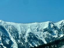
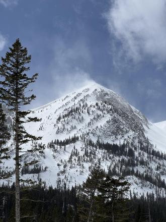
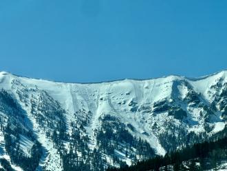
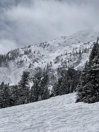
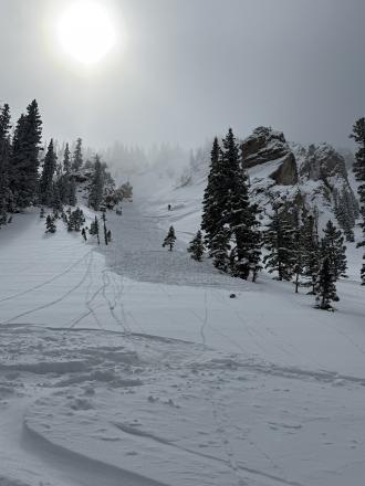
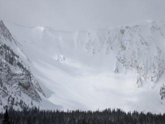
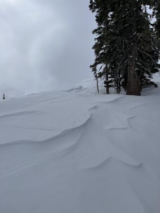
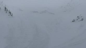
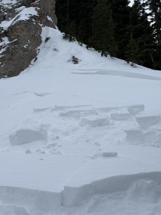
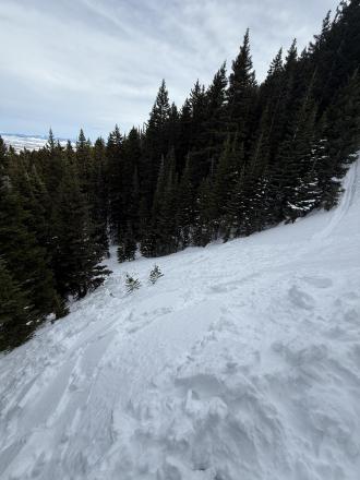
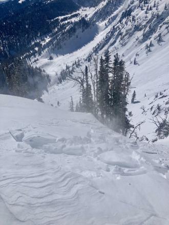
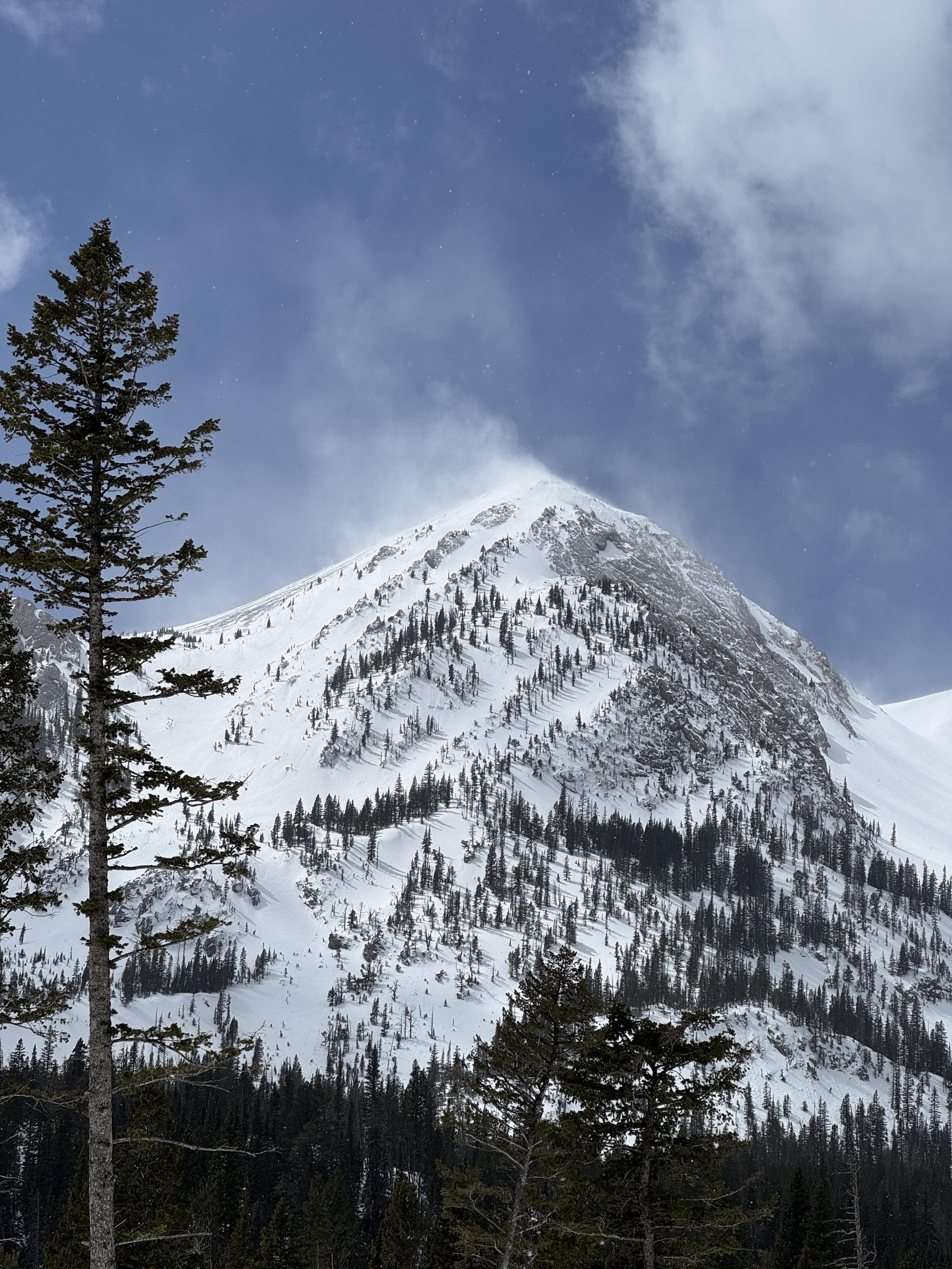
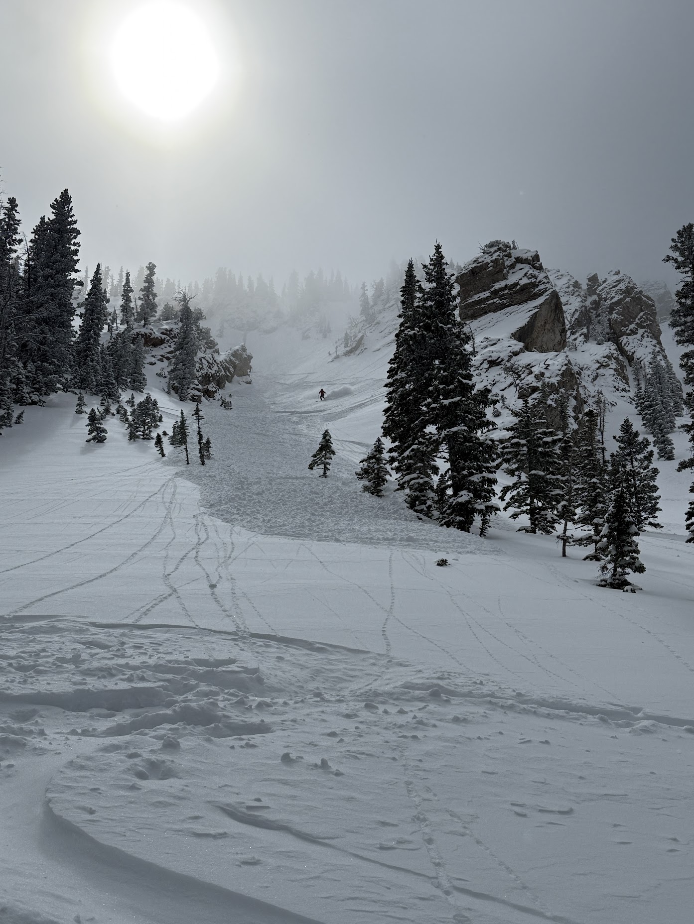
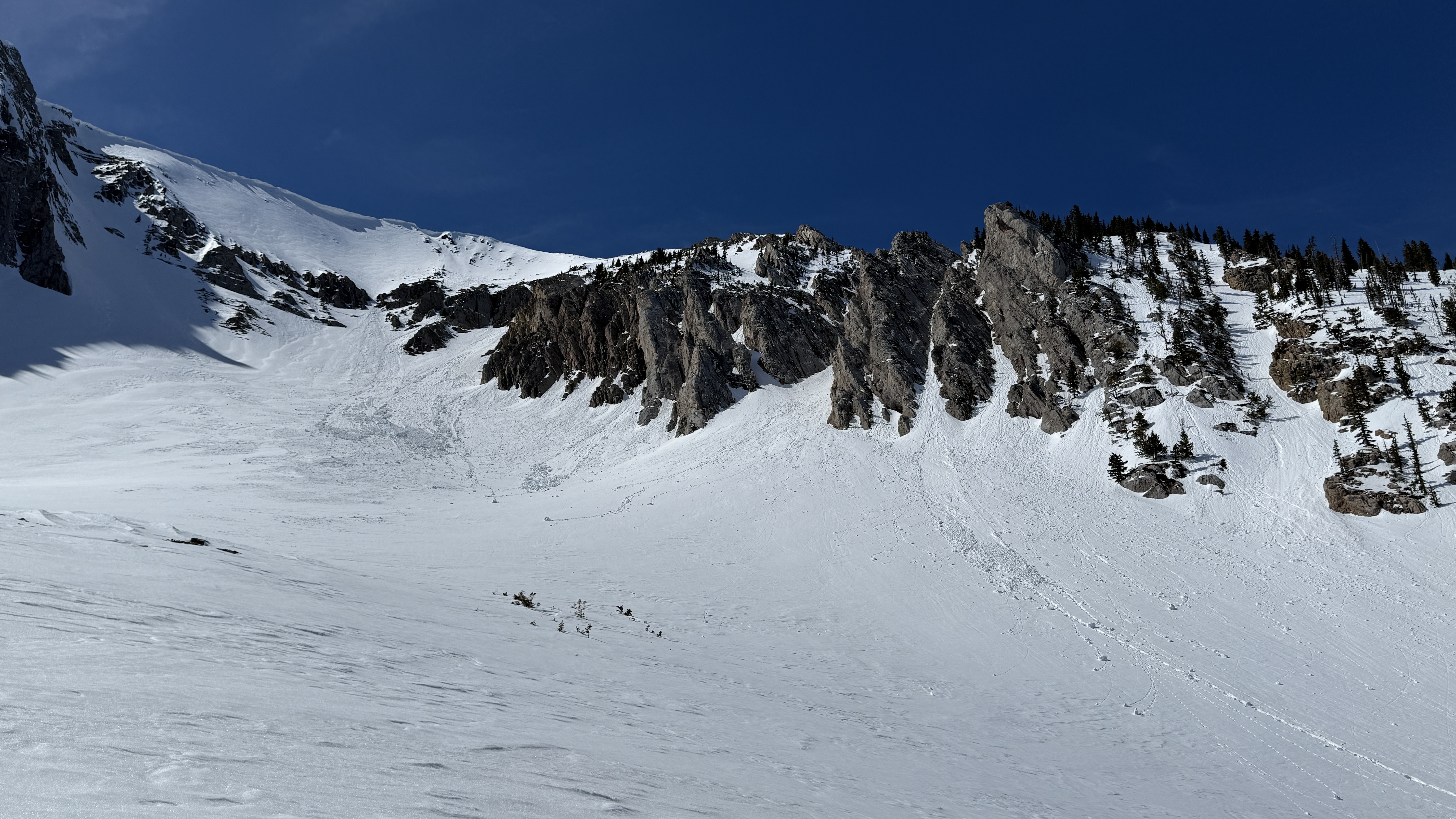
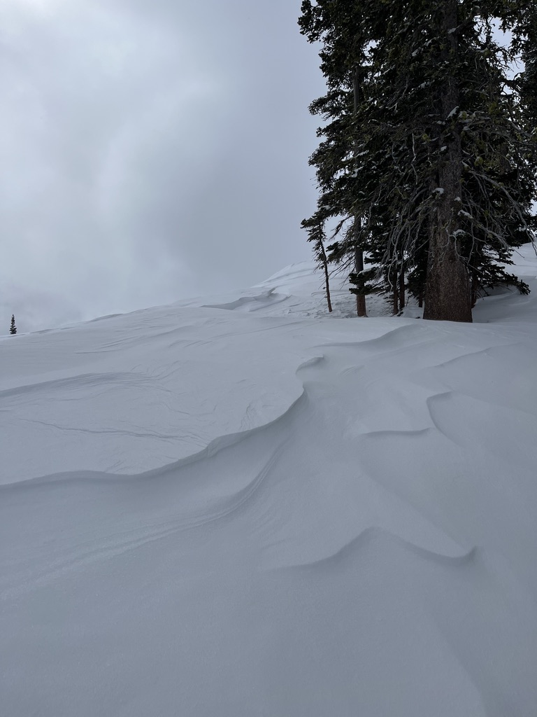
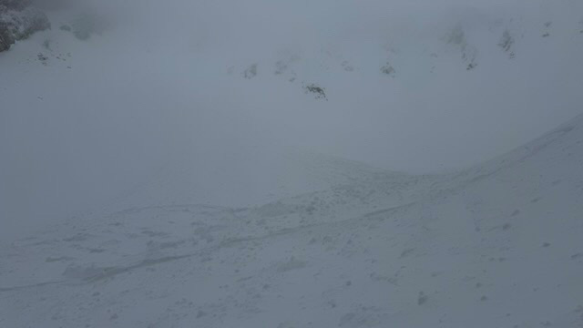
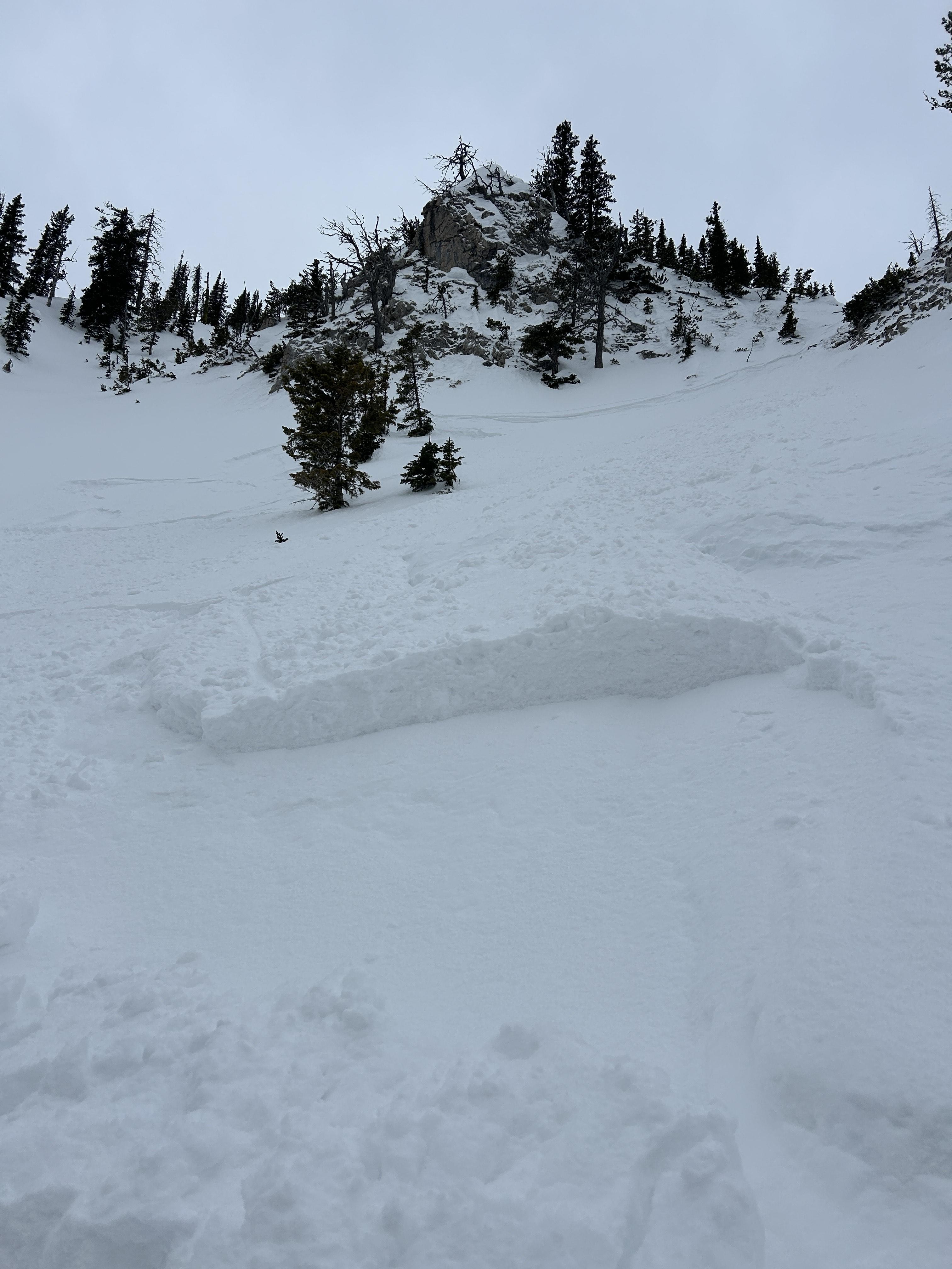
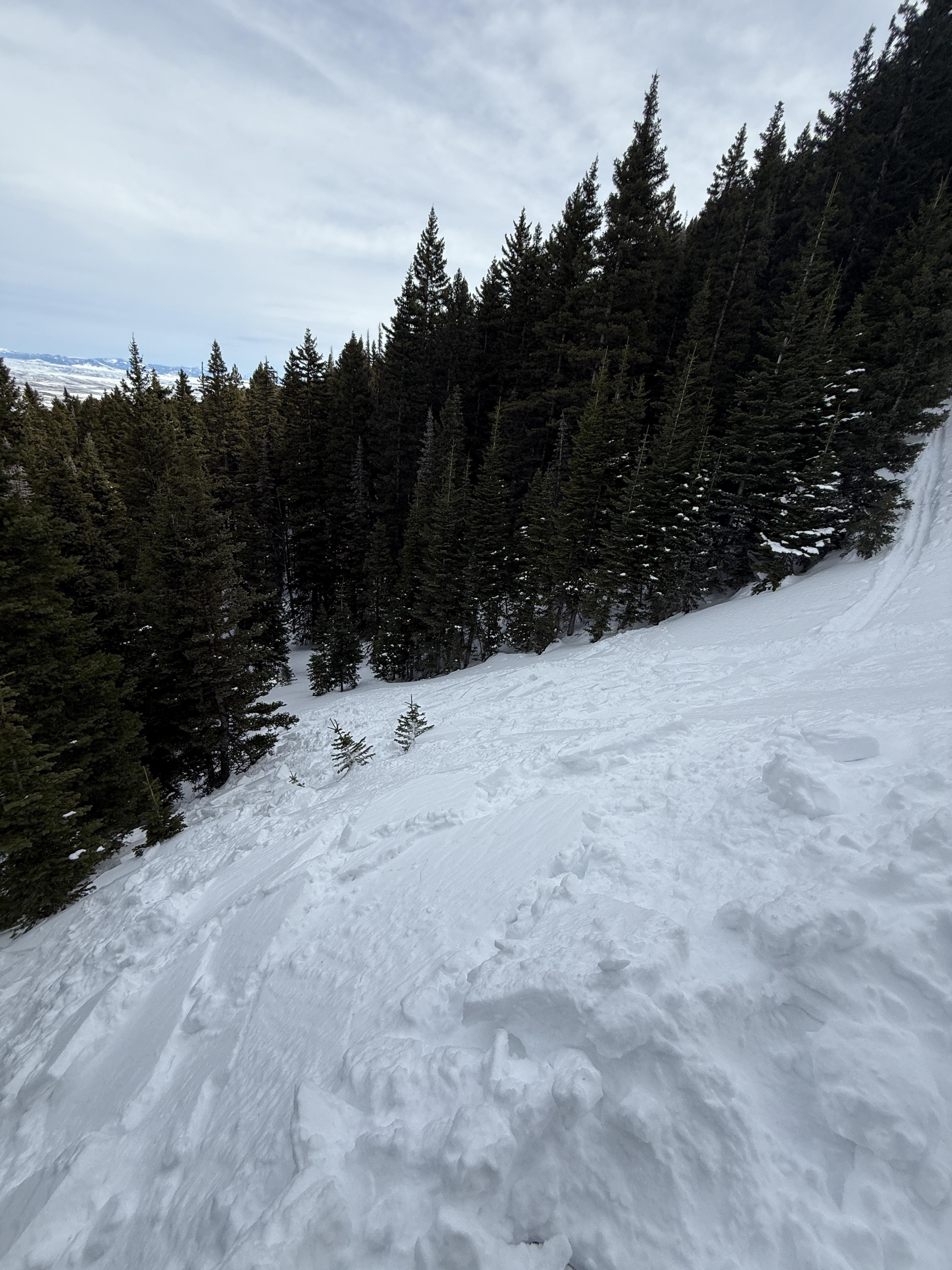
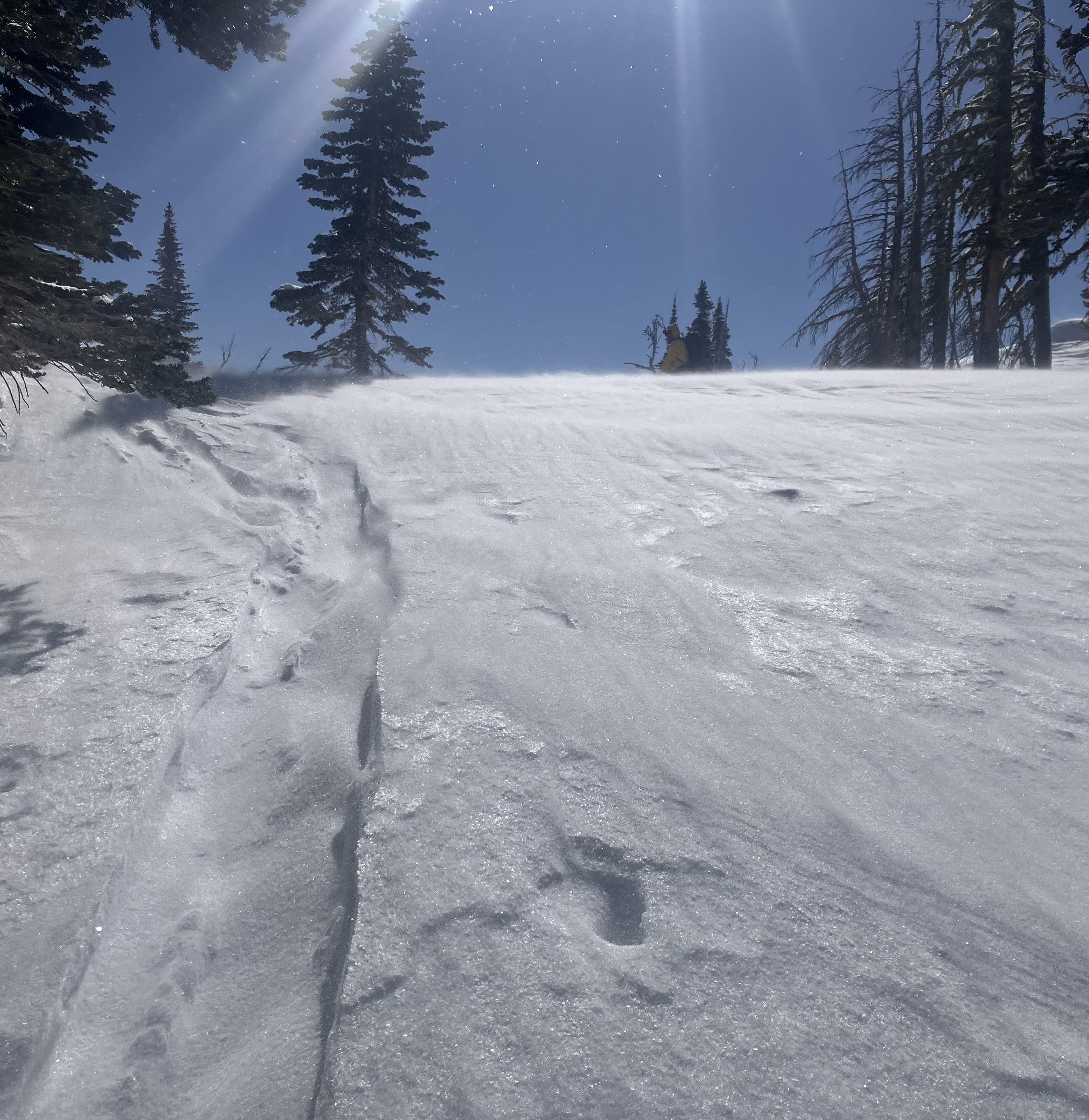
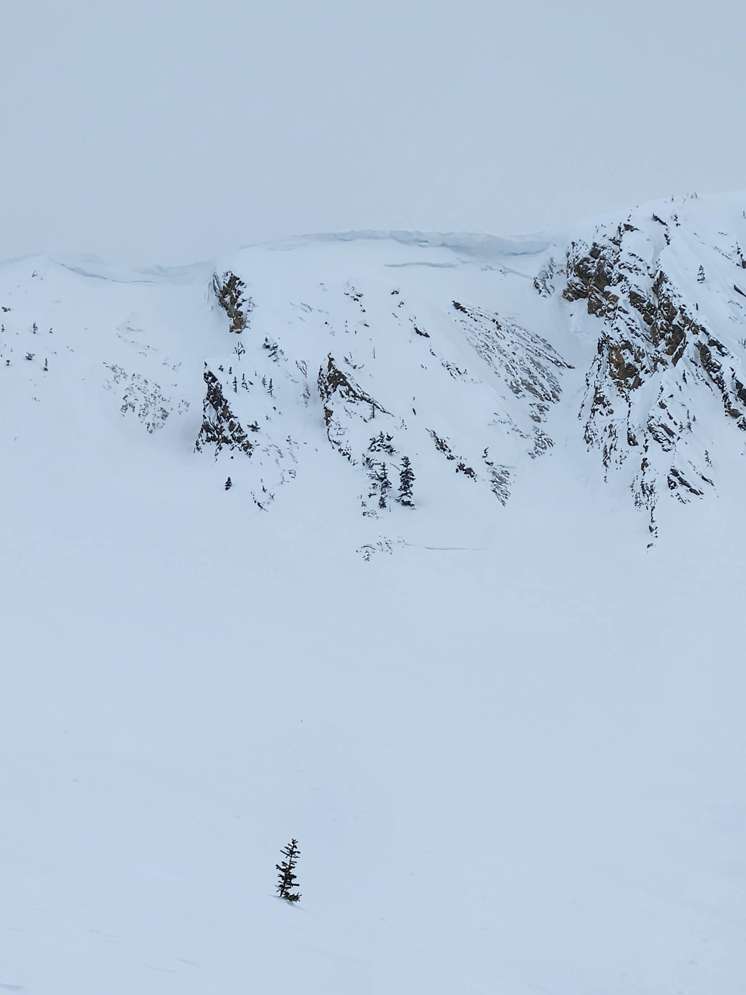
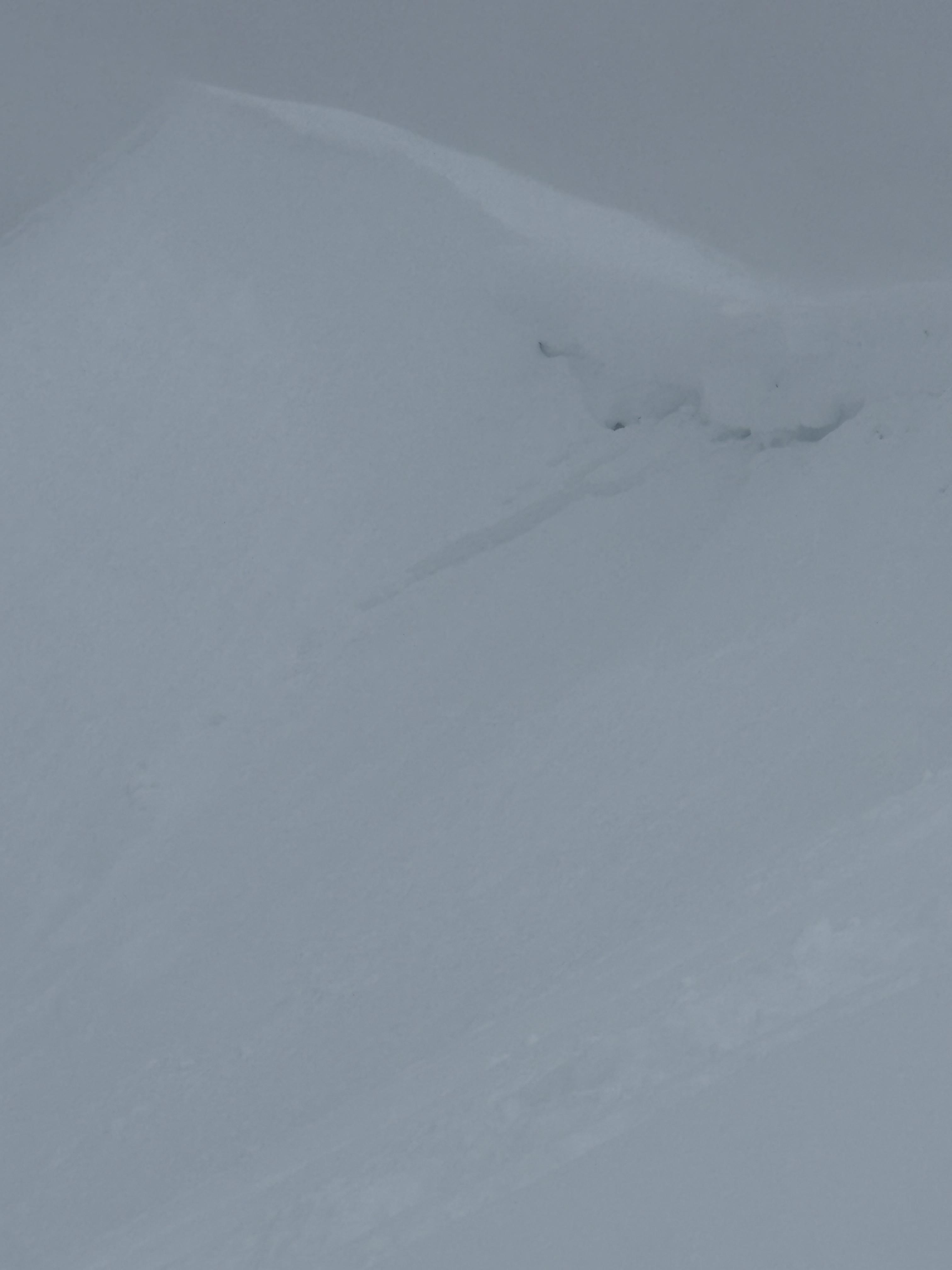
Winds were cranking at ridge top elevation, transporting what soft snow there was. Minimal hazard formation. I spotted one fresh wind slab avalanche near Hardscrabble. The slide ran several hundred feet in steep terrain but was very thin (R1,D1). Photo: GNFAC
Trip Planning for Bridgers

Primary Problem: Loose Wet
Bottom Line: Cold temperatures refroze the snowpack and will delay the onset of wet snow instability today. As the day warms and the sun hits this weekend’s snow, there will be a few small wet loose avalanches, especially on rocky, south-facing slopes. With only a few inches of recent snow, these avalanches will only be a problem in very steep or extreme terrain where they could sweep a skier or rider off their feet, into obstacles and terrain traps. Redirect to cooler, northerly aspects if you observe pinwheels and small wet slides.Past 5 Days
Thu Apr 10

Moderate
Moderate
Fri Apr 11
Moderate
Moderate
Sat Apr 12
Moderate
Moderate
Sun Apr 13

Low
Low
Today
Low
Low
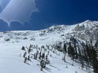
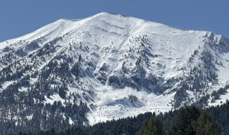
Relevant Avalanche Activity
Bridger Range
Fairy Lake
Thin Wind Slab Avalanche near Hardscrabble
Fairy Lake
SS-N-R1-D1-I
Elevation: 9,000
Aspect: SE
Coordinates: 45.9043, -110.9580
Caught: 0 ; Buried: 0
More Avalanche Details
SS-N-R1-D1-I
Elevation: 9,000
Aspect: SE
Coordinates: 45.9043, -110.9580
Caught: 0 ; Buried: 0
I rode into Fairy Lake. There was 2-3” of new snow above the elevation of Fairy Lake, a trace below. Winds were cranking at ridge top elevation, transporting what soft snow there was. Minimal hazard formation. I spotted one fresh wind slab avalanche near Hardscrabble. The slide ran several hundred feet in steep terrain but was very thin (R1,D1).
There was a mostly supportable crust below the new snow about 1” thick. The snow below the crust was moist.
More Avalanche Details
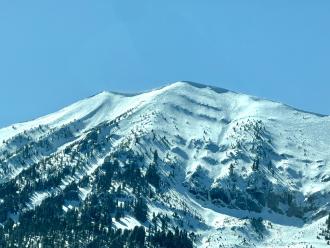
Bridger Range
Bridger Peak
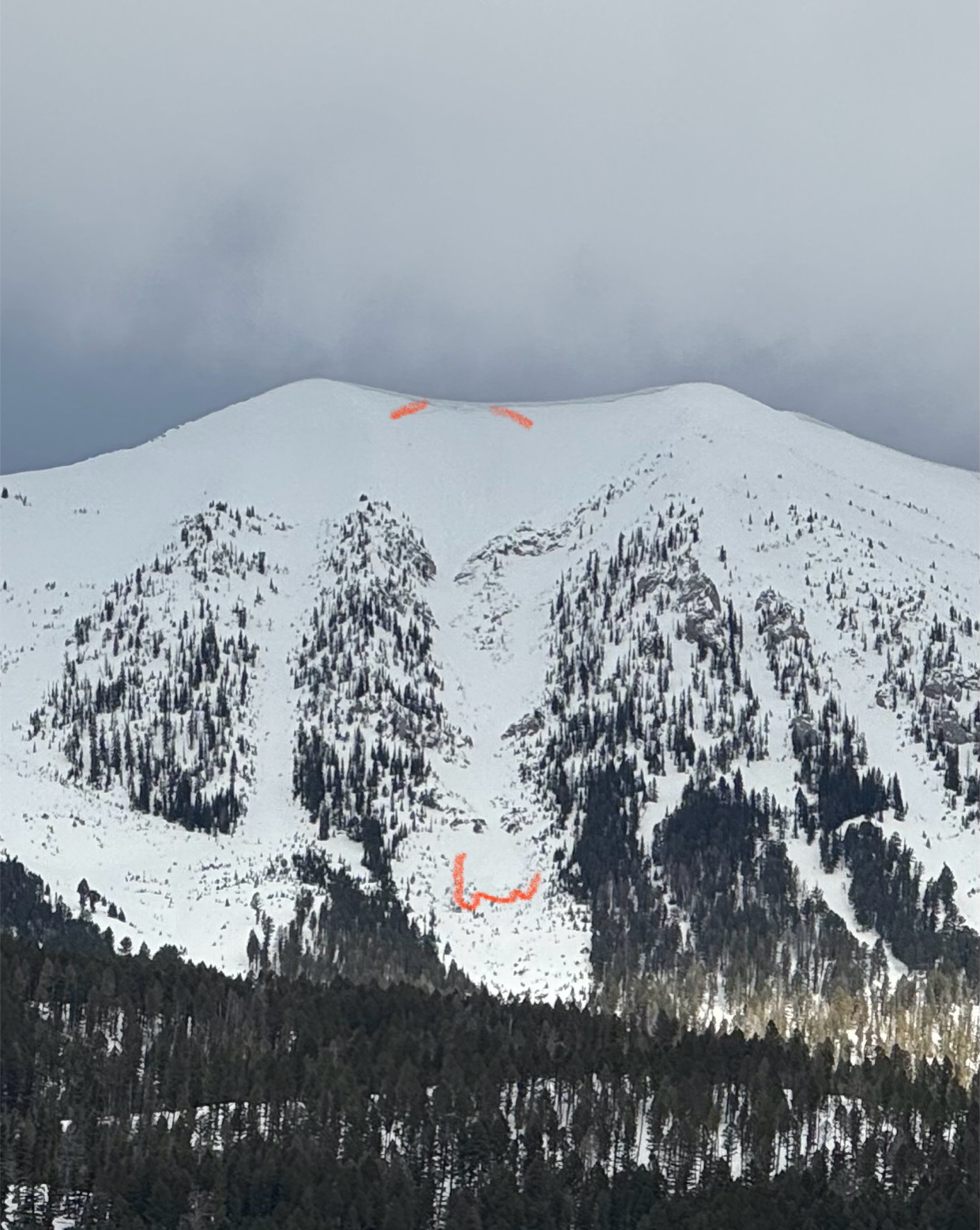
natural loose snow slides in Bridgers
Bridger Peak
L-N-R1-D1.5
Elevation: 8,500
Aspect: E
Coordinates: 45.7701, -110.9400
Caught: 0 ; Buried: 0
More Avalanche Details
L-N-R1-D1.5
Elevation: 8,500
Aspect: E
Coordinates: 45.7701, -110.9400
Caught: 0 ; Buried: 0
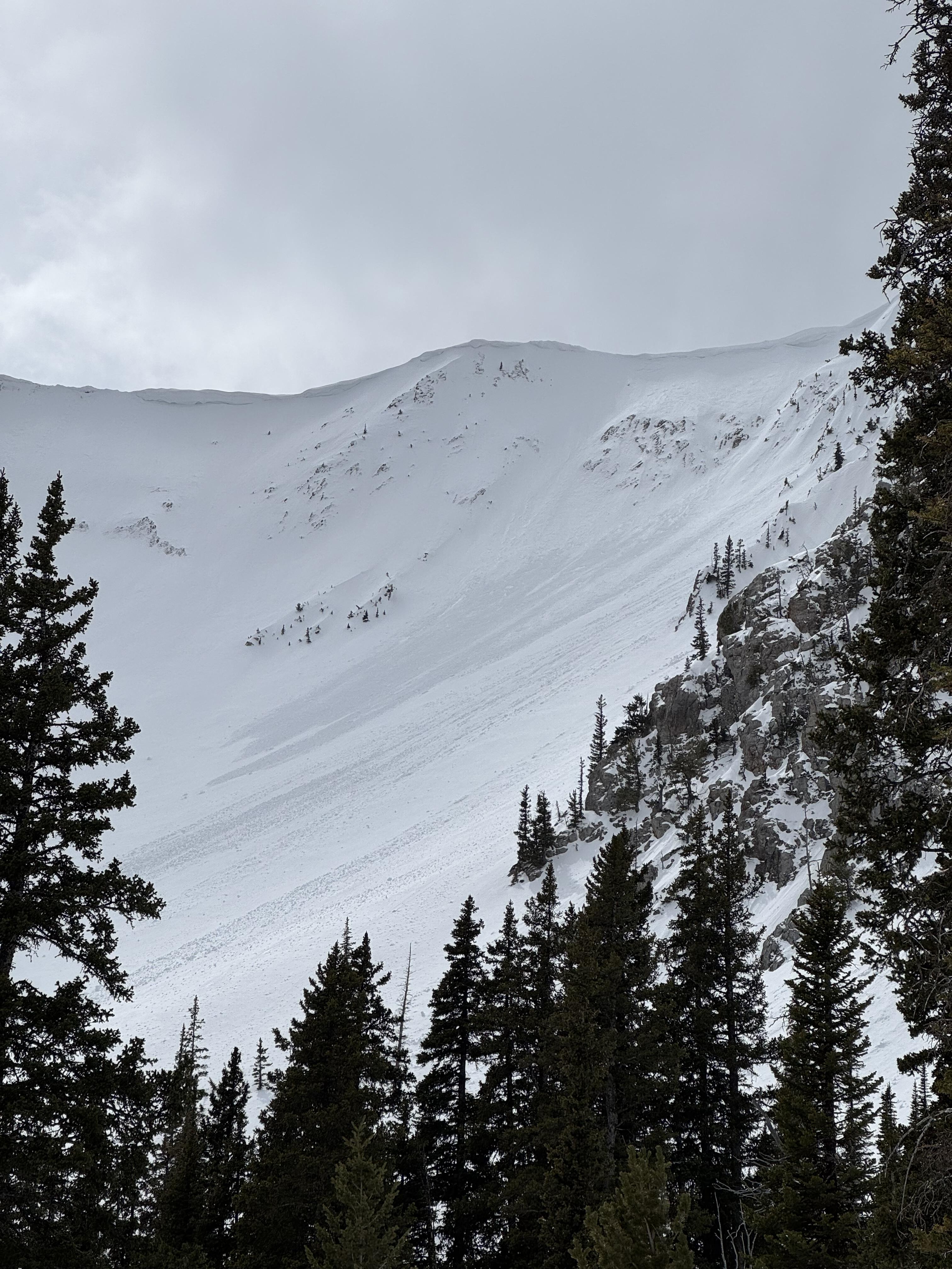
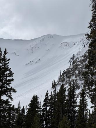
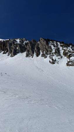
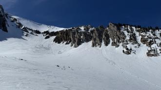
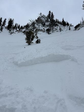
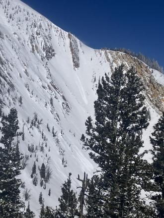
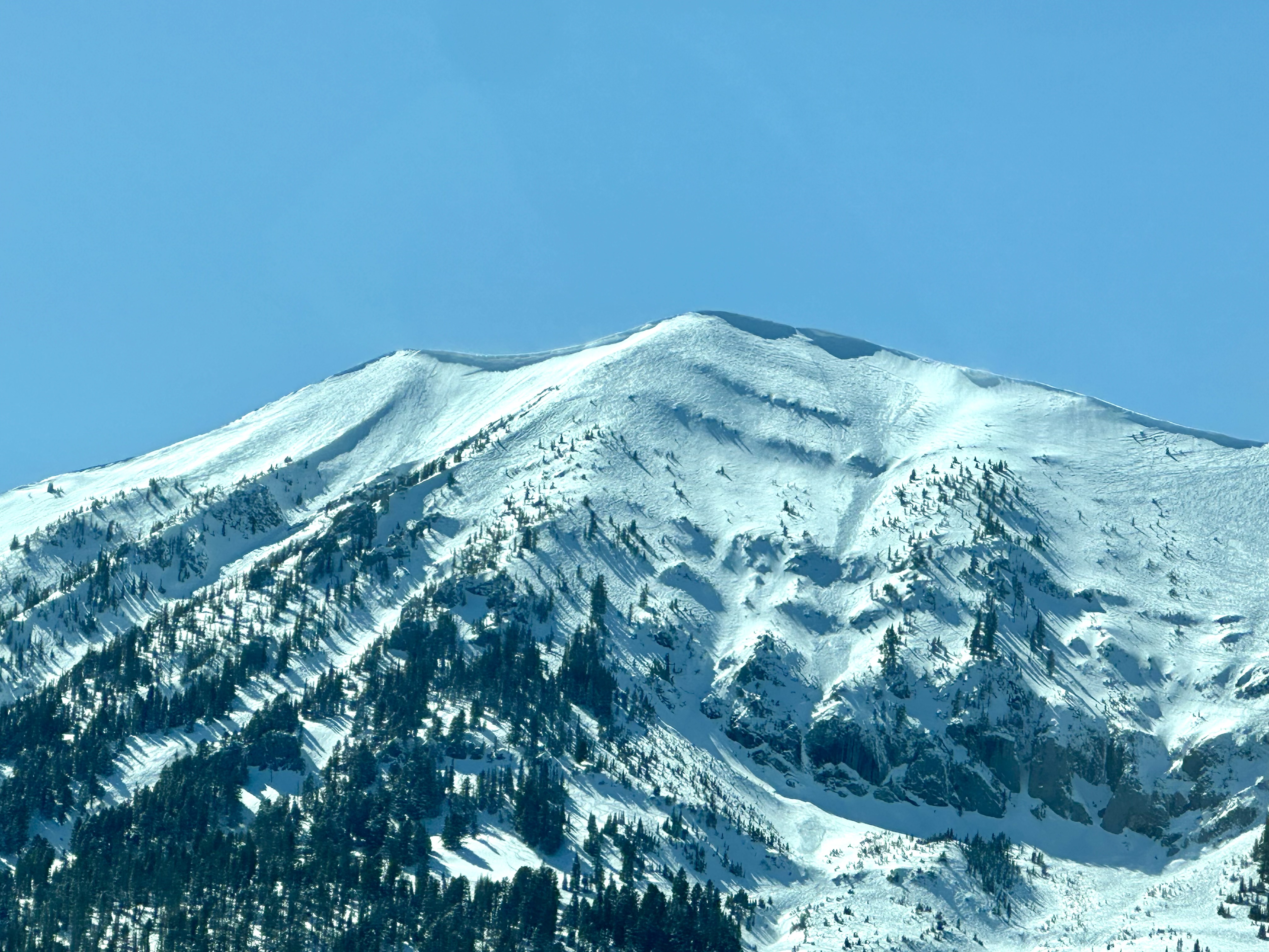
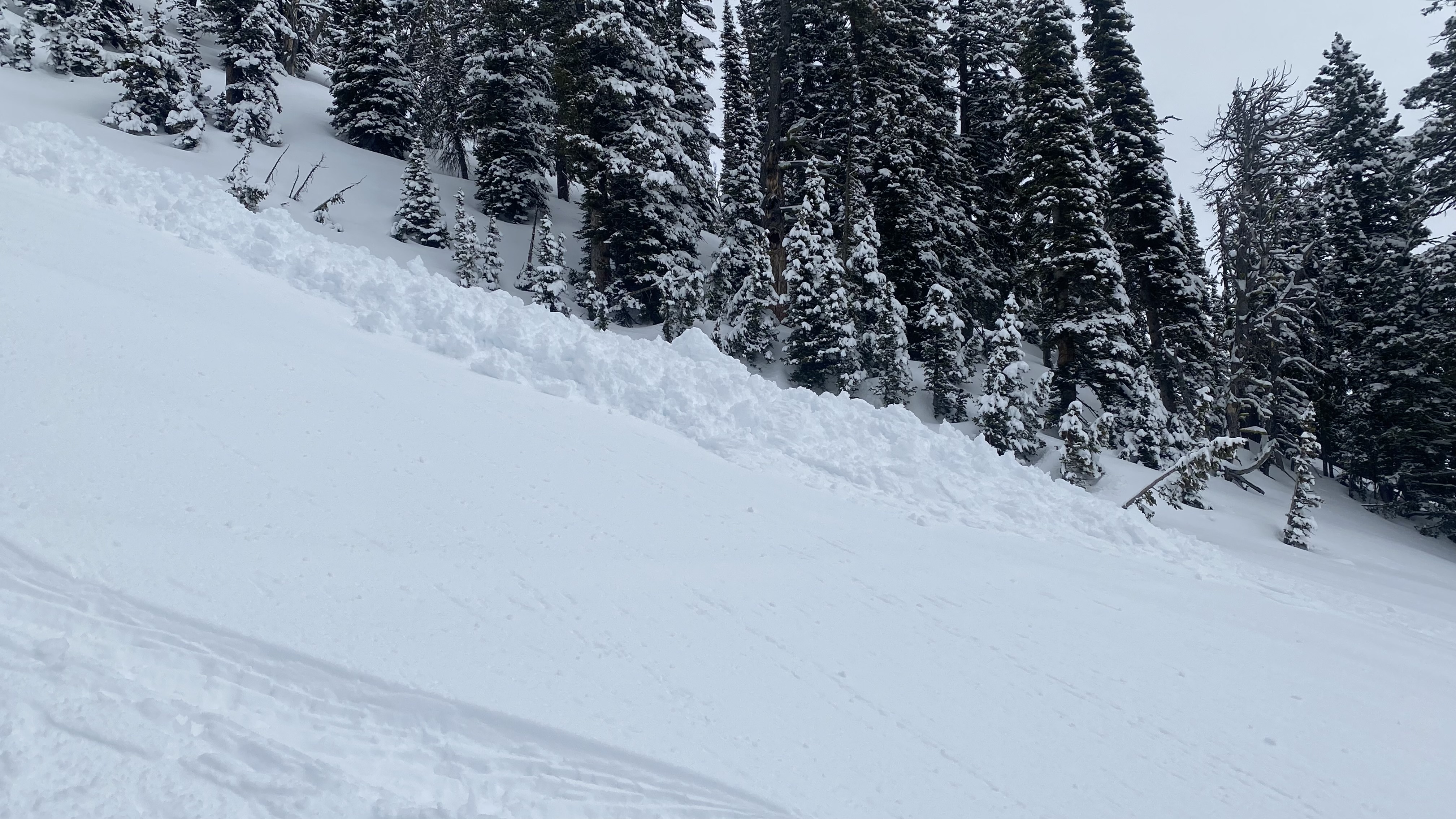
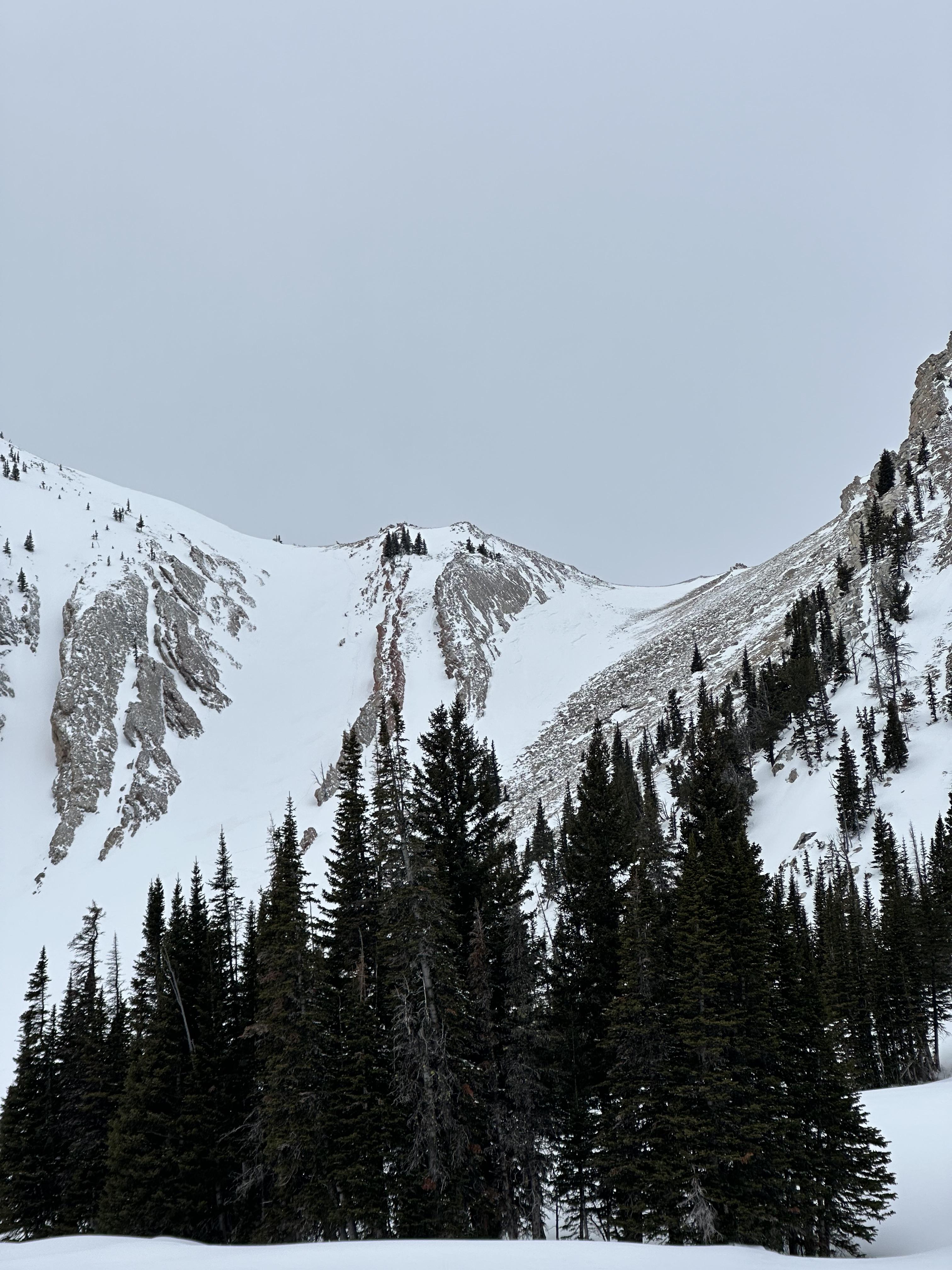
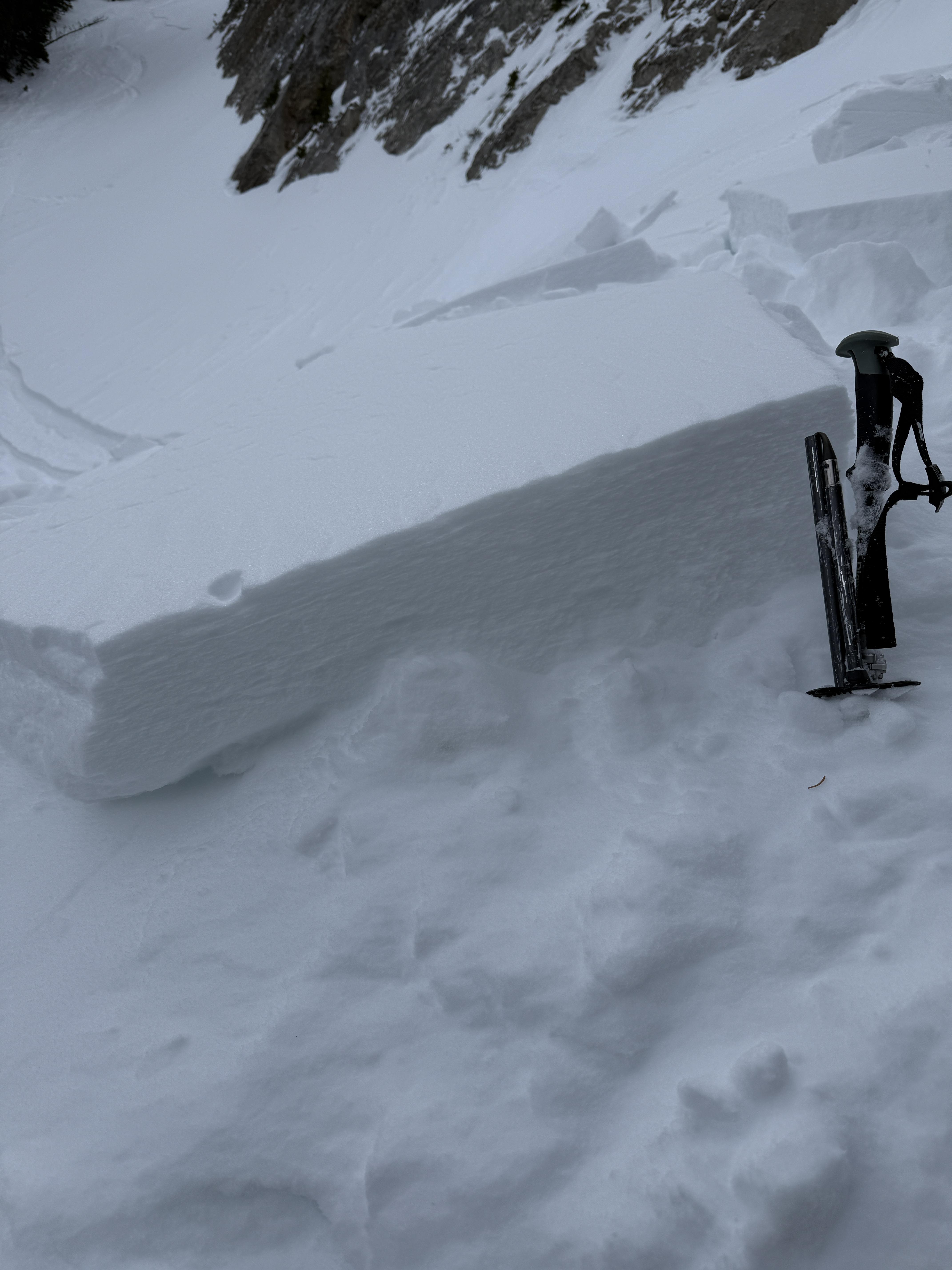
Observed multiple D1-1.5 natural dry loose avalanches (and some tiny wind slab pockets under the ridge cornice) that likely occurred during peak warming around 2-3 PM. North/sheltered aspects from ~9- 8.5k held an average of 8+ inches of dry, drifted snow. Early AM to mid-afternoon, very active wind transport followed by tapered winds and a rapid increase in temp.
More Avalanche Details
Bridger Range
The Great One
Skier carried in wind slab on Naya Nuki
The Great One
AS-R1-D1.5
Elevation: 9,000
Aspect: E
Coordinates: 45.8926, -110.9620
Caught: 0 ; Buried: 0
More Avalanche Details
AS-R1-D1.5
Elevation: 9,000
Aspect: E
Coordinates: 45.8926, -110.9620
Caught: 0 ; Buried: 0
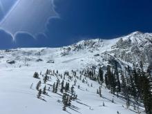
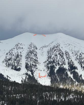
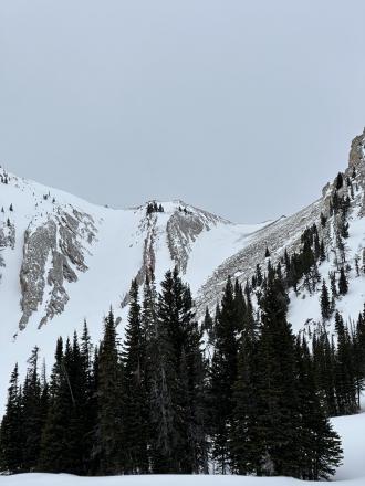
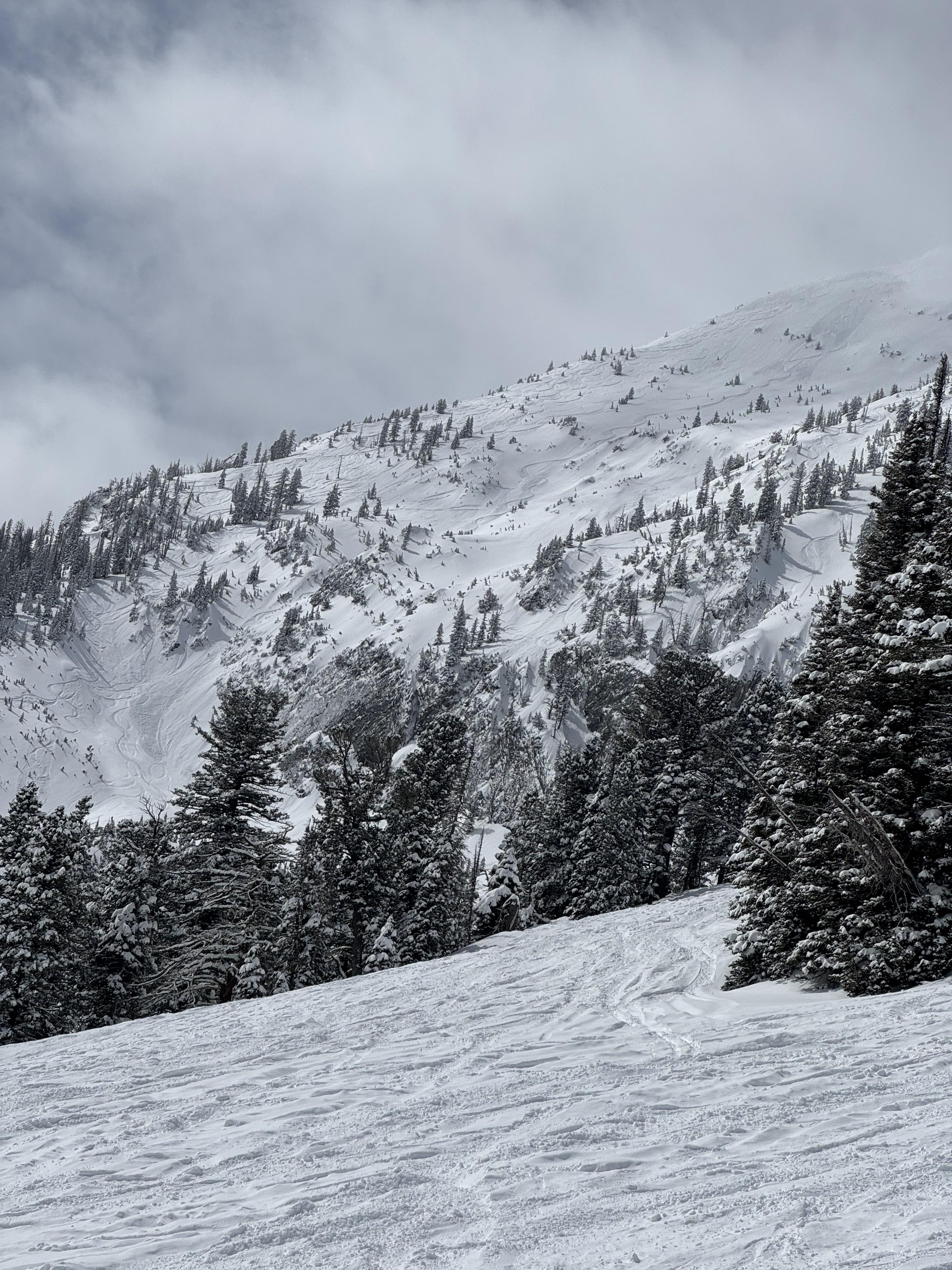
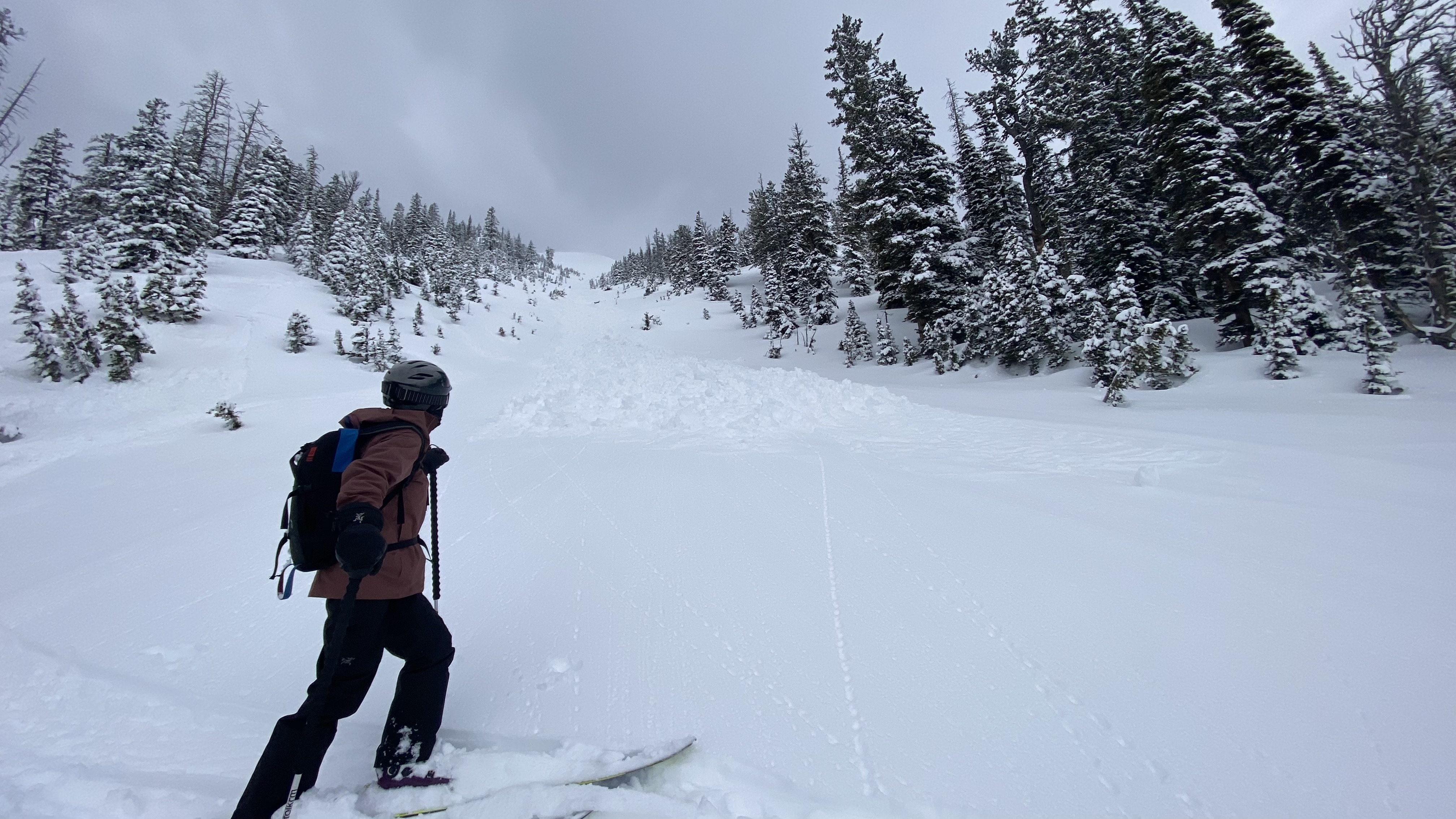
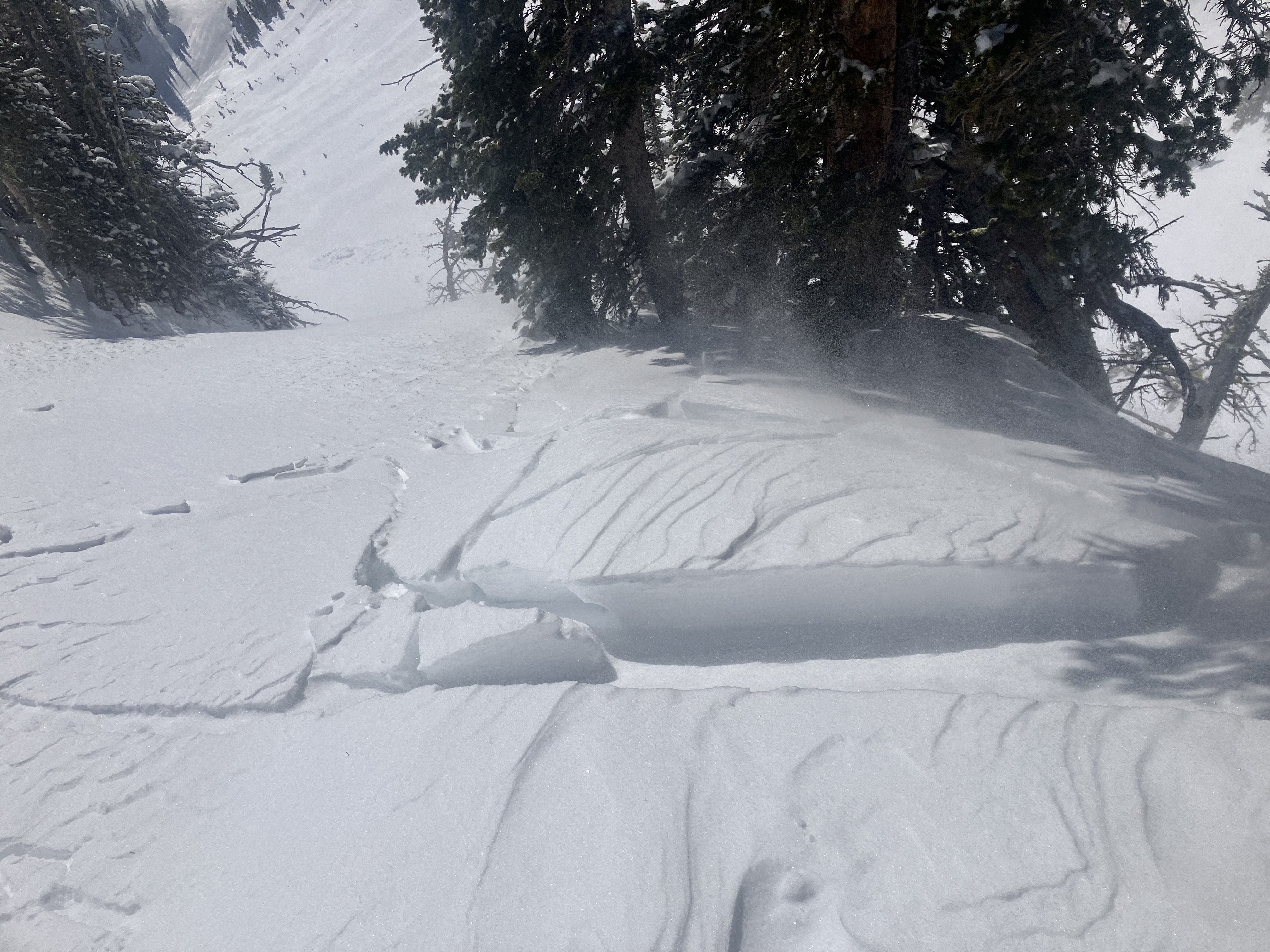
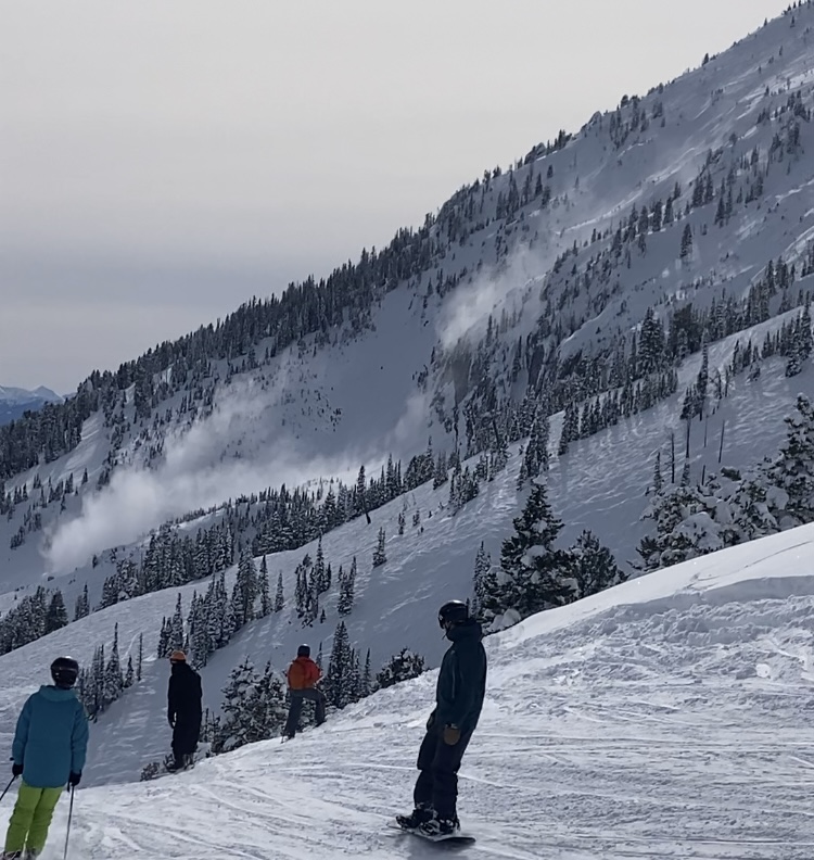
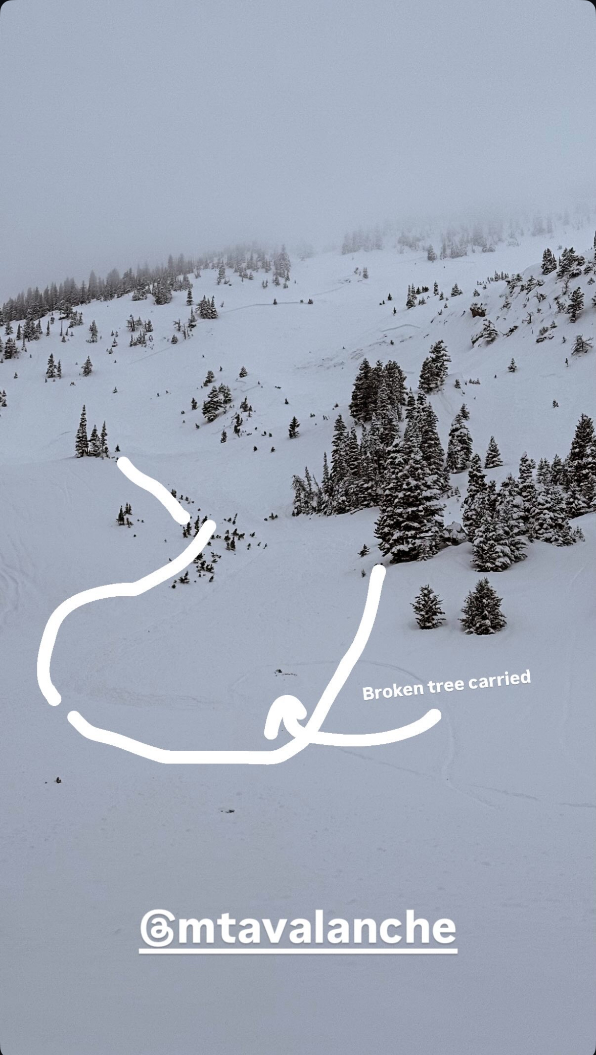
We went on a tour in the Bridgers today, we ascended the east ridge of Naya Nuki to the entrance of the Great One. Wind was blowing and we were being careful about potential wind slabs up high.
Skier 1 ski cut the top of the chute and produced a small wind slab that ran to the break in the chute and continued another 100 vert down the east apron. After all meeting up halfway down, skier 2 proceeded to ski the E facing apron. A wind slab propagated and carried skier 2 roughly 300 vert down the apron where skier 2 was able to swim out of the fall line and came to a rest on top of the debris. Everyone was okay aside two missing ski poles.
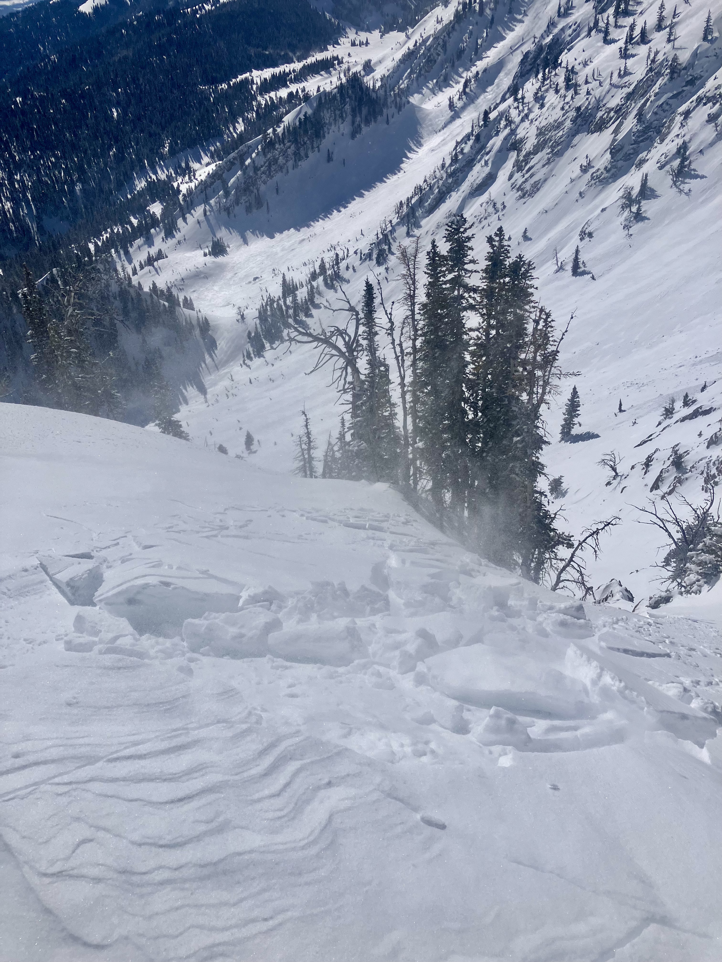
On the way out, we saw a few more small natural wind slabs that broke naturally near ridge lines as well as point and release wet slides.
More Avalanche Details
Relevant Photos
Displaying 1 - 40
-
-
Winds were cranking at ridge top elevation, transporting what soft snow there was. Minimal hazard formation. I spotted one fresh wind slab avalanche near Hardscrabble. Photo: GNFAC
-
"We went on a tour in the Bridgers today [Apr 5], we ascended the east ridge of Naya Nuki to the entrance of the Great One. Wind was blowing and we were being careful about potential wind slabs up high.
Skier 1 ski cut the top of the chute and produced a small wind slab that ran to the break in the chute and continued another 100 vert down the east apron. After all meeting up halfway down, skier 2 proceeded to ski the E facing apron. A wind slab propagated and carried skier 2 roughly 300 vert down the apron where skier 2 was able to swim out of the fall line and came to a rest on top of the debris. Everyone was okay aside two missing ski poles."
-
From BBSP: " At 2.45?pm [Apr 5] a... solo skier triggered a wind loaded pocket on the main face of Saddle Peak that ran down over the cliff and produced an impressive powder cloud.... I met him... and confirm he was alone and no one was in front of him. The avalanche looked to be 2' deep on the southern flank and 5" deep on the northern flank... It entrained more snow on the way down, one 2' deep downhill wind loaded pocket and some loose wet snow. It ran into the bottom of the going home chute, gouging a large hole and then 100ft downhill left a 200ft by 30ft wide shallow debris pile."
-
(Apr 5) "...Also observed one small wind slab occurring between Saddle & the Football Field, possibly skier-triggered." Photo: G. Antonioli
-
(Apr 5 ) "Observed multiple D1-1.5 natural dry loose avalanches (and some tiny wind slab pockets under the ridge cornice) that likely occurred during peak warming around 2-3 PM. North/sheltered aspects from ~9- 8.5k held an average of 8+ inches of dry, drifted snow...." Photo: G. Antonioli
-
There was a pair of R1, D1 avalanches on Saddle Peak. One appears to be a loose snow avalanche triggered by a skier coming off of north Saddle Peak That ran a couple hundred feet. The second was a small slab coming out of Spencer’s with debris running into Going Home Chute. Photo: GNFAC
-
In one steeper roll over, I got shooting cracks and a small storm slab to break at my ski tips. Photo: GNFAC
-
Heavy, wet slide of recent snow released while skiing off South Saddle. The photo is from South Central. Photo: E. Volk
-

Heavy, wet slide of recent snow released while skiing off South Saddle. The photo is from South Central. Photo: E. Volk
-
"Skied the north chutes above fairy lake around 8,400 ft. Found 8-12" of new snow, with the bottom 2" consisting of large graupel. In steep terrain our sluff entrained lots of snow making for some large debris piles. Overall the snow was generally well bonded." Photo: S. Lipsteuer
-
There were a number of wet loose avalanches in Airplane Bowl. All on E/S aspects near rocks or cliffs. Most were relatively small and had not entrained much snow from the surface or gouged deeper than a few inches. Photo: GNFAC
-
There were a number of wet loose avalanches in Airplane Bowl. All on E/S aspects near rocks or cliffs. Most were relatively small and had not entrained much snow from the surface or gouged deeper than a few inches. Photo: GNFAC
-
Noticed crown and debris on drive up Bridger Canyon this morning. Looks like a wind slab. Photo: Peter H
-

Understanding Avalanche Safety Preparedness – 5-Minute Survey for Motorized Users
We need your input! Eastern Oregon University is conducting a survey to better understand avalanche safety preparedness among motorized backcountry users like you. Your feedback will help us learn more about who is purchasing and practicing with avalanche rescue gear (beacon, probe, shovel) and participating in avalanche education—and why some riders aren’t. The survey is confidential and anonymous.
Your feedback is invaluable in improving avalanche education and awareness. Please take a moment to share your experience and help us make a difference.
https://eoustmhs.qualtrics.com/jfe/form/SV_3L8QKAuZzcxJBLo
Thank you for your time and for being a part of this important effort!
-

We skied past a wet loose avalanche that came off of the south face of Bradley‘s Meadow. It was slightly bigger than the rest of the wet snow activity that I observed during the day. Photo: GNFAC
-
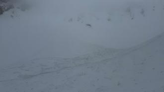
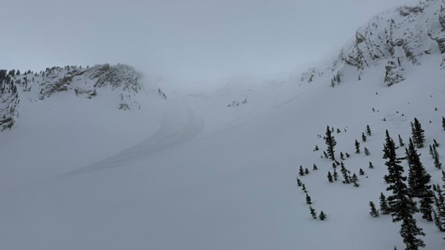
The snow ranger crew was riding around the Bridgers today and we spotted this slide in the bowl to the south of Hardscrabble peak. It looked fairly recent (last 2 days) but a little hard to tell due to the new snow since yesterday and blowing snow today. Photo: USFS Snow Rangers
-
As we neared the ridgeline and shifted to a more southerly aspect, we noted scalloped and scoured snow surfaces and the development of thin wind skins and a few 1-2" wind slabs. Photo: GNFAC
-
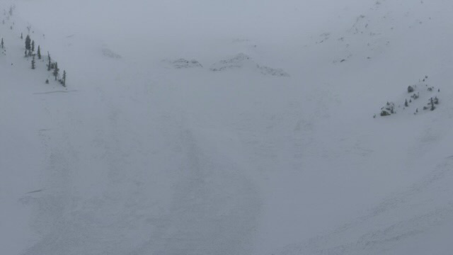
Nature or cornice triggered slides in Arrowhead and Hardscrabble Bowls. Photo: I Freeland
-
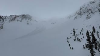
Nature or cornice triggered slides in Arrowhead and Hardscrabble Bowls. Photo: I Freeland
-
Nature or cornice triggered slides in Arrowhead and Hardscrabble Bowls. Photo: I Freeland
-
Isolated wind slabs today in the southern Bridgers. Photo: E. Selinger
-
Mar 15 Winds in the Frazier Basin zone were stronger than expected with moderate to strong gusts at the ridge, increasing through the day. We noticed two large windslab pockets that had released since yesterday’s snow. One at the base of Hardscrabble Peak on a N aspect, the other in one of the SE facing gullies that access the Peak 9299/Hollywood Headwall ridge (see photo).
-
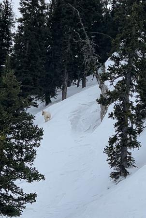
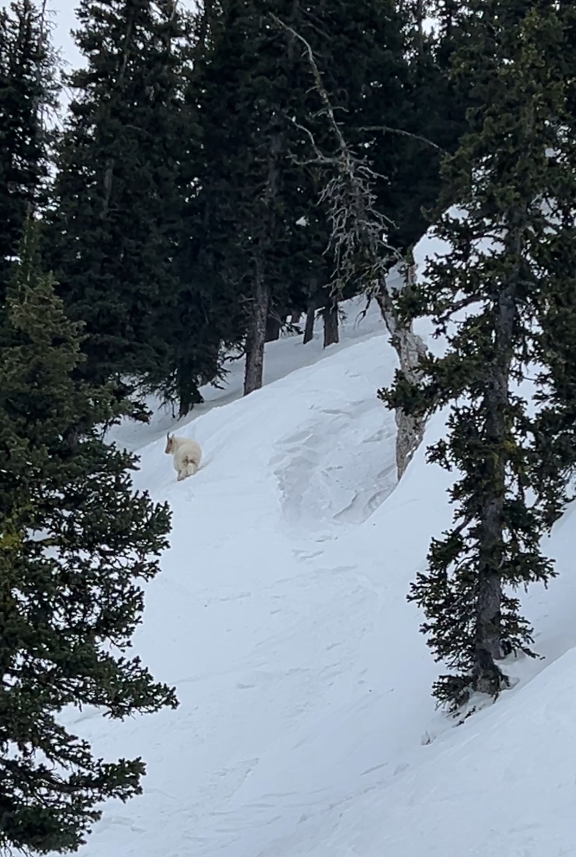
Mountain goat hanging out in Wolverine Bowl
-
Skier triggered wind slab on Northeast slope at 7,450 feet elevation. One skier was caught and carried roughly 10 feet before the slide came to a stop.
-
Skier triggered wind slab on Northeast slope at 7,450 feet elevation. One skier was caught and carried roughly 10 feet before the slide came to a stop.
-
Skier triggered wind slab on Northeast slope at 7,450 feet elevation. One skier was caught and carried roughly 10 feet before the slide came to a stop.
-
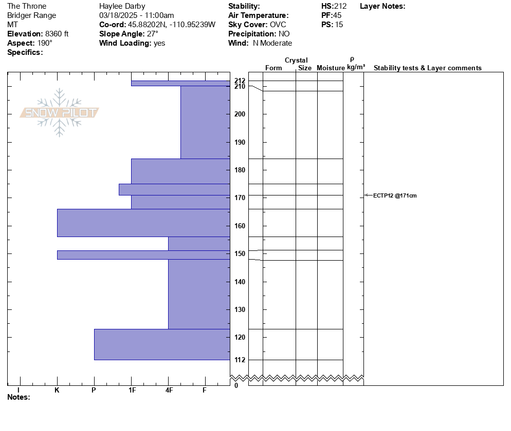
Mar 7 obs: "...There was 6" of low density snow from yesterday. Winds were stronger than expected, from the north at the top of the Throne, and increased through the morning.... We found fresh drifts that were reactive, cracking easily and 5-10' wide out from our skis, on south and east facing slopes around 8000-8300'." Photo: GNFAC
-
Mar 7 obs: "There was 6" of low density snow from yesterday.... The new snow was low density and sluffed easily on steep shady northerlies. On steep slopes facing the sun (south and east, and probably west) the new snow sat on a crust and became moist as the sun warmed it up and started to slide under skis. We saw a couple very small natural loose snow slides below rock outcrops on south facing slopes. Air temperatures were well below freezing, especially with wind chill, but the sun quickly warmed the recent new snow." Photo: GNFAC
-

From obs on 3/4/25:
"Saw a few sluffs in the new snow triggered by skiers in the very steep terrain just north of the Bridger Bowl ski area boundary (see photo). These sluffs were small, definitely not large enough to bury someone."
-

Observed multiple wet loose slides naturally triggering and running on south facing slopes beyond bradleys and on the south facing aspects of hourglass chute.
-

Observed multiple wet loose slides naturally triggering and running on south facing slopes beyond bradleys and on the south facing aspects of hourglass chute. Photo: T McGarry
-
From obs.: "Saw a recent cornice triggered wind slab off of Hardscrabble Peak, crown looked fairly fresh. There was a second crown line below the rock band. Conditions were very windy, with snow still being transported. Most snow surfaces were wind affected, but saw no cracking or collapsing." Photo: F. Miller
-

Skiers triggered a medium sized cornice fall that triggered a dry loose (sluff) avalanche that created large powder cloud.
-

Toured out to Frazier Basin and turned around seeing widespread avalanches and active wind loading. Despite our pits on the Throne the day before showing no weak layers, the amount of wind loading and potential for slabs over density changes gave us pause. Good skiing and sledding down low.
-

Toured out to Frazier Basin and turned around seeing widespread avalanches and active wind loading. Despite our pits on the Throne the day before showing no weak layers, the amount of wind loading and potential for slabs over density changes gave us pause. Good skiing and sledding down low.
-

Cornice broke in between north and south saddle peaks. The initial propagation width was hard to distinguish. Maybe 50 feet. About 18 inches deep at height of crown. Photo: Anonymous
-

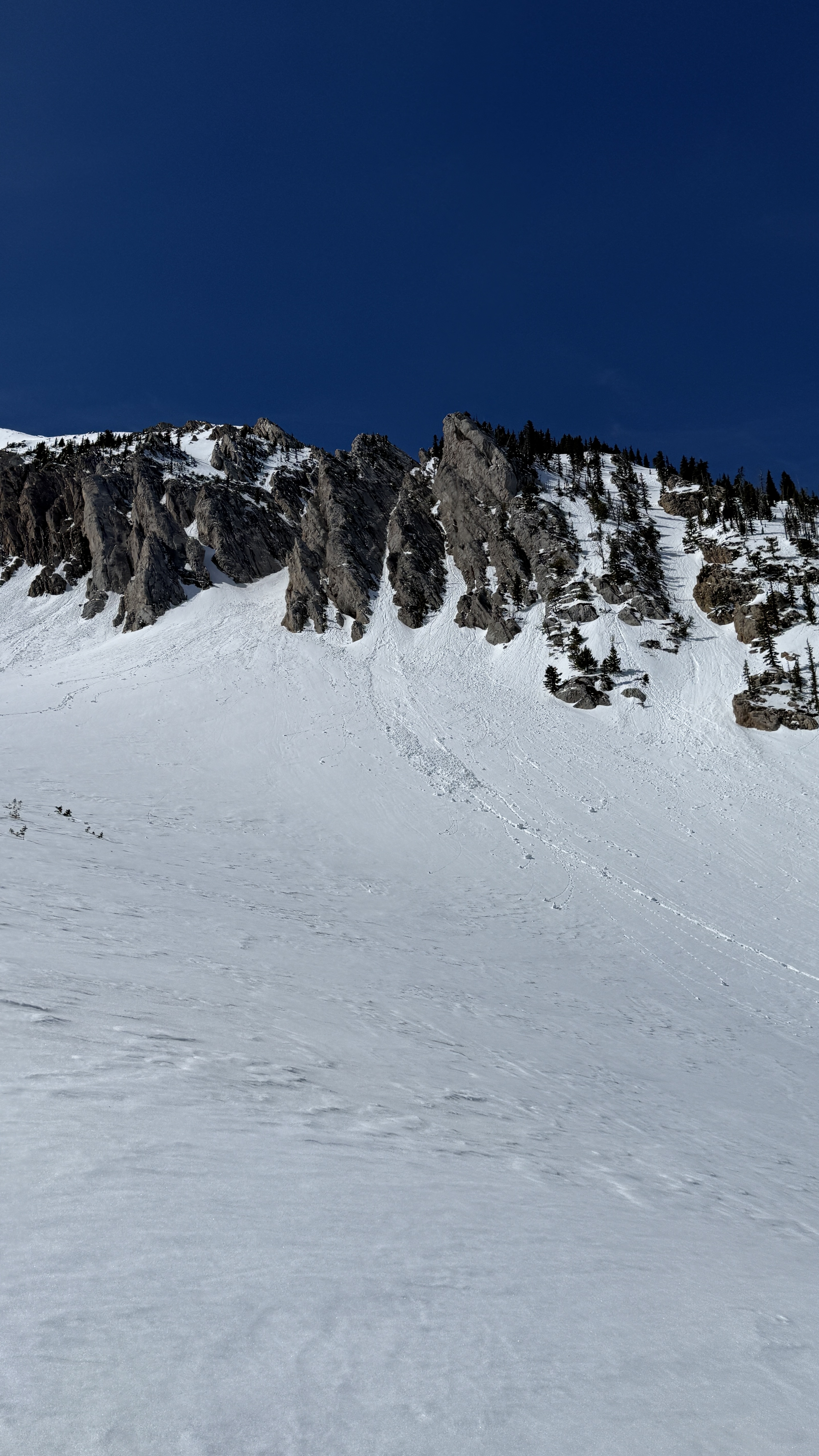
Skiers saw three natural slides south of the throne today. All east facing. Photo: I Freeland


Videos- Bridgers
WebCams
Bridger Base Area
Ridge, Looking North
Alpine Apron


Weather Forecast Bridgers
Extended Forecast for10 Miles NNE Bozeman MT
This Afternoon

High: 46 °F
Sunny
Tonight

Low: 33 °F
Mostly Clear
Tuesday

High: 58 °F
Sunny
Tuesday Night

Low: 37 °F
Partly Cloudy
Wednesday
High: 54 °F
Mostly Sunny
then Showers
LikelyWednesday Night
Low: 27 °F
Rain/Snow
Likely then
SnowThursday

High: 29 °F
Snow and
BlusteryThursday Night

Low: 22 °F
Chance Snow
ShowersFriday

High: 35 °F
Partly Sunny
The Last Word
Our last daily avalanche forecast will be Sunday, April 20th. We will issue updates on Mondays and Fridays through the end of April.