Snow Observations List
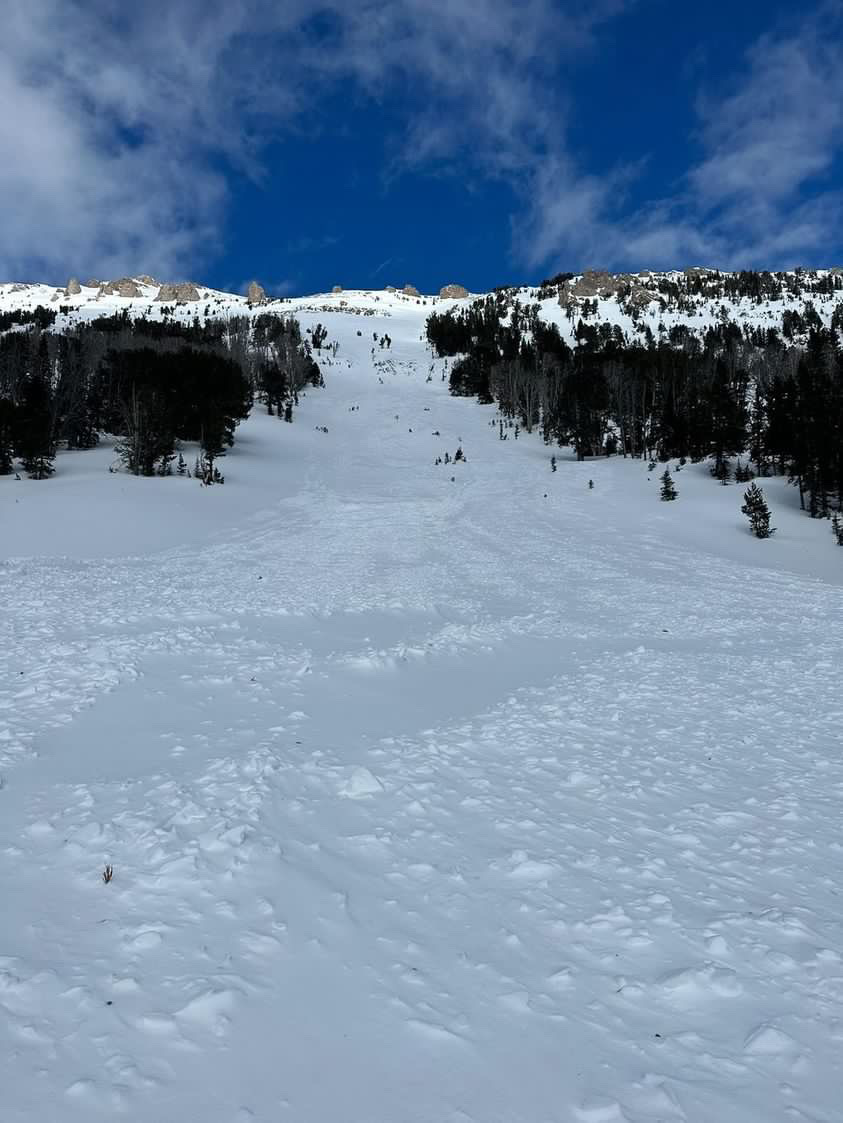
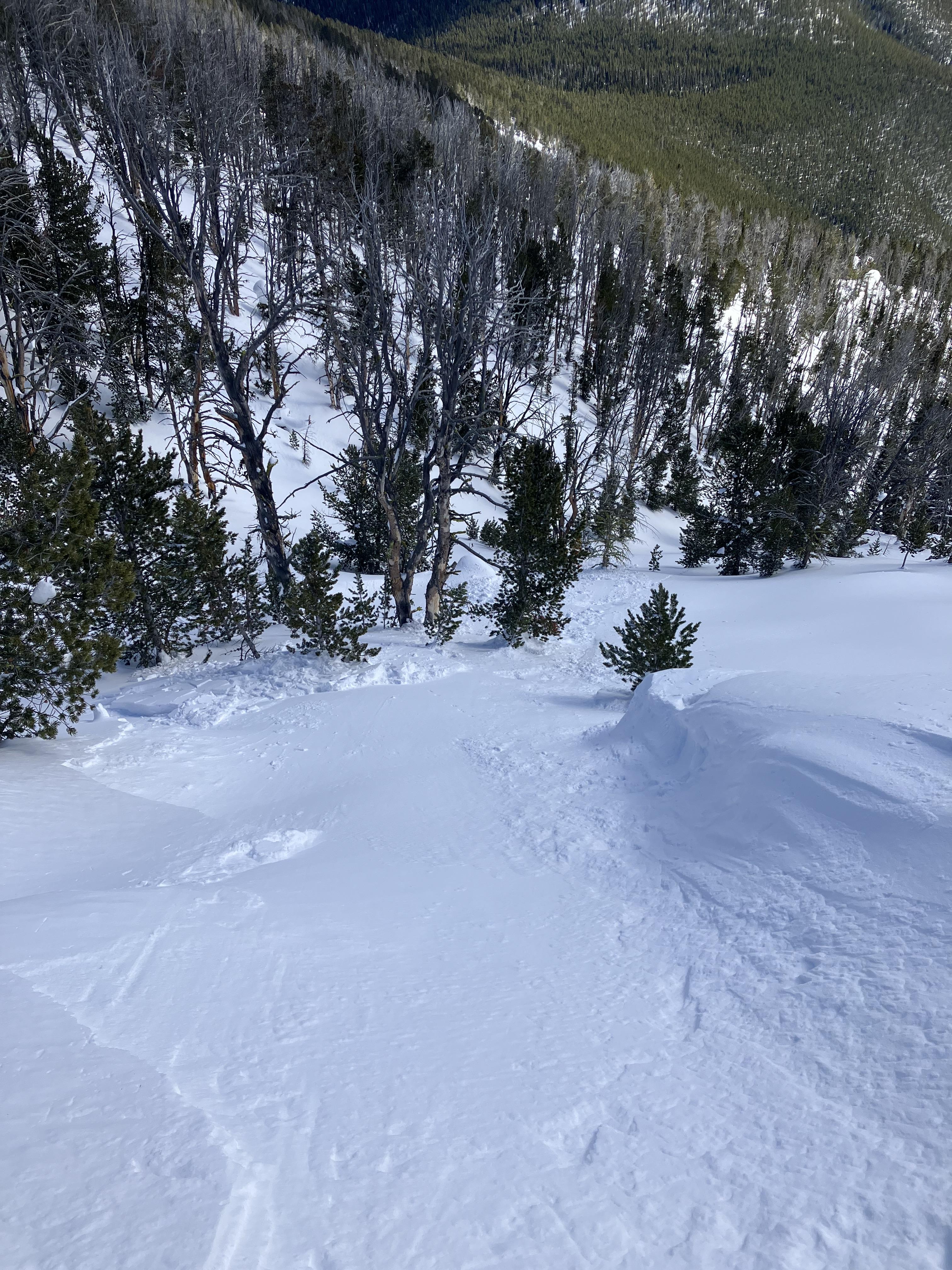
I triggered a avalanche on the way back down the mountain. I'm unsure of the exact location but a buddy said it was under bear tooth butte. I was able to outrun the avalanche and there was no injuries.
Full Snow Observation ReportNoticed this large avalanche in unsupported terrain yesterday morning. I called it HS-N-R3-D3-U although it looks to have failed on facets at the ground. Frequent flyer but impressive. Debris was approx. the size of a football field and 8-10' deep, ran full extent of D3 track.
We dug on a nearby slope. 8050', E/SE, 29 deg. HS 200cm, N/O interface down 40cm. 1cm MFcr with small grained facets above and below. Fair structure, no prop. A bit of grapple mixed in new snow and todays solar input was not warm enough to soften current surf. crust
Full Snow Observation Report(screenshots from IG story)
Full Snow Observation ReportFrom FB message: "triggered this today (3/11/23) in Cooke City south side of Crown Butte."
Full Snow Observation ReportFrom obs 3/11/23: "Saw a deep crown today in Republic Valley. This is peak 10383 (just north east of republic peak). Crown looks about 100 feet wide and probably 5 feet deep. Couldn’t see debris or how far it ran."
Full Snow Observation ReportSkiing the slopes in Pebble Creek was pretty awful - very wind affected. But the exit to the highway was great.
Full Snow Observation ReportWhile driving into Cooke City this afternoon I saw recent large (D2) natural avalanches on north and northwest aspects above Silver Gate, and there was a large avalanche in the main gully on Town Hill (southerly aspect) above Cooke (photos attached).
Full Snow Observation ReportFrom IG message: "3 different slides lionhead area. One was very big the run out was 20 feet tall and quarter mile long"
Full Snow Observation ReportSeveral avalanches observed D2-D2.5.
Crown depth 80-120cm
ENE @ 10,000’
E @ 9700’
SSW @ 8800’
On Saturday we toured up Dudley Creek. At around 1pm we ski cut an isolated, wind loaded pocket on a SE aspect at approximately 9200ft elevation and released a wind slab (see photo). The slab was about 20 feet wide, about 1 foot at it's deepest, and ran for about 200 feet. Staying wary of wind loading, we dug a pit on a NE aspect, in a spot without evidence of significant wind loading, and received an ECTNX. Although we did not identify any failure on buried weak layers in this location, it will remain something to watch for with more snow and warmer temps on the way.
Full Snow Observation ReportPHotos attached of some natural avalanches near Cooke City today.
Avy1: NW aspect, around 10,000'. (This starting zone also avalanched in a similar way around Feb. 21).
Avy2: E aspect, around 9,000'.
Full Snow Observation ReportLarge avalanche with small tree and branch debris. Located on the lower NE bench face of Mt Abundance, near Lake Abundance. There were snowmobile tracks near the slide but could not determine if that was the cause. Approx 2000 feet across. Possibly 4-6 feet deep but couldn't tell from the bottom of the hill.
Full Snow Observation Report
On a wind exposed northeast aspect between 7400 and 8400', we found about 8 cm of fist hardness new snow capping an older 20-25 cm 1F wind slab over a thin layer of small .3 to .5 mm facet. The slab was stubborn and we observed only minimal cracking at our skis, no shooting cracks, and no reactivity to jumping on test slopes or small ski cuts. There were large cornices at the ridge at 8400'. There were signs in the area of the strong west/northwest wind over night, though the slopes we were on were largely sheltered from that particular wind direction.
On a more sheltered northeast aspect, we found good snow conditions and observed no signs of wind loading.
Full Snow Observation ReportWe rode up Lulu Pass at 8AM on 3/11/23 and saw the debris from a large D2.5-3 avalanche on the SE face of Fisher Mtn. Similar slide path to the large avalanche on Fisher earlier this season.
Full Snow Observation ReportSnowpit from a SE aspect around 9100', from today near Cooke City.
HS 228cms. ECTN's in upper layers on density changes.
About 85cms of settled snow from the storm cycle that started on Feb. 19th.
No new avalanche activity to report.
No collapsing.
Full Snow Observation ReportHeavy snow and strong winds are creating dangerous avalanche conditions. The snow is letting up and the sun will poke out this weekend, but the snowpack needs time to stabilize. If the wind continues, loading from drifting is equivalent to loading from new snow. We observed shooting cracks where snow on top of a rain crust 6-12" deep was sliding easily on steep rolls.
Steer clear of steep slopes, especially those loaded by wind drifts and avoid gullies with walls over 30 degrees. Opt instead for meadows and tree riding under 30 degrees where the snow is deep, and you'll be safe from avalanches.
Full Snow Observation ReportFrom IG message 3/11/23: "...yesterday, at Fairy Lake, very windy and this slid naturally sometime between when we got to the area at noon and 3oclock. There was also a smaller natural wind slab in the northern bowl with arrowhead. Observed wind loading all day."
Full Snow Observation ReportDid a day of field work in the Absarokas up Mill Creek via snowmobile and ski. We got to approximately 8500 ft, and the snowpack there was ~150cm deep on a S aspect, with 2-3 inches of surface snow over a crust. Moderate to intense wind transport at treeline and above treeline. Snowed S-1 to S2 all day, and was raining below ~6000 ft when we sledded out.
Full Snow Observation ReportShooting cracks and collapsing on SW facing slope at 9600'. Shallow snowpack estimated at 120 cm.
Full Snow Observation Report


