Snow Observations List
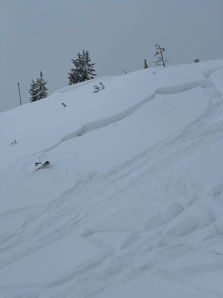
Observed a fresh slab avalanche on Mt. Henderson this morning. E, SE aspect, 9,900'.
I skied up to investigate it and would estimate the size of the crown to be 2-4' deep and about 80' wide. Somewhat surprised by the size relative to the starting zone. Likely a natural avalanche (from about 36 hrs ago), but there were fresh sled tracks in the vicinity from yesterday, so possibly a remote trigger.
LOTs of collapsing again today while breaking trail on low angled S, E and W aspects. Some collapses were quite large (100'+ diameter).
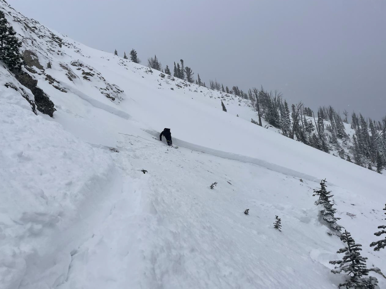
Full Snow Observation ReportObserved this natural avalanche on the south summit of Mt Henderson. Slope is SE facing, 9800 ft. This slope is heavily wind loaded. I estimate the crown is two feet deep and the avalanche is D2. Likely occurred on Friday 12/8
Full Snow Observation ReportFrom email:
"While grooming the xc trails in Beaver Creek drainage last night, I observed extensive cracking and collapsing in the 12"+ of new snow. Essentially every slope above the trail would fail as I approached them, some breaking up to 30' away. I know it's not a good sign but was cool to watch.
7,5k'-7,9k' mostly North facing aspect.
Yesterday's addition here was right side up with the initial snow coming in very wet and heavy, while ending in a light fluffy topping which is now getting blown around. Additional trace overnight and currently snowing again at 8am. "
Full Snow Observation ReportFrom facebook message: "North facing slope 15 miles south of west Yellowstone probably 30ish degree slope. Probably 16-18 inch slab"
Full Snow Observation ReportI skinned up the south edge of the apron below the midways today. 12 inches plus or minus, the wind moved it a little. Hard crust underneath up to 3” thick. 3 good whoomphs on the up track and another skier that broke trail above me to the bottom of the first midway said he had a good settlement while he was stomping out a spot. I didn’t see any cracks or any movement but it made me step back
Full Snow Observation ReportFrom email:
"We skied in Republic Creek and Hayden Creek today.
No avalanche activity observed, but we had very widespread collapsing (about 20 large thunderous ones), on all aspects, primarily in the upper elevations.
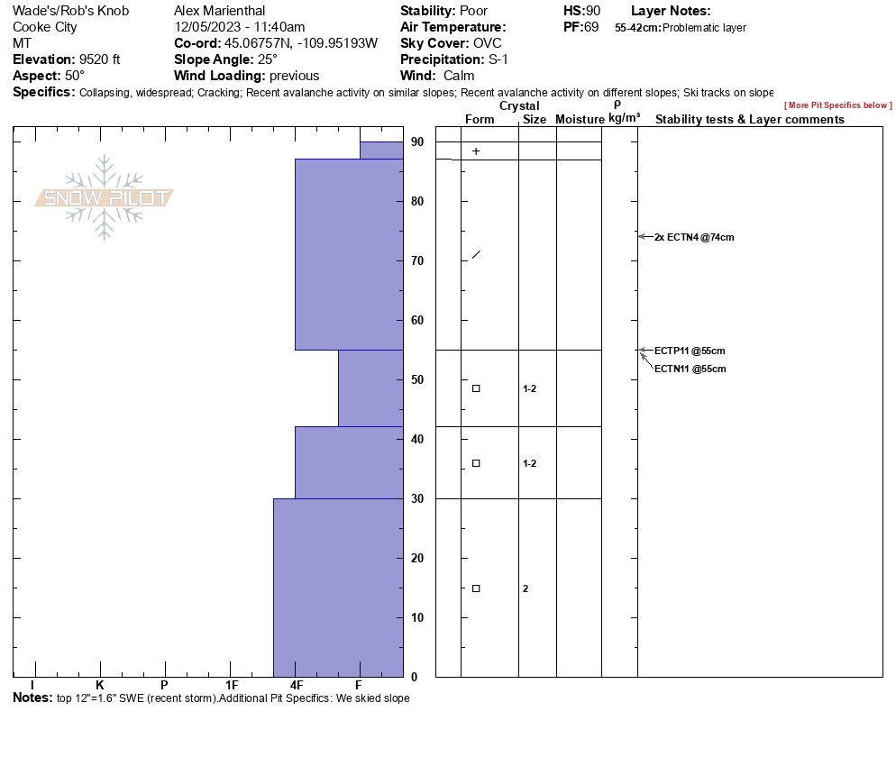
Snowpit attached from a west aspect at 9700'. HS: 90. ECTP3 @ 54."
Full Snow Observation Report
Dug into the hillside right before going up the creek. Snow pack was 75 cm deep consisting of three layers. Bottom 35cm is obviously faceted, grain size is around 2mm. Very thin ice crust at around 35cm. Upper 35 cm of snow is brand new snow from this current storm, precipitation particles, low density, with minor wind effect. Performed a quick Compression Test and the ice crust layer failed on the second tap. Sudden collapse, clean sheer. Snowmobiled a small test slope next to pit and got no shooting cracks or whoompfs.
Full Snow Observation ReportFrom email:
"South of Cooke City today. Good conditions on low-angle open meadows. Fun problem-solving in the trees!
MC/PC/PS/C, seasonal temp (20s), calm.
No collapses or shooting cracks. Corners broke on steeper kick turns. I had a good view of lower (N) Woody Ridge and did not observe any Avalanche activity. I don't trust this shallow snowpack, but really fun low-angle meadow skipping.
HS 74cm; ECTN14 on new-snow M/F interface, ECTP21 on old-snow depth hoar interface."
Full Snow Observation ReportWell I had to go see what the snow was doing today. We climbed the Fallen (about 100m below Climb Above Dribbles). On ascent there were no signs of instability (no cracking, collapsing, naturals, good results in hand pits, etc). New snow had accumulated to around 1m in spots however! No activity in the old snow, which seemingly gained some strength in the warm weather midweek (hardness in FCs went from fist to 4F from mon-fri).
During the day, snowfall rates hit S2 at times, and accumulation was around 5 cm, with moderate winds and moderate drifting. On descent this new snow was touchy, and we observed 2 natural avalanches, max depth 15 cm, on the small end of size 1, F hardness, running less than 30-50m exclusively in new snow. (SS-N-R1D1-N)
Structure remains poor overall.
Full Snow Observation ReportEctp 12 on SW slope around 8800' on new snow/old snow interface. ECTP 9 on SE slope around 9200' on new snow/old snow interface. Shooting cracks on ENE slope around 9000'.
Full Snow Observation ReportSkinned up Bridger Bowl (currently backcountry above the Quad) to Bradley's Meadow and the Ramp. As we neared the top of the Alpine lift we started getting collapses and whumpfs whenever leaving the established skin track. There were a few inches of old, weak, faceted snow near the top of the Alpine lift, this increased to approximately a foot of old snow at the bottom of the Ramp (7900 ft). This was covered by a foot of new snow (1.5" snow water equivalent measured). We dug at the base of the ramp on a NE aspect and got two ECTP11s on the facets.
Every other group we spoke with also experience multiple collapses. This clearly showed the snowpack was unstable and made decision making easy. We stuck to slopes <30 degrees.
Full Snow Observation ReportBig Sky Ski Patrol intentionally ski cut an avalanche breaking on the weak snow near the ground during avalanche mitigation work on 12/8/23.
From email: "[An avalanche] released on a ski cut, breaking on facets above a basal crust, easterly aspect, just below tree line."
Full Snow Observation ReportThe snowpack at low elevations is thin (<1 foot). Off-trail riding looked questionable, and we let the sleds stay in one piece for another day or two. We went a cornice line at 9000.’ We walked over to our pit site on a NE facing slope, triggered a large collapse, and got an ECTP13 in a snowpack that resembled what Dave saw at Lionhead and Ian and Alex saw in Cooke City. There was 8” of new snow with 1” of SWE with a total snow height of just over 105cm.
Across the way, we dug on a SW-facing slope and found a similar snowpack structure although there were a few more ice crusts mixed into the 90cm deep snowpack (ECTP14).
We rode up a bit farther to get a view of the Jefferson Bowl and saw one, small natural avalanche that occurred within the storm snow.
There was no real way to navigate avalanche terrain without rolling the dice with the persistent weak layer that makes up the foundation of the snowpack. Avoidance is key.
Full Snow Observation ReportFrom IG: Pocket I set off between finger 2 and 3 at Bridger Bowl just above the road. Finger 1 had someone ski it while we were hiking and they got a face wide crack.
Full Snow Observation Report8" of snow fell in 3 hours this morning. We inspected the snowpack in the gully above Silken Falls for the Bozeman Ice Festival. New snow and wind are increasing the avalanche danger. Be careful crossing gullies, especially the one above the Sceptor, the one below Responsible Family Man, Avalanche Gulch and Silken Falls. Triggering an avalanche in these is a very real possibility as they continue to get wind-loaded.
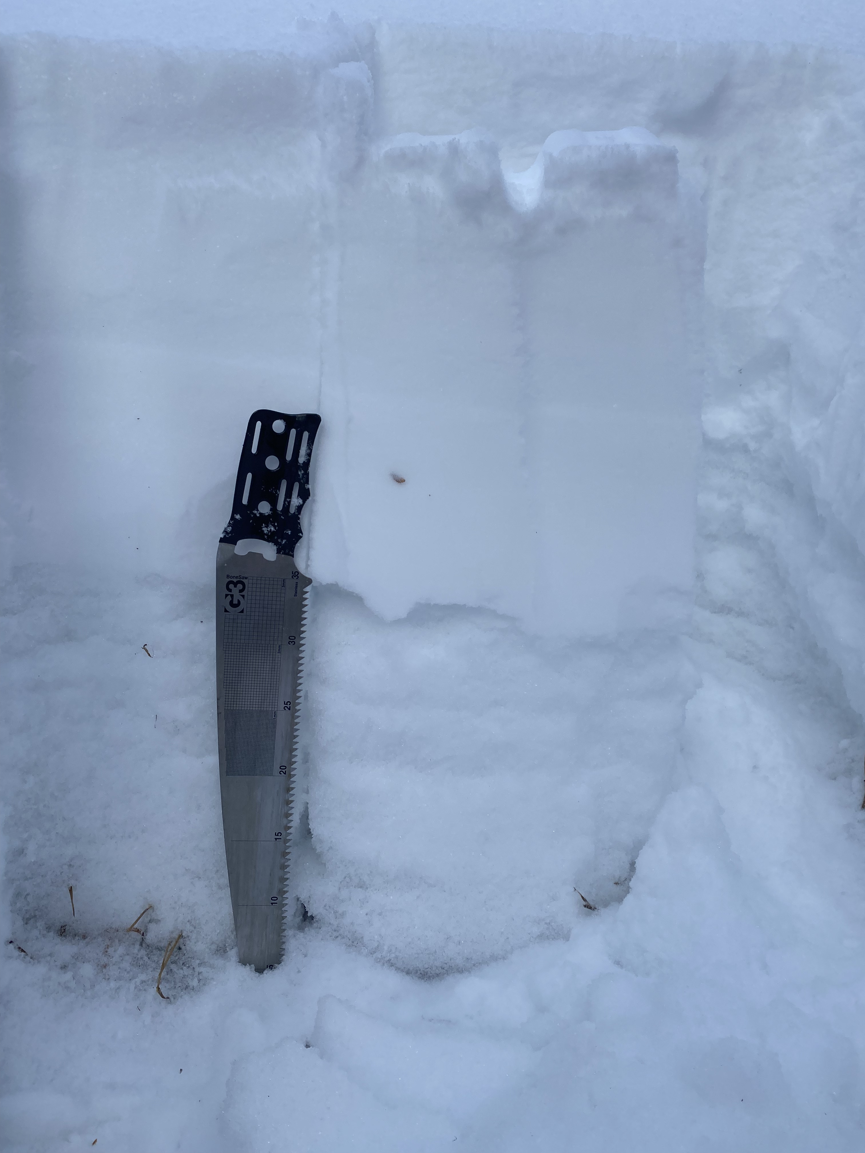
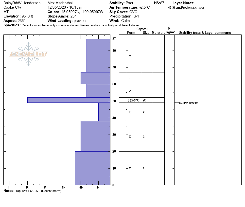
Full Snow Observation ReportWe rode up Daisy Pass road and dug below the road at 9,510' on a WSW aspect. Snowpack was 2.5feet deep (87cm). The recent snow was 1 foot =1.6" SWE (measured in field), sitting on a hard crust above 2mm facets which made up the bottom half of the snowpack. We got an ECTP11. We dug a second pit near Lulu Pass on a NE facing slope at 9,520', and found a very similar snowpack structure, without the crust below the recent snow, and also got ECTP11 as well as some ECTNs.
We saw a couple 8-10" deep natural avalanches on the steep slopes above Miller Creek that probably ran in the last 24-48hours. We had multiple collapses on the NE facing slope where we ski toured to dig our second pit.
Full Snow Observation ReportConstant red flags on W Henderson.
Full Snow Observation ReportFrom FB Comment: "We were seeing shooting cracks in the snow Sunday in the Black Canyon area."
Full Snow Observation ReportFrom text message: "The attached picture is a little slide that went off when I was doing small turns on an adjacent slope. That's Beaver Slide! There was more small slides south in the trees. Heard whumphing here and there."
Full Snow Observation ReportToured up to the east ridge of Blackmore. About what you’d expect. Old snow was only about 20cms deep. Mix of crusts and facets depending on aspect. New snow from the past few days ranged from 10cms-30cms in the most wind loaded areas. Experienced whoomfing and collapsing while skinning in wind loaded areas. Very bony skiing off the lower ridge. Walked the trail back down due to lack snow.
Full Snow Observation Report


