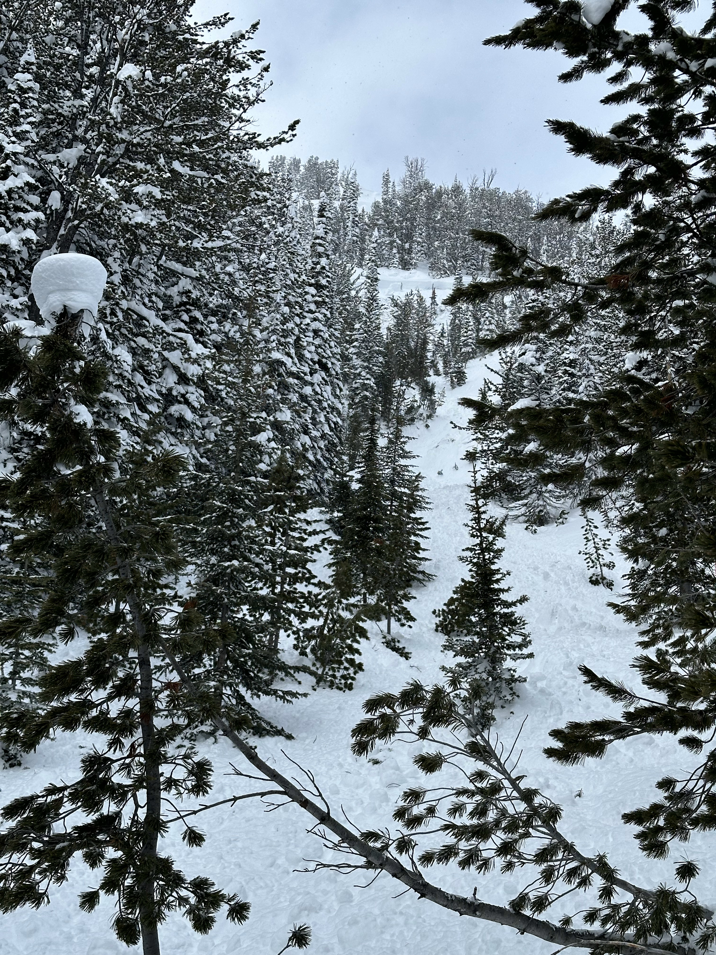
Snow Observations List
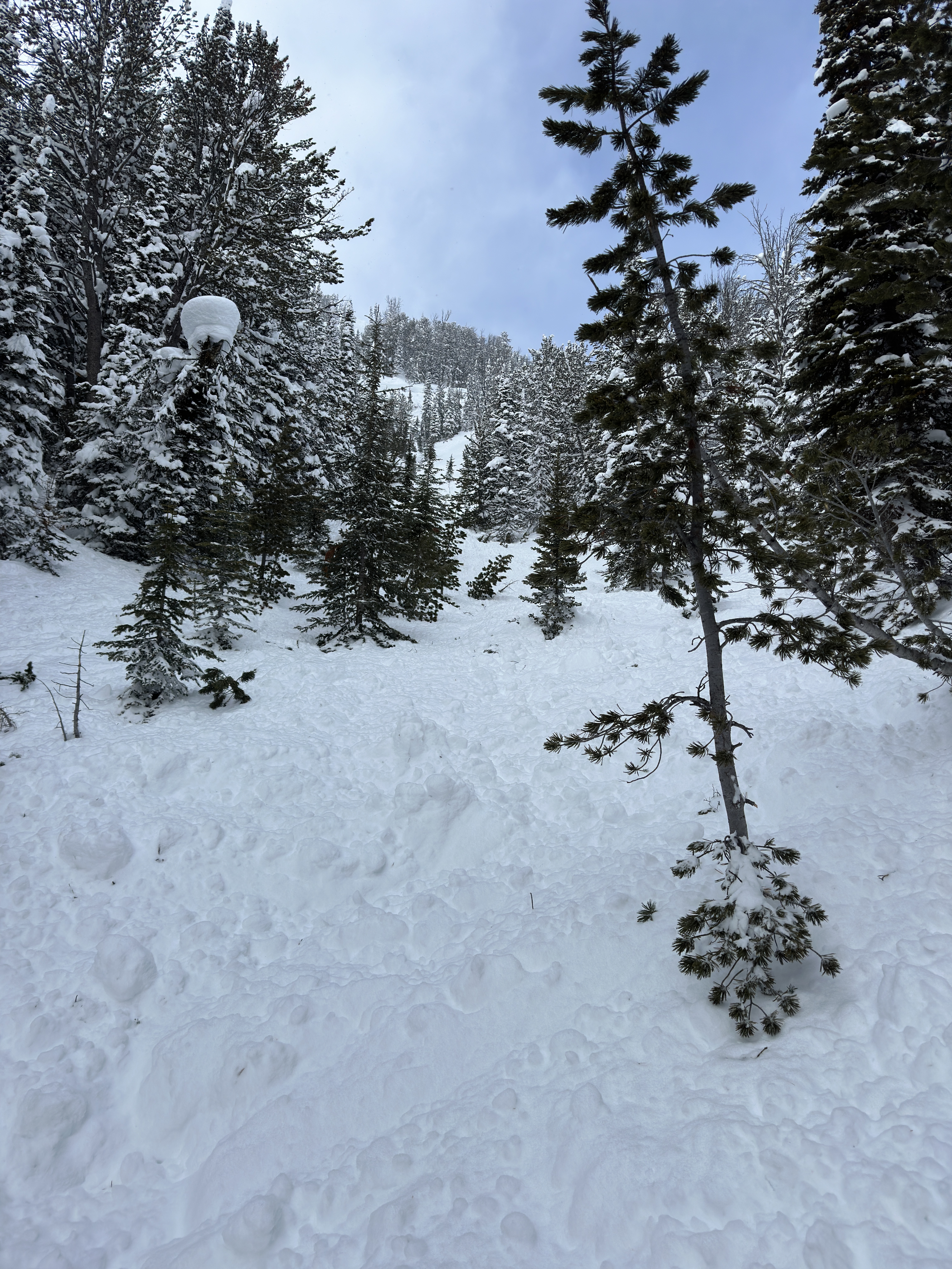
From email: "This avalanche was triggered by a rider in our group on the 7th. The rider was midway up the slope, it broke above him right under the cornice and he successfully outrun the avy to the bottom. Right above the trail it looked the deepest at 10' to 12' deep at the peak and 6' plus further to the north."
Full Snow Observation Report


Big slide below the radio tower. Kept our distance but looks like a large crown. The base up Portal is really inconsistent. Some spots it’s great and others you sink up to your chest. Had 4 instances of whompfing on fairly flat ground in the trees. 1st picture is from today and 2nd is from Sunday
Thanks for all your hard work!
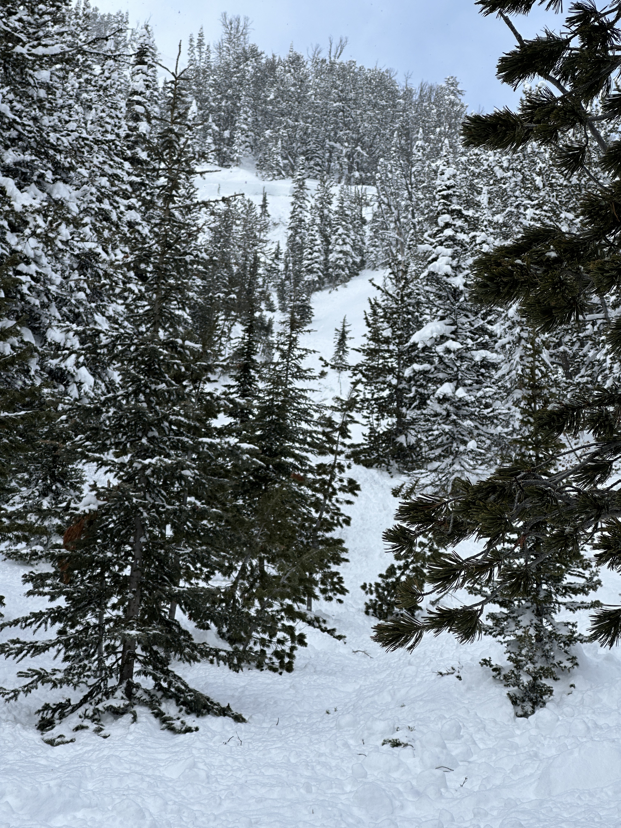
Full Snow Observation Report

03/07 - observed several crowns on Republic from Town Hill, likely from 03/06. Ray's had a slide on its west end which appeared to be isolated from the large avalanche that was filmed on the shoulder/Ray's. We saw up to 4 other crowns in Republic bowl on NE, N, and NW aspects including one that broke on the NE facing spines looker's left of the Fin that got legs and ran into the trees out of site (R1-D2?).
One note - while all of these slides, including the large one already reported on the shoulder were on northerly aspects, the majority of the trigger points appeared to be small, steep, thin, NE facing features. We surprisingly woke up to clear skies early on 03/06 and I wonder how much of an impact solar may have played. Other faces and features in the area that are strictly north facing or otherwise protected from the sun didn't appear to be sliding naturally.
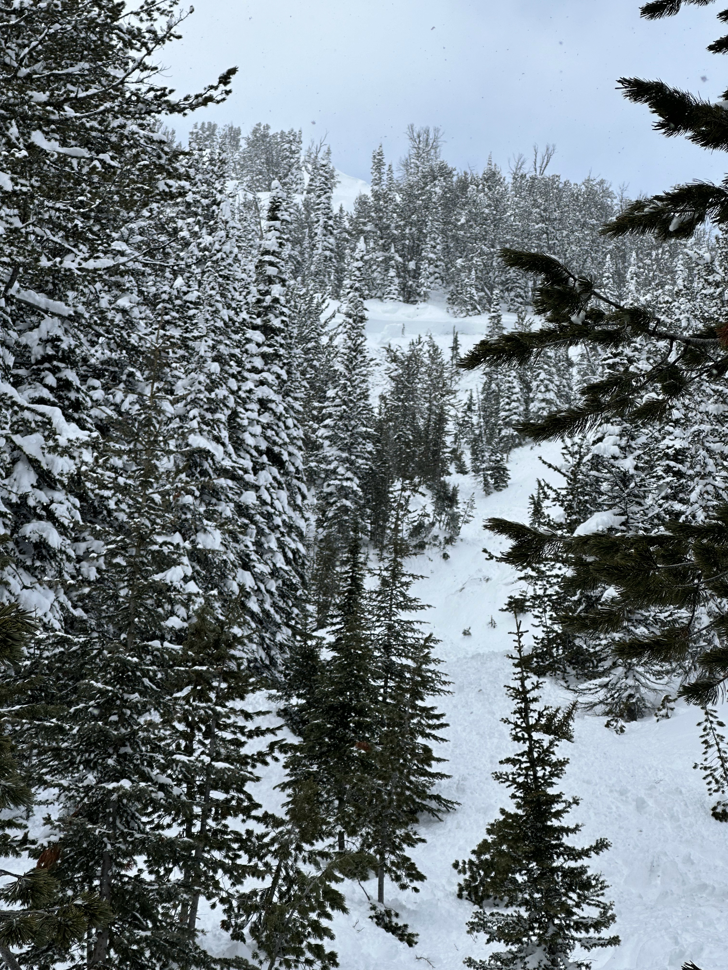
Full Snow Observation Report


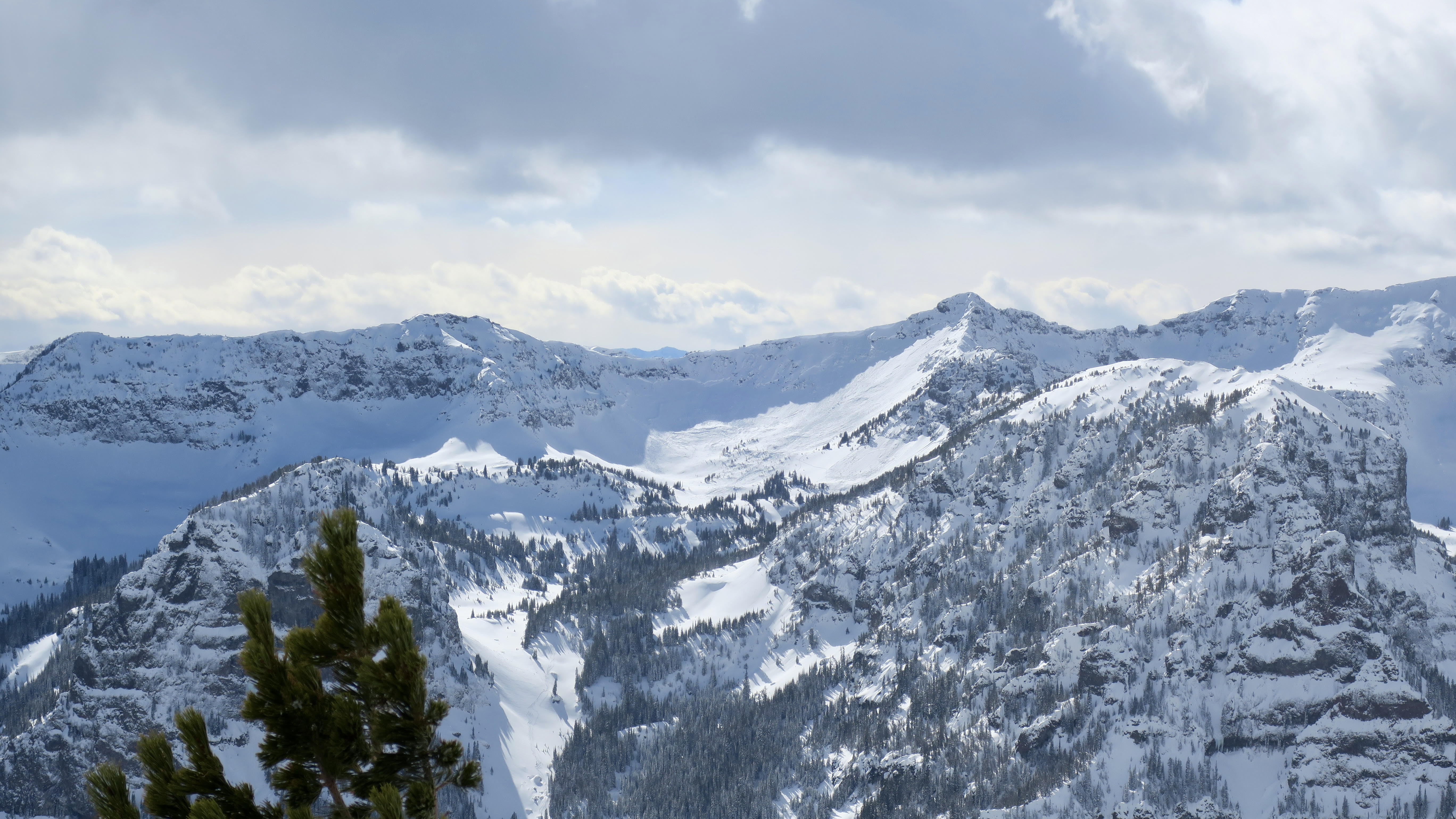
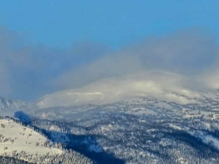
We rode Denny Creek to the head of Targhee Creek. The primary objective was to search for avalanche activity from the last storm and avalanche warning. There were two deep avalanches on heavily wind-loaded slopes. Otherwise, avalanches were confined to the new and recently wind-drifted snow - there were four of these smaller avalanches. The snowpack at Lionhead handled the recent loading events better and there were fewer avalanches I expected.
We did not experience any signs of instability (cracking, collapsing), but the winter’s snowpack history and concerns about triggering large avalanches kept us off of steep slopes.
Full Snow Observation ReportThe Avalanche Warning verified but on the low end of the rating. Today was good at CONSIDERABLE. We are moving quickly toward MODERATE. Riders are starting to climb and based on what we saw, none triggered slides. On a normal season, we would say it is MODERATE tomorrow. The hesitancy is purely based on the history of the season.


Skinned to the top of big Ellis completing 2 ECTs along the way. The first pit was at an elevation of 7946 feet, north of the burn, east aspect, exposed to the sky/not shaded. Snow depth 100cm. 2 buried crust layers, ECTNR. We did get the column to fracture below the lower crust layer by prying on it after the ECT test. The hardness of the faceted snow at the ground was 4 fingers trending to 1 finger. The second pit was completed at an elevation of 8209 feet, top of the burn, east aspect, exposed to the sky. Snow depth 120 cm, 2 buried crust layers, ECTNR. The column failed at the ground post ECT via the same prying as previous column. Hardness of the faceted snow at the ground was 4 fingers. We experienced no signs of instability during the day. The skiing was good. There were a few old ski tracks, partially buried by recent snow.
Full Snow Observation ReportFrom email: "Natural avalanches observed near Cooke City today. At least 3 big PWL/ deep slab avalanches. All northerly aspects, mid elevations.
Also, observed one upper elevation north facing slide that looked more like a storm slab."
Full Snow Observation Report

Today I saw evidence of Multiple N-R2-D2-I avalanches in the fairy lake zone. All three were NE facing, around 8800’. 2 slabs in Fraizer basin and one in the basin to the south. All three looked to be from 3/3-3/4 storm cycle
We skied in the love chutes and Fraizer basin today with No collapsing or cracking.
Full Snow Observation Report
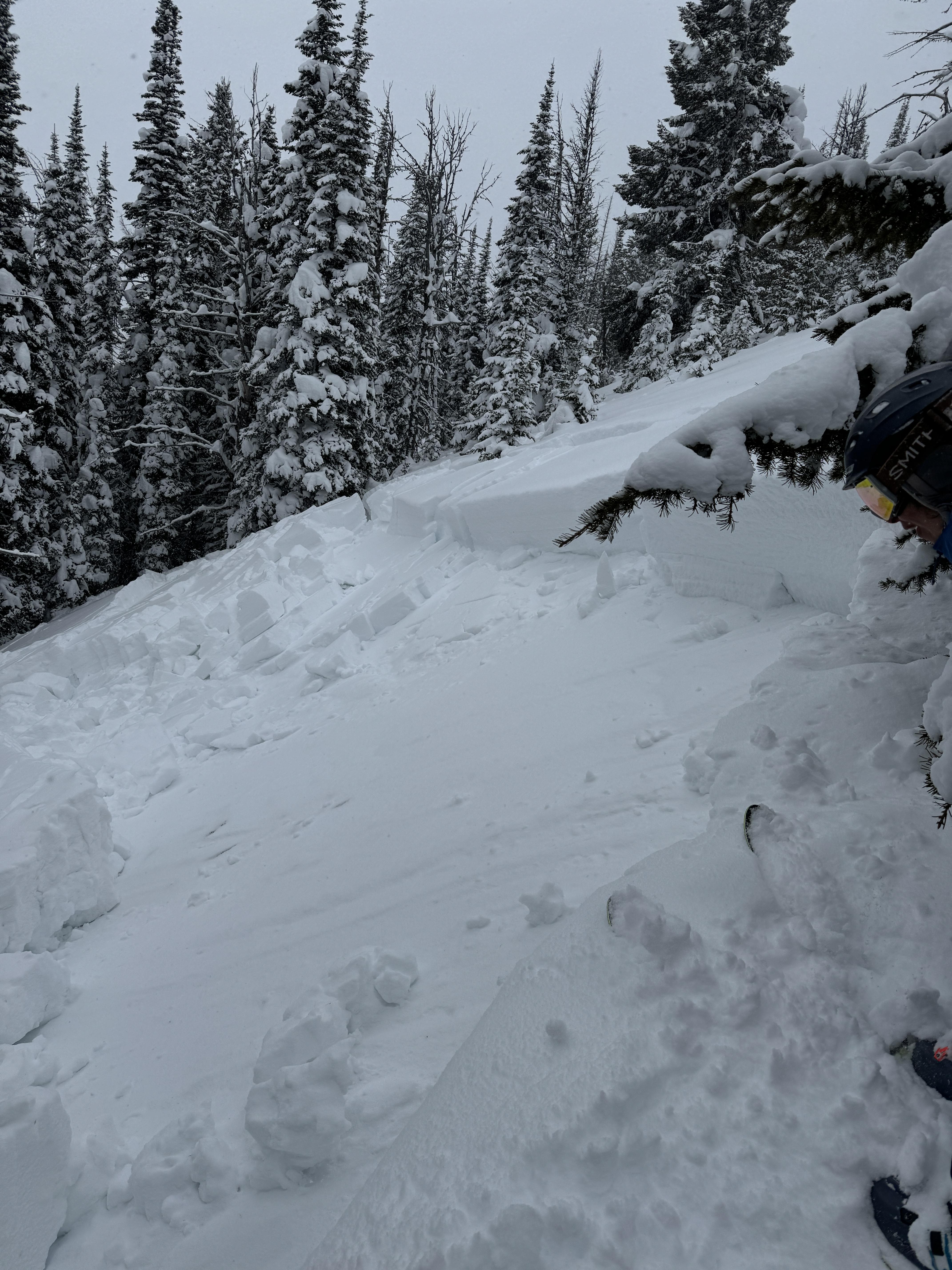
Toured up to the Cinnamon Mountain Lookout today. In a small meadow along the trail I got a small whumph, with a crack propagating out 5-10 feet all around me. HS was around 30-40 cm in this meadow. HS rose rapidly with elevation and I had no other large collapses throughout the day, but noticed some localized cracking in recently formed windslabs, and rapid warming of the snow surface in the sun all day. I dug a pit about 200' down from the summit, directly south facing, and got unremarkable test scores from a scary structure (full profile is in snowpilot). With the several warning signs I had seen, I chose to take my test results with a grain of salt, and ski a conservative line.
Full Snow Observation Report
East face of Republic Mountain above Erma Mine Cabins. 8800 ft natural avalanche just below the ridge. 3-4 foot crown, Apx 100’ across, ran approximately 1000 feet down the creek bed. Appeared to be from earlier in the morning possibly when the avalanche slid off the north face of Republic, as it had a light dusting of snow over the debris. This start zone was just over the ridge from the North facing 9:14 am avalanche but I don’t think the start zones were connected.
Full Snow Observation Report
Toured up on the ramp yesterday. In wolverine bowl, another skier and I both popped small wind pockets (6” deep at the most) about half way done the slope on a north facing roll. We also saw lots of snow transport up high on the ridges all day, as well as some slight warming on direct south faces.
Full Snow Observation ReportObservation cam from IG.
Full Snow Observation Report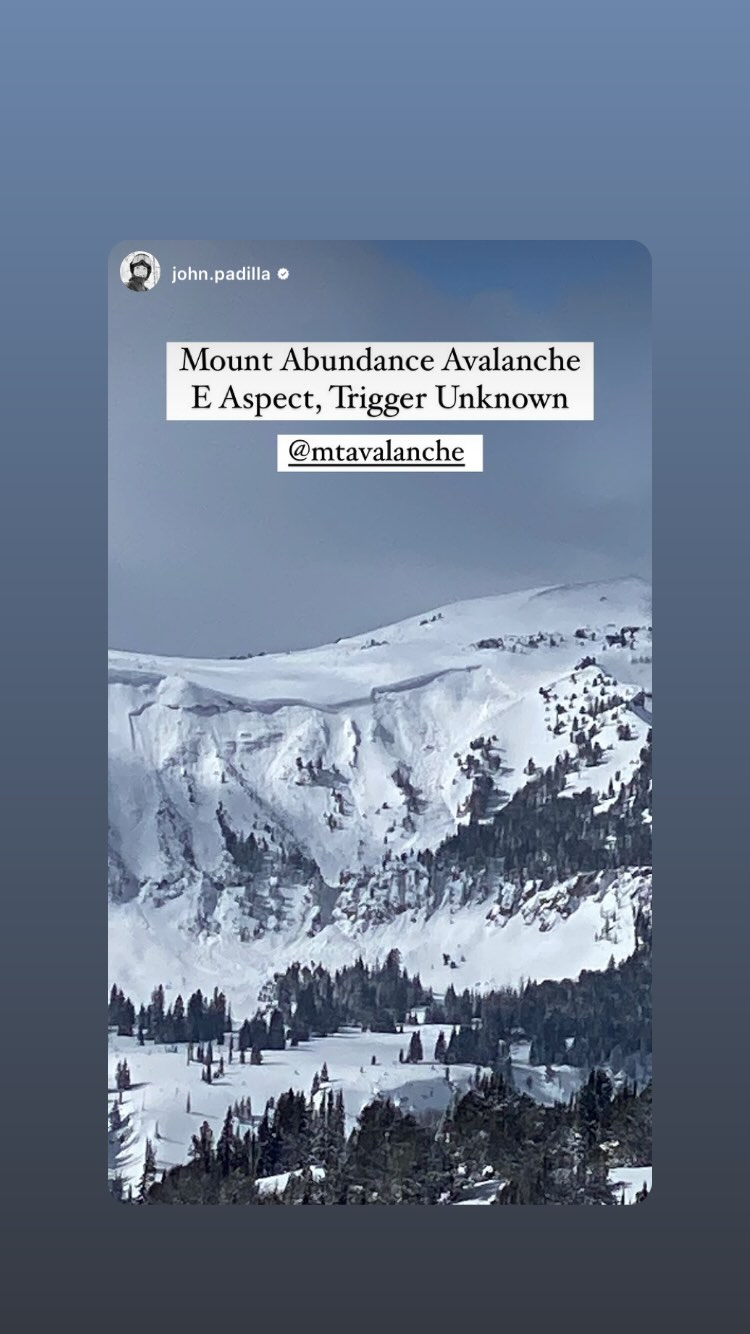
While riding north of Cooke City today we observed a large debris pile southern end of Sheep Mountain. SE facing at ~9700'. With poor visibility, I couldn't see a crown but much of the path had been filled in by wind and the debris was covered with fresh snow, making it at least a few days old. This slope was remotely triggered earlier this year in January by riders from the bottom of the slope.
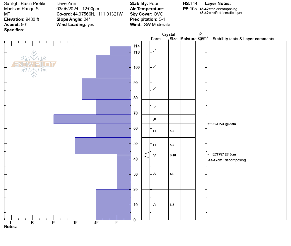
Full Snow Observation ReportWe rode into the Taylor Fork past Consolation Hill and to the weather station at Sunlight Basin. Winds were strong through the morning and we rode in a ground blizzard in all the open meadows along the trail in. There was not much for obvious drifting on the road, but the snow was obviously going somewhere. Snowfall intensity varied from a trace to an inch per hour (S -1 to S2). The highest precipitation intensities occurred around 1-1:30 PM as we began our ride out.
We did limp our way to the Sunlight Basin pit site in poor visibility and dug, but the wind, snow and light were such that we couldn't even visualize the bowl near the weather station. Digging a pit, we found more of the same structure that we have tracked for a few months now. The depth hoar does not seem to have gained any measurable strength, but the layers of surface hoar are somewhat more decomposed. We got an ECTP 23 on a layer of facet in the mid-snowpack and an ECTP27 on the depth hoar.
As we discussed in our video for the day, today and tomorrow the equation is simple... new and wind-drifted snow on a weak snowpack equals dangerous conditions. As we move into a period of high pressure for the rest of the week, the likelihood of triggering an avalanche will decrease as will signs of instability and, most likely, the frequency of avalanches. However, the consequences of getting caught will remain unchanged. As folks are enticed by steeper terrain later in the week, we strongly recommend an incremental approach to expanding terrain selection and avoiding slopes with terrain traps. Additionally, safe travel practices become essential if you are stepping into the ring, especially carrying rescue equipment, knowing how to use it, and traveling one at a time on any slope steeper than 30 degrees.
Full Snow Observation ReportDanger was CONSIDERABLE as far as I could tell, given the zero visibility.

From IG:
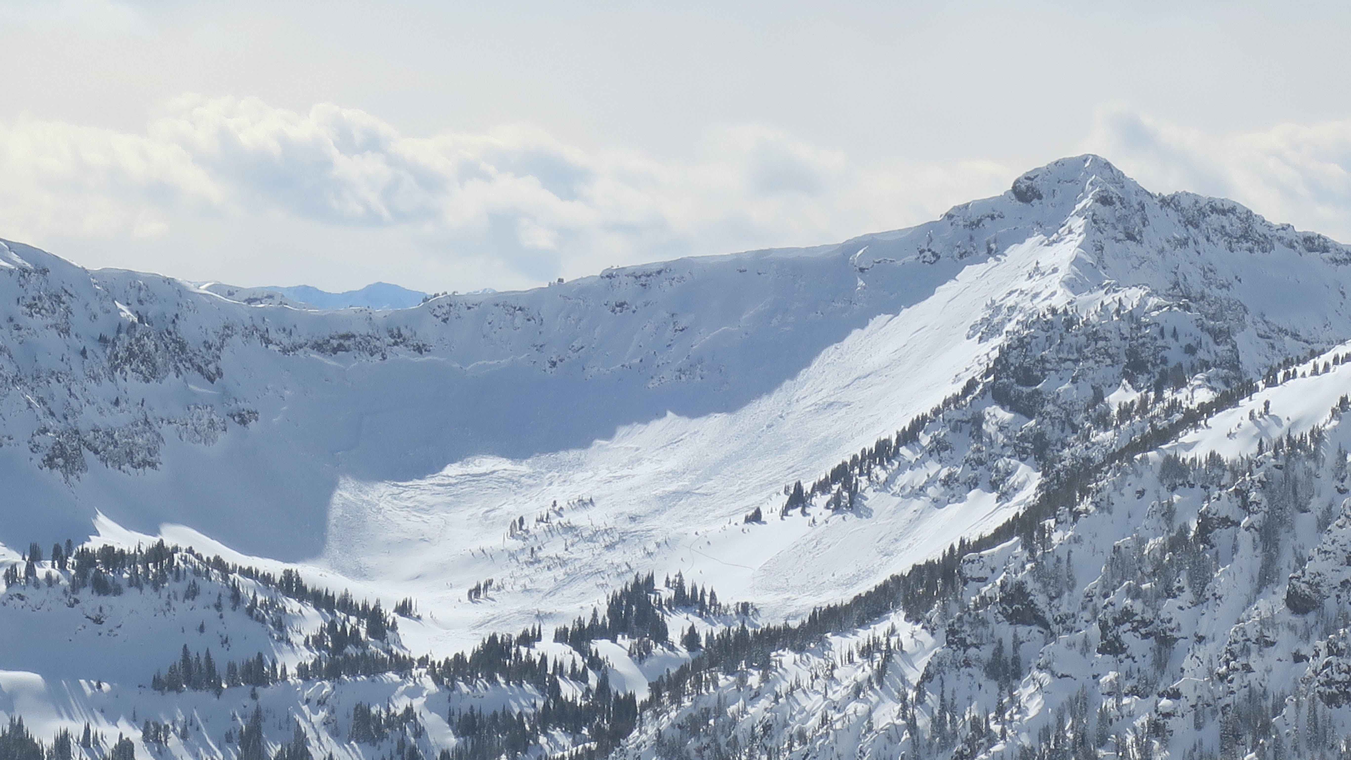
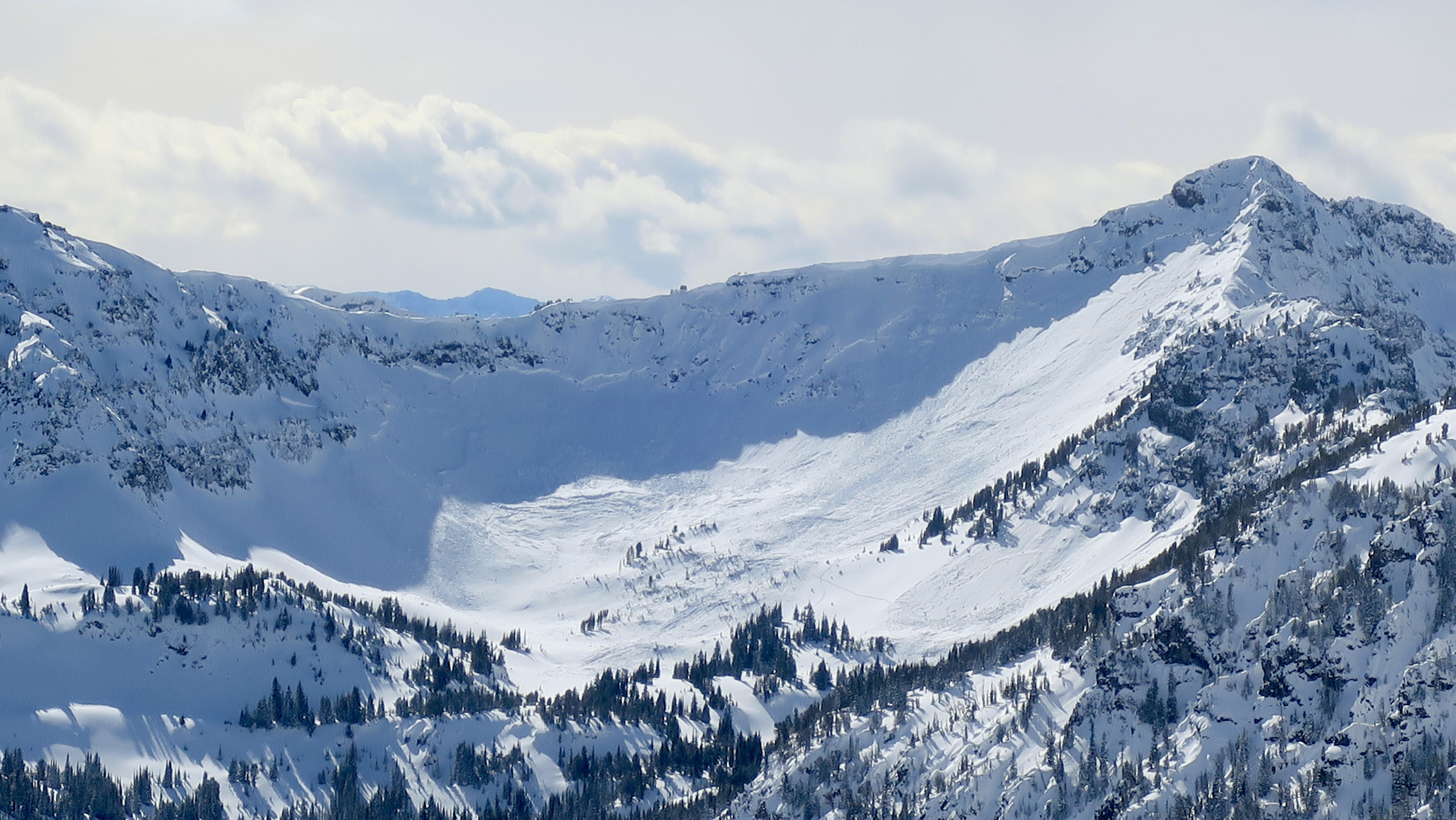
Very large natural avalanche in the Lionhead Area. Multiple other smaller naturals as well.
Pics taken 03/05/24
Full Snow Observation Report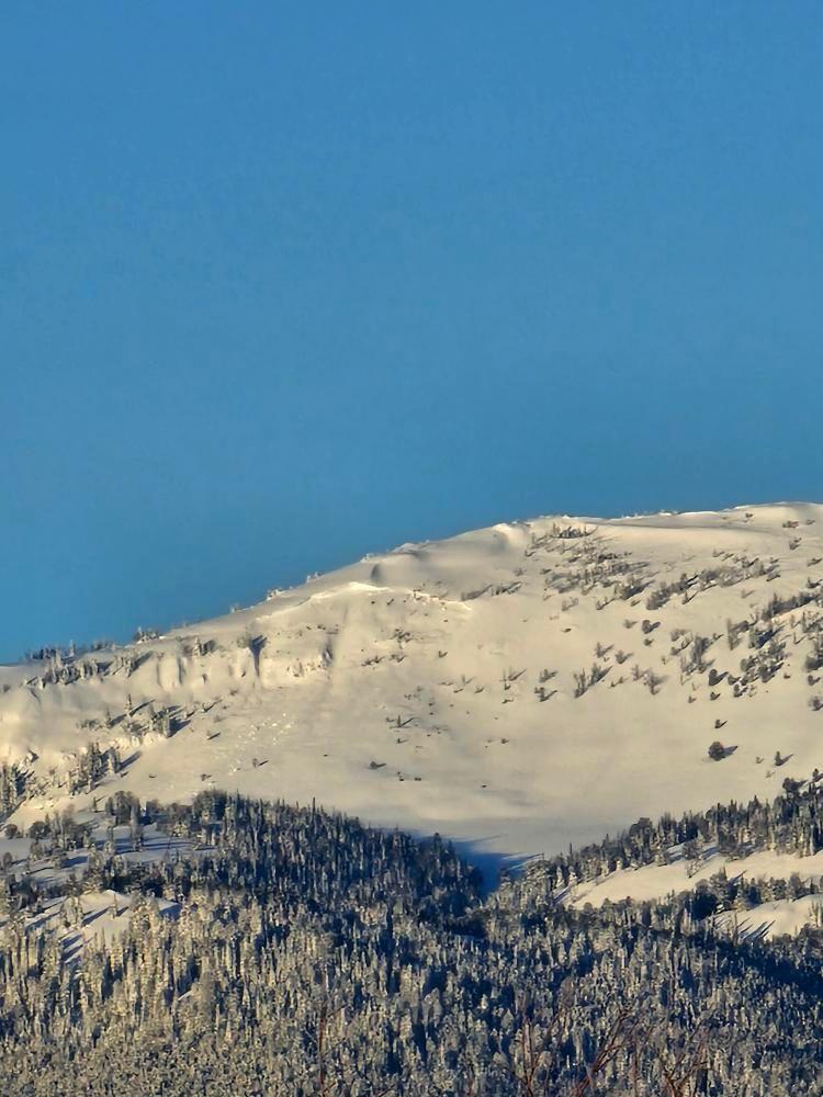
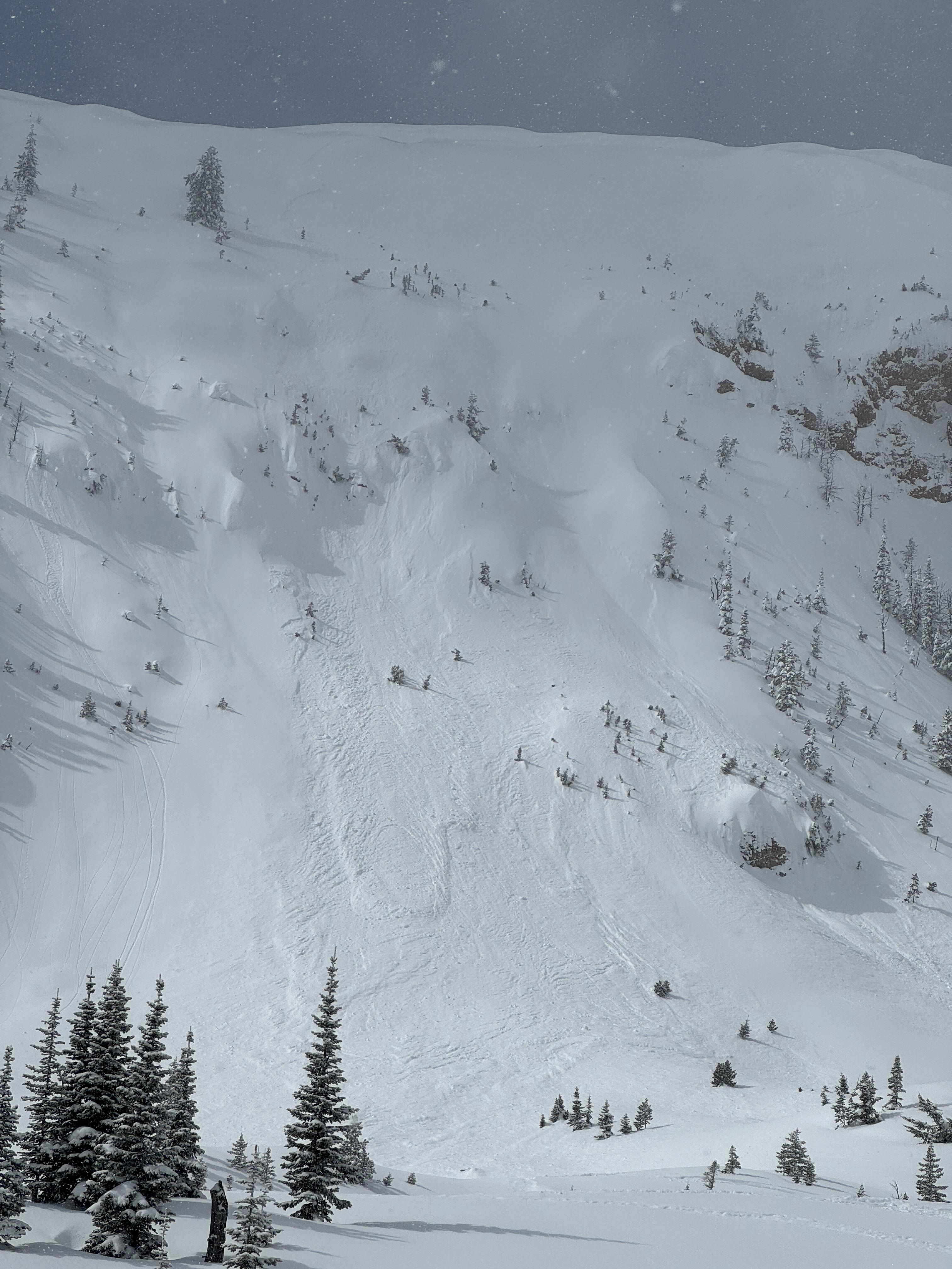
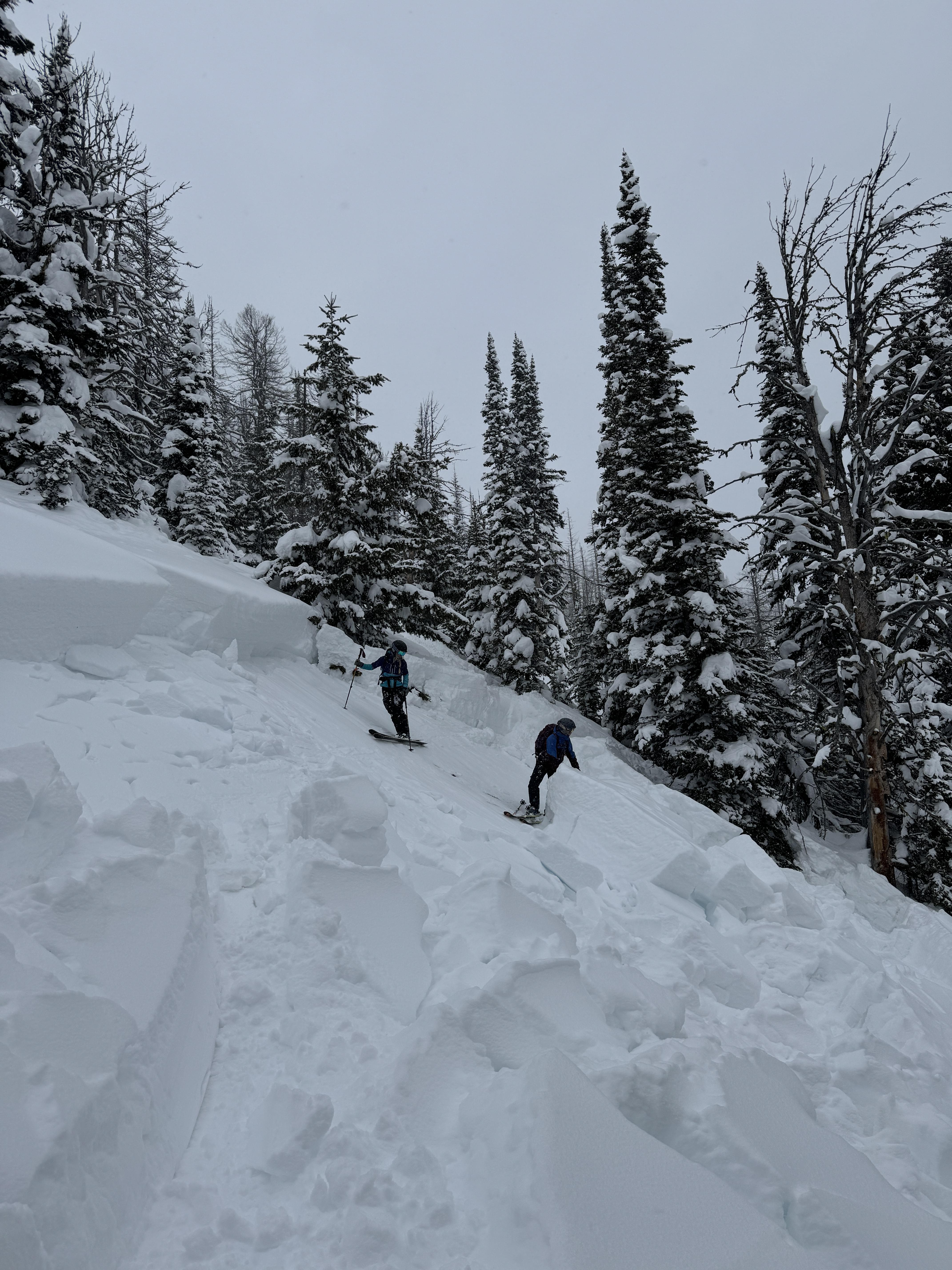
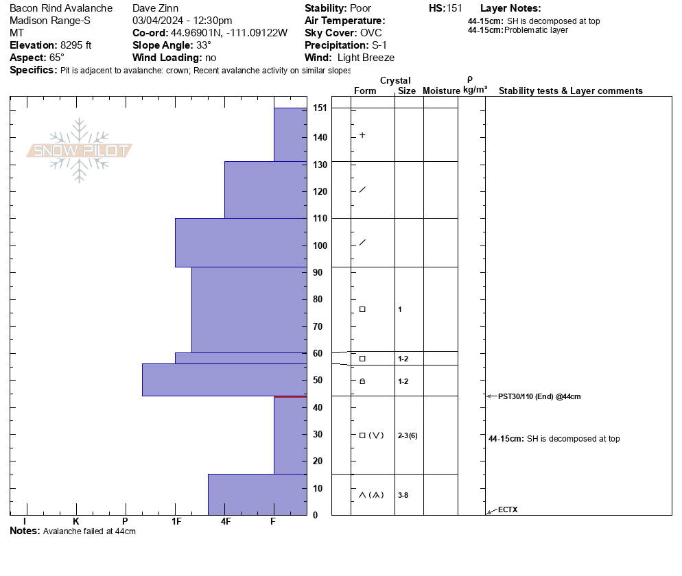
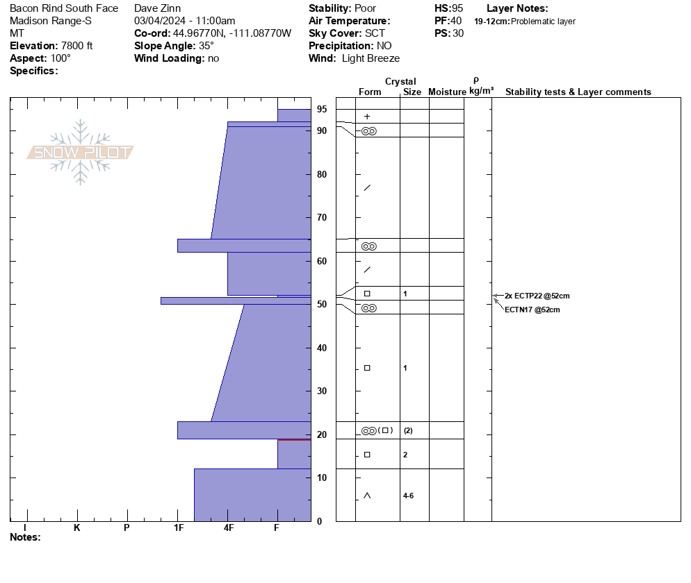
We toured up toward the Skillet along the standard uptrack route at Bacon Rind. We deviated to the south to look for a natural avalanche that broke on March 2nd in the south-facing meadows a third of the way up. We did not find it but dug a pit. 95 cm HS with a newly buried weak layer of facets above a crust at 52 cm (ECTP22x2 plus an ECTN17 on this layer). The depth hoar near the ground was moist.
Somewhat dejected after failing to locate the avalanche, we proceeded back to the typical route. We came across a deep avalanche on a small rollover. 100 feet wide, 3-4 feet deep, and 50-75 feet vertical. Slope angles ranged from 29-33 degrees steep. It was an R5, D1.5 avalanche that certainly would have been very dangerous on a larger slope. ECT in the crown was unremarkable (this is not uncommon in the crown of an avalanche), PST 30/110 End.
Continuing up, the next open meadow had collapsed and was splintered with shooting cracks. The failure propagated through the trees with more cracks and buckle marks as the slab tried to release... which it did a bit further downslope. Again, the crown was 3-4 feet deep, and the terrain constrained the length.
No additional signs of instability.
These two avalanches were different than the two we were initially looking for. I suspect skiers triggered them remotely on March 2 given the amount of new snow on the debris, but they may have failed naturally. Regardless, avalanches in these locations are very unusual and are indicative of dangerous conditions. With more snow coming the next two days, travel in or near avalanche terrain requires a great deal of caution. Conservative terrain selection will be essential.
Full Snow Observation Report

Observed a debris pile on the east face of Fischer Peak. Unable to determine when and what triggered it. Numerous debris piles on the Rasta Chutes on Scotch Bonnet.
Full Snow Observation ReportThe Snow Ranger crew was out on Buck Ridge today. We did not see any new slides around Beaver Creek, 1st Yellowmule, or Slatts Hill/ upper Buck Creek. It began snowing before we made it to the McAtee/ 3rd Yellowmule area but from what we could see, it looked like the N/NE faces in McAtee that slid just over a week ago had avalanched again, nearly to the ground. There were slightly dirty looking debris piles mid slope and several prominant crowns just below the ridge top but it was hard to make out details through the light snow, even with binoculars.
Full Snow Observation ReportWhile traveling to Big Sky from Ennis, I noticed a large avalanche on the east face of Fan Mt.
Crown appears to start at approx. the 9500' elevation with a vertical drop of at least 2000'. Crown appears to be 200-300 yards wide
Full Snow Observation ReportWhite touring in the History Rock area, I spotted a couple of recent slides on the NW shoulder of Mt. Blackmore. From a distance, these look like dry-loose slides on the recent snow interface around 8,500ft. on a N-NE aspect.
Otherwise, 12-20cm of new snow was present in the area (~ HS 80-115cm), with evidence of wind loading on east aspects, and scouring on west aspects. No other signs of instability were observed.
Full Snow Observation Report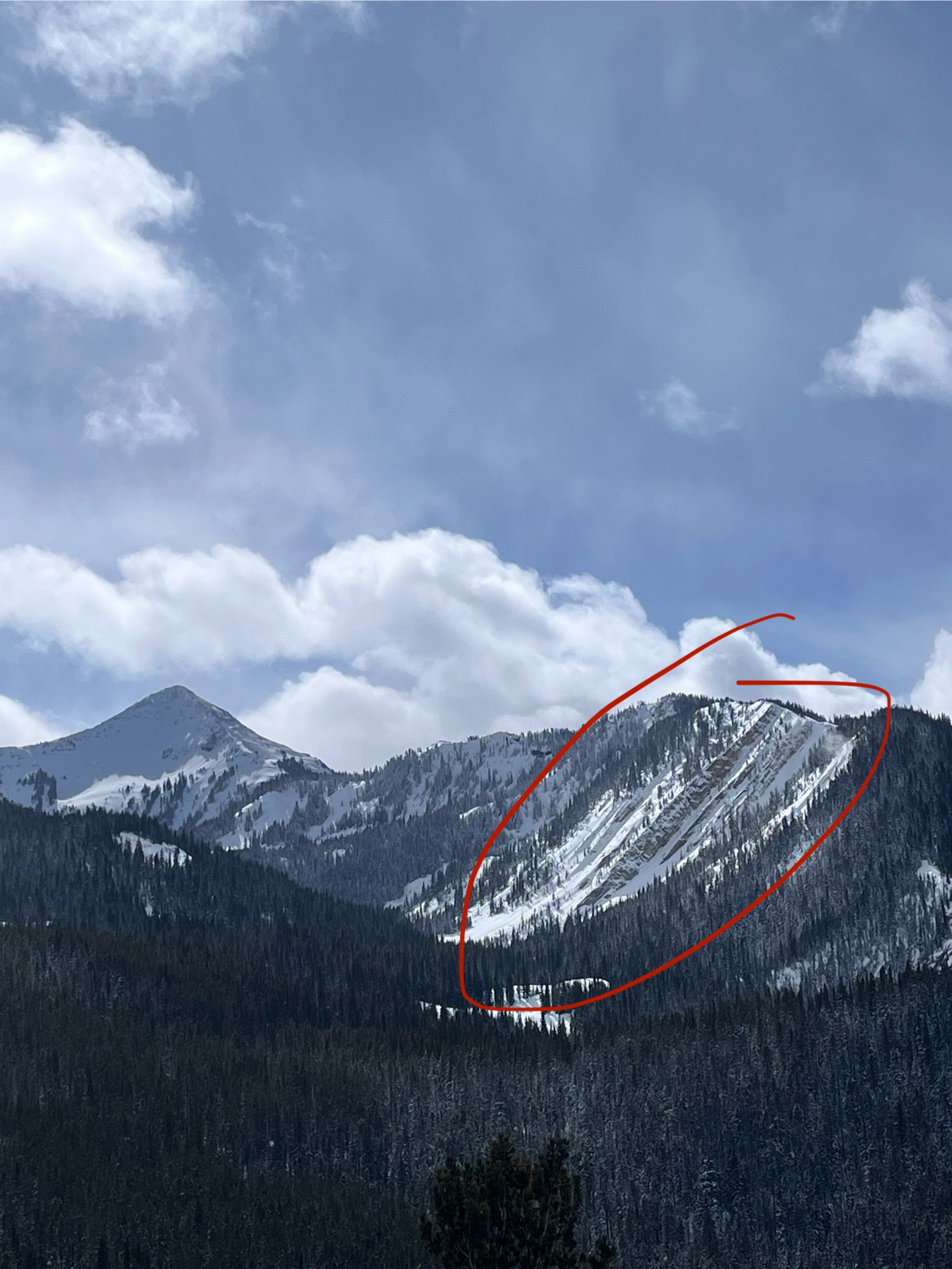
Shot from the top of Flanders, ~1400 this afternoon, 3/3/2024. Big slide(s) on Arden and in Maid of the Mist.
Looks like the skin track and ski track between the two slides got taken out. At first glance from across the way it looked like the skin track was crossing over the debris, but when zoomed in it looks like the debris overran the skin track and the ski track.
Full Snow Observation Report