Photos
|
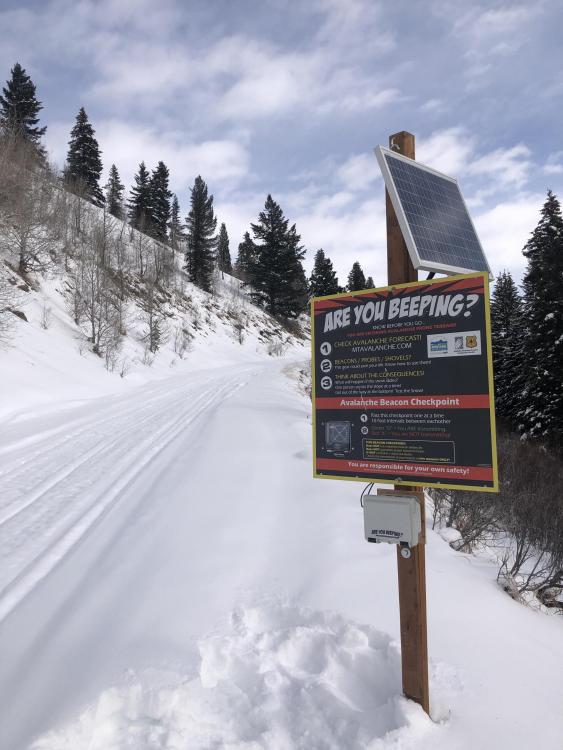
Southern Madison, 2022-11-30 We just installed a new Beacon Checker at the Fir Ridge Trailhead which leads into Teepee Basin and Cabin Creek. Thanks Jim Norlander for installing it! Photo: J. Norlander |

|
Northern Gallatin, 2022-11-28 Toured up to the NE shoulder on Mt. Blackmore yesterday. Winds were strong and variable, but mostly gusting from the S-SW. A lot of snow was moving around, skin tracks were filled in very quickly, and you could actively see small cornices starting to build on the lee side of the ridge. Photo: H. Darby |
|
Northern Gallatin, 2022-11-28 On the descent, I intentionally triggered a small wind pocket in one of the chutes in the cliffs near the trail at 8700 ft. I included a video. It was D1 and about 5 inches deep at the crown. I think just a good reminder that even in the trees, the tops of those chutes get wind loaded and can definitely slide. Photo: H. Darby Link to Avalanche Details |
|
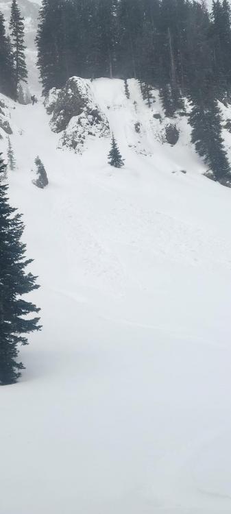
Northern Gallatin, 2022-11-28 Saw a group of skiers trigger a small wind slab avalanche on an eastern aspect at around 8,300' in the main fork of Hyalite in "Candy Land" just south of the climb Big League Chew at 2:00pm on Saturday (11/26). Crown looked to be around 2" to 1' and 90' wide. The slide ran maybe 100'. No skiers were caught. Photo: Anon Link to Avalanche Details |

|
Northern Gallatin, 2022-11-28 Saw a group of skiers trigger a small wind slab avalanche on an eastern aspect at around 8,300' in the main fork of Hyalite in "Candy Land" just south of the climb Big League Chew at 2:00pm on Saturday (11/26). Crown looked to be around 2" to 1' and 90' wide. The slide ran maybe 100'. No skiers were caught. Photo: Anon. Link to Avalanche Details |
|
Northern Madison, 2022-11-28 From BSSP Observations: "A wind slab triggered near the top of Cold Springs ran down and triggered a persistent slab around constriction level (see pics). This deeper failure occurred about 20cm off the ground at the Oct/Nov interface in a snowpack that was only about 1m deep." Photo BSSP Link to Avalanche Details |
|
Bridger Range, 2022-11-27 Looking up Skier triggered slide at Bridger on 11/27. Link to Avalanche Details |
|
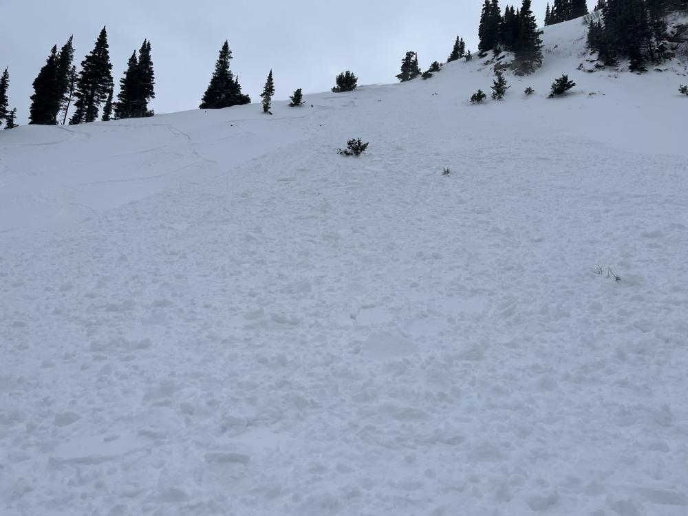
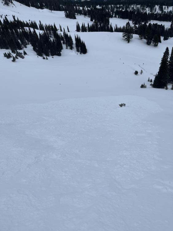
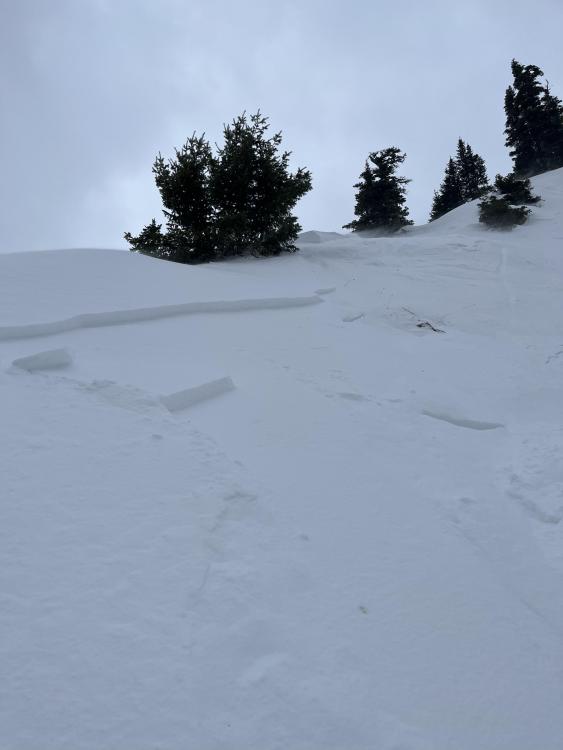
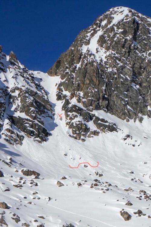
Bridger Range, 2022-11-27 View from top of skier triggered slide at Bridger on 11/27: "NE face. Rollover around 35 degrees mellowing throughout the run. The face had tracks from earlier today before i triggered the slide. I was able to self arrest and stop myself before being carried. The crown was around 20-25 ft wide and the slide ran roughly 100ft downhill before stopping. Both myself and my partner skied away unharmed." Link to Avalanche Details |
|
Bridger Range, 2022-11-27 Crown of skier triggered slide at Bridger on 11/27: "NE face. Rollover around 35 degrees mellowing throughout the run. The face had tracks from earlier today before i triggered the slide. I was able to self arrest and stop myself before being carried. The crown was around 20-25 ft wide and the slide ran roughly 100ft downhill before stopping. Both myself and my partner skied away unharmed." Link to Avalanche Details |
|
Bridger Range, 2022-11-26 Toured to the ramp and Bradley's Meadow on 11/25 around noon. Temperature was 45 F and wind was calm. Snow surface was moist 5-10cm deep on most slopes. The snow surface on shady slopes above about 8,000' remained dry, despite temperatures above freezing at all elevations. Natural rollerballs and pinwheels on steep, rocky southerly slopes around 7,800'. Photo: GNFAC Link to Avalanche Details |

|
Cooke City, 2022-11-26 From obs: "Well developed surface hoar was widespread this morning near Cooke City (11/25). The strong sun burned it off on aspects that received sun, but it was preserved in shaded areas." Photo: N. Salsburg |
|
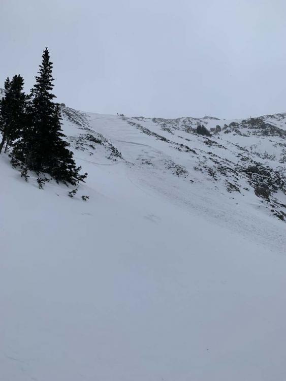
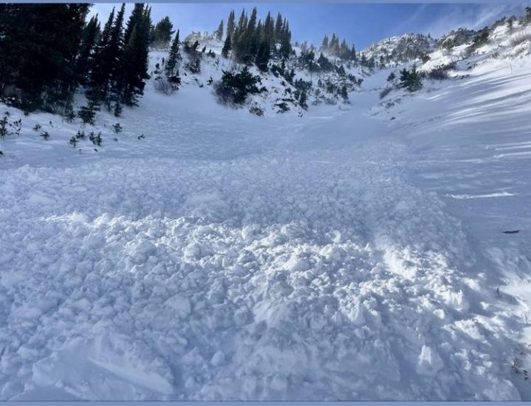
Bridger Range, 2022-11-25 A skier was caught and carried 40-45 yards in an avalanche on Thanksgiving Day in an area known as Papa Bear at Bridger Bowl. Bridger Bowl is not open, and there are no avalanche mitigation or ski patrol services. Photo: Anonymous Link to Avalanche Details |
|
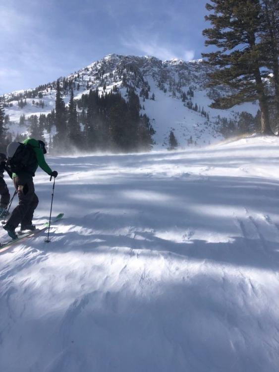
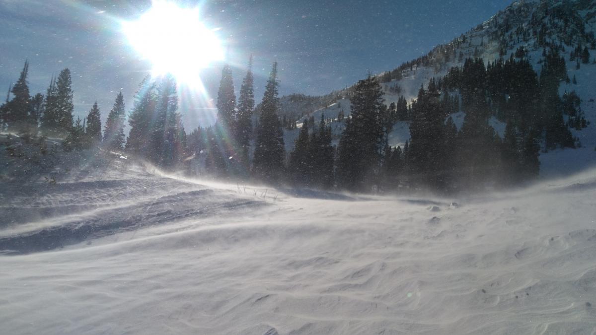
Bridger Range, 2022-11-25 A group of skiers sent in this photo to show how windy it was up at Bridger on Thanksgiving Day. The wind was focused at mid-mountain levels and blew from the north to northwest. There was a lot of snow moving around and stripping of snow surfaces. Photo: H Darby |
|
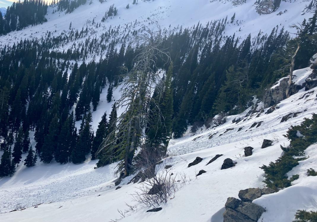
Northern Madison, 2022-11-24 From observations: "The snow was getting warm on my way up 4th of July couloir (pinwheels coming off lookers right wall started around 11:30) top half took a long time due to deep snow so I was suspicious of the pinch. Ski cut it during the descent (12:30p) and set off a wet slide (point release) that picked up quite a bit of steam as it came out the bottom. Big enough to injure/bury a skier." Photo: Anonymous Link to Avalanche Details |
|
Bridger Range, 2022-11-24 Skiers at Bridger Bowl observed a small avalanche near the lower Nose that was likely human-triggered. Photo: T. Chingas Link to Avalanche Details |
|
Bridger Range, 2022-11-24 Skiers observed a small avalanche below the Nose at Bridger Bowl. They believed it may have been human triggered. Photo: T. Chingas Link to Avalanche Details |
|
Bridger Range, 2022-11-24 From Obs: "Moderate to strong wind at mid-mountain level with visible transport across and downslope in many locations. Skiing conditions deteriorating in wind affected zones." |
|
Bridger Range, 2022-11-24 From Obs: "Moderate to strong wind at mid-mountain level with visible transport across and downslope in many locations. Skiing conditions deteriorating in wind affected zones." |

|
Island Park, 2022-11-23 A snowmobiler noted cracking of the snow surface on the south face of Reas Peak out of Island Park. The wind crust was 3-4" thick and had facets underneath which aided the propagation. Photo: Anonymous |